205.251.163.243 - IP Lookup: Free IP Address Lookup, Postal Code Lookup, IP Location Lookup, IP ASN, Public IP
Country:
Region:
City:
Location:
Time Zone:
Postal Code:
IP information under different IP Channel
ip-api
Country
Region
City
ASN
Time Zone
ISP
Blacklist
Proxy
Latitude
Longitude
Postal
Route
Luminati
Country
Region
oh
City
perrysburg
ASN
Time Zone
America/New_York
ISP
COMMUNITYISP
Latitude
Longitude
Postal
IPinfo
Country
Region
City
ASN
Time Zone
ISP
Blacklist
Proxy
Latitude
Longitude
Postal
Route
IP2Location
205.251.163.243Country
Region
ohio
City
millbury
Time Zone
America/New_York
ISP
Language
User-Agent
Latitude
Longitude
Postal
db-ip
Country
Region
City
ASN
Time Zone
ISP
Blacklist
Proxy
Latitude
Longitude
Postal
Route
ipdata
Country
Region
City
ASN
Time Zone
ISP
Blacklist
Proxy
Latitude
Longitude
Postal
Route
Popular places and events near this IP address

Clay Center, Ohio
Village in Ohio, United States
Distance: Approx. 7198 meters
Latitude and longitude: 41.57305556,-83.36416667
Clay Center is a village in Ottawa County, Ohio, United States. The population was 262 at the 2020 census.

Millbury, Ohio
Village in Ohio, United States
Distance: Approx. 2002 meters
Latitude and longitude: 41.56472222,-83.42555556
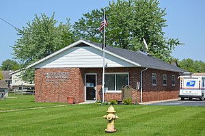
Millbury is a village in Wood County, Ohio, United States. The population was 1,193 at the 2020 census.

Northwood, Ohio
City in Ohio, United States
Distance: Approx. 6046 meters
Latitude and longitude: 41.60888889,-83.48361111
Northwood is a city and eastern suburb in Wood County, Ohio, United States, within the Toledo metropolitan area. The population was 5,160 at the 2020 census.

Walbridge, Ohio
Village in Ohio, United States
Distance: Approx. 5440 meters
Latitude and longitude: 41.58833333,-83.50333333
Walbridge is a village in Wood County, Ohio, United States, within the Toledo metropolitan area. The population was 3,011 at the 2020 census.

Lake Township, Wood County, Ohio
Township in Ohio, United States
Distance: Approx. 1927 meters
Latitude and longitude: 41.56972222,-83.46916667
Lake Township is one of the nineteen townships of Wood County, Ohio, United States. The 2020 census found 11,160 people in the township.

Genoa Area High School
Public school in the United States
Distance: Approx. 7264 meters
Latitude and longitude: 41.5556,-83.3622
Genoa Area High School is a public high school in Genoa, Ohio, United States. It is the only high school in the Genoa Area Local School District. Other towns in the district are Curtice, Clay Center, Martin, and Williston.

Lake High School (Millbury, Ohio)
School in Millbury, Ohio, United States
Distance: Approx. 1832 meters
Latitude and longitude: 41.55976111,-83.47101944
Lake High School is a public high school near Millbury, Ohio in Lake Township. It is the only high school in the Lake Local School District, serving about 500 students in grades 8 to 12.

Moline, Ohio
Unincorporated community in Ohio, U.S.
Distance: Approx. 5196 meters
Latitude and longitude: 41.55861111,-83.51138889
Moline is an unincorporated community in western Lake Township, Wood County, Ohio, United States. Moline does not have a post office. It shares its ZIP code with neighboring Walbridge (43465).

Forest Park, Ottawa County, Ohio
Unincorporated community in Ohio, United States
Distance: Approx. 6127 meters
Latitude and longitude: 41.54472222,-83.37888889
Forest Park is an unincorporated community in northwestern Clay Township, Ottawa County, Ohio, United States. It lies at the intersection of Hellwig and Reiman Roads with State Route 51, Gray and Kennard Roads, less than 2 miles (about 3 km) northwest of Genoa and a similar distance southwest of Clay Center. The headwaters of the South Fork of Turtle Creek, which empties into Lake Erie to the east, are located south of Forest Park, and both parts of the South Fork flow past the community.
Lake Local School District (Wood County)
School district in Ohio
Distance: Approx. 2100 meters
Latitude and longitude: 41.56388889,-83.42416667
Lake Local School District is a public school district in Northwest Ohio. The school district primarily serves students who live in Lake Township and the villages of Millbury and Walbridge in Wood County. It also includes small portions of Perrysburg, Troy, and Allen townships and a small portion of the city of Northwood.
Northwood Local School District
School district in Ohio
Distance: Approx. 6930 meters
Latitude and longitude: 41.61083333,-83.49916667
Northwood Local Schools is a school district in Northwest Ohio. The school district serves students who live in the cities of Northwood located in Wood County. The superintendent is Jason Kozina.

Woodville Mall
Former shopping center in Northwood, Ohio
Distance: Approx. 4832 meters
Latitude and longitude: 41.60358333,-83.461
Woodville Mall was an enclosed shopping mall off of Woodville Road (State Route 51) in Northwood, Ohio, outside the city of Toledo, Ohio. The mall opened in 1969 and, after losing most of its stores in the 2000s, became a dead mall. The mall's interior was closed in December 2011 and demolished in March 2014.
Weather in this IP's area
broken clouds
5 Celsius
5 Celsius
4 Celsius
6 Celsius
1025 hPa
85 %
1025 hPa
1002 hPa
10000 meters
0.89 m/s
2.68 m/s
58 degree
71 %