205.211.204.107 - IP Lookup: Free IP Address Lookup, Postal Code Lookup, IP Location Lookup, IP ASN, Public IP
Country:
Region:
City:
Location:
Time Zone:
Postal Code:
IP information under different IP Channel
ip-api
Country
Region
City
ASN
Time Zone
ISP
Blacklist
Proxy
Latitude
Longitude
Postal
Route
Luminati
Country
Region
fm
City
tegucigalpa
ASN
Time Zone
America/Tegucigalpa
ISP
Newcom Limited
Latitude
Longitude
Postal
IPinfo
Country
Region
City
ASN
Time Zone
ISP
Blacklist
Proxy
Latitude
Longitude
Postal
Route
IP2Location
205.211.204.107Country
Region
florida
City
coral springs
Time Zone
America/New_York
ISP
Language
User-Agent
Latitude
Longitude
Postal
db-ip
Country
Region
City
ASN
Time Zone
ISP
Blacklist
Proxy
Latitude
Longitude
Postal
Route
ipdata
Country
Region
City
ASN
Time Zone
ISP
Blacklist
Proxy
Latitude
Longitude
Postal
Route
Popular places and events near this IP address

Coral Springs, Florida
City in the United States
Distance: Approx. 442 meters
Latitude and longitude: 26.27055556,-80.25916667
Coral Springs is a city in Broward County, Florida, United States. The city is located approximately 20 miles (32 km) northwest of Fort Lauderdale. As of the 2020 U.S. Census, the city had a population of 134,394.
Ramblewood East, Coral Springs, Florida
Neighborhood in Broward, Florida, United States
Distance: Approx. 1658 meters
Latitude and longitude: 26.28055556,-80.245
Ramblewood East is a former census-designated place (CDP) in Broward County, Florida, United States. The population was 1,395 at the 2000 census. It is now incorporated as a community of Coral Springs, Florida.

Coral Springs High School
Public high school in Coral Springs, Florida, United States
Distance: Approx. 3496 meters
Latitude and longitude: 26.2736918,-80.2206029
Coral Springs High School is a public high school located in Coral Springs, Florida, United States. It is a part of the Broward County Public Schools district.

Coral Glades High School
Public high school in Coral Springs, Florida, United States
Distance: Approx. 4009 meters
Latitude and longitude: 26.264,-80.295
Coral Glades High School is a public high school in Coral Springs, Florida, United States. Founded in 2004, it is part of the Broward School District. It educates students in grades 9 through 12.

Coral Springs Charter School
Charter school in the United States
Distance: Approx. 618 meters
Latitude and longitude: 26.2713889,-80.2497221
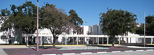
Coral Springs Charter School was established in 1999 in Coral Springs, Florida, United States. The school was originally constructed in 1977 as an enclosed mall. When the mall failed, the nearly vacant structure was purchased by Charter Schools USA and converted into a combination school, serving students in grades 6 through 12.

Coral Square
Shopping mall in Florida, United States
Distance: Approx. 3122 meters
Latitude and longitude: 26.2412525,-80.2493377
Coral Square, often referred to as Coral Square Mall, is a regional enclosed shopping mall located northwest of Fort Lauderdale in Coral Springs, Florida, on the northeast corner of Atlantic Boulevard and University Drive; it opened in 1984. The mall features 120 retailers, including JCPenney, Kohl's and 2 Macy's locations as its anchors. Originally developed by a joint venture of Eddie Debartolo of DeBartolo Realty & JCP Realty, Inc.
Coral Springs Christian Academy
Private school in Coral Springs, Florida, United States
Distance: Approx. 2251 meters
Latitude and longitude: 26.258137,-80.236042
Coral Springs Christian Academy (CSCA) was a private Christian school in Coral Springs, Florida, serving students in pre-school through 12th grade. The school was a ministry of First Presbyterian Church of Coral Springs, until the school was sold because of damages caused by Hurricane Irma. Also known as CSCA, the school opened in 1971 as an elementary and middle school called "Coral Springs Christian School." CSCA was accredited by the Southern Association of Colleges and Schools (SACS), Association of Christian Schools International (ACSI), and the Florida Council of Independent Schools (FCIS).
Coral Springs Center for the Arts
Theatre and art museum in Florida, US
Distance: Approx. 1014 meters
Latitude and longitude: 26.2664,-80.265
The Coral Springs Center for the Arts is a modern style 1,471-seat theatre and art museum in Coral Springs, Florida. The facilities include a theater which hosts broadway shows and their home studio, Next Stop Broadway. The studio also hosts many audition workshops.
Our Lady of Health Syro-Malabar Catholic Church of Miami
Distance: Approx. 3932 meters
Latitude and longitude: 26.23355,-80.25266
Our Lady of Health Catholic Church in Coral Springs, Florida is a parish of the St. Thomas Syro-Malabar Catholic Diocese of Chicago.
Coral Springs Covered Bridge
Bridge in Florida, United States
Distance: Approx. 1916 meters
Latitude and longitude: 26.285918,-80.253204
The Coral Springs Covered Bridge is a 40 ft covered bridge located in Coral Springs, Florida and was the first permanent structure built in the city. The only publicly accessible covered bridge in Florida, it has also been honored with a Florida Heritage Site Marker.
Charter School Associates
Distance: Approx. 3852 meters
Latitude and longitude: 26.2342,-80.2551
Charter School Associates (CSA) is a charter school operator headquartered in Sunrise, Florida. It is led by Michael Strader.

Barbizon Modeling and Acting School
American modeling and acting school
Distance: Approx. 577 meters
Latitude and longitude: 26.269141,-80.249429
Barbizon Modeling and Acting School is an international modeling and acting school headquartered in Tampa, Florida. The school provides instructional courses in the domain of modeling and personal development.
Weather in this IP's area
scattered clouds
18 Celsius
18 Celsius
17 Celsius
19 Celsius
1015 hPa
74 %
1015 hPa
1014 hPa
10000 meters
2.06 m/s
180 degree
40 %

