205.207.214.243 - IP Lookup: Free IP Address Lookup, Postal Code Lookup, IP Location Lookup, IP ASN, Public IP
Country:
Region:
City:
Location:
Time Zone:
Postal Code:
IP information under different IP Channel
ip-api
Country
Region
City
ASN
Time Zone
ISP
Blacklist
Proxy
Latitude
Longitude
Postal
Route
Luminati
Country
ASN
Time Zone
America/Toronto
ISP
LVLT-1
Latitude
Longitude
Postal
IPinfo
Country
Region
City
ASN
Time Zone
ISP
Blacklist
Proxy
Latitude
Longitude
Postal
Route
IP2Location
205.207.214.243Country
Region
ontario
City
markham
Time Zone
America/Toronto
ISP
Language
User-Agent
Latitude
Longitude
Postal
db-ip
Country
Region
City
ASN
Time Zone
ISP
Blacklist
Proxy
Latitude
Longitude
Postal
Route
ipdata
Country
Region
City
ASN
Time Zone
ISP
Blacklist
Proxy
Latitude
Longitude
Postal
Route
Popular places and events near this IP address

Markham—Unionville (federal electoral district)
Federal electoral district in Ontario, Canada
Distance: Approx. 1603 meters
Latitude and longitude: 43.846,-79.305
Markham—Unionville is a federal electoral district in Ontario, Canada, that has been represented in the House of Commons of Canada since 2004.

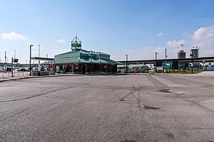
Unionville GO Station
Railway station in Markham, Ontario, Canada
Distance: Approx. 1534 meters
Latitude and longitude: 43.85166667,-79.31444444
Unionville GO Station is a train and bus station in the GO Transit network located in Markham, Ontario, Canada. It is a stop on the Stouffville line. The station is also served by Highway 407 East Express buses, which run westbound to Highway 407 station, northbound to Mount Joy GO Station, and eastbound to the Oshawa GO station.

Milliken Mills High School
High school in Markham, Ontario, Canada
Distance: Approx. 1559 meters
Latitude and longitude: 43.8375,-79.30333333
Milliken Mills High School is a high school in the city of Markham, Ontario, Canada. Milliken Mills High School is one out of the 33 high schools in the York Region District School Board and is situated in ward 8 of Markham, Ontario. The high school is located on the border of the Milliken Mills West and the Milliken Mills East neighbourhoods and is located next to Milliken Mills Community Center.
Underwood, Markham
Unincorporated community in Ontario, Canada
Distance: Approx. 1029 meters
Latitude and longitude: 43.83472222,-79.31138889
Underwood is a community in the Regional Municipality of York in Markham, Ontario, Canada that is located at the corner of Warden Ave between Birchmount Road and Steeles Avenue, north up to Hwy 7. Underwood is considered part of Downtown and Uptown Markham. It is likely considered to be part of Milliken.

IBM Toronto Software Lab
Software development lab in Toronto, Canada
Distance: Approx. 1674 meters
Latitude and longitude: 43.849013,-79.338399
The IBM Toronto Software Lab is the largest software development laboratory in Canada and IBM's third largest software lab. Established in 1967 with 55 employees, the Toronto Lab, now located in Markham has grown to employ 2,500 people. These employees develop some of IBM's middleware.

Downtown Markham
Downtown in Ontario, Canada
Distance: Approx. 1220 meters
Latitude and longitude: 43.85,-79.32
Downtown Markham is the main downtown of Markham, Ontario, Canada. Currently under development, it is located near the historic Unionville district and serves as the new heart of Markham. Businesses in the district are expected to employ up to 16,000 individuals, and it may house as many as 10,000 residents.

Beaver Creek (York Region)
River in Ontario, Canada
Distance: Approx. 1321 meters
Latitude and longitude: 43.84722222,-79.33472222
Beaver Creek is a river in the municipalities of Markham and Richmond Hill in the Regional Municipality of York, part of the Greater Toronto Area of Ontario, Canada. It is part of the Great Lakes Basin and is a right tributary of the Rouge River.

Town Centre Private Schools
Private school in Markham, Ontario
Distance: Approx. 1312 meters
Latitude and longitude: 43.83194444,-79.30972222
Town Centre Private Schools (TCPS) is a private, co-educational, IB world school in Markham, Ontario founded in 1986. Students from preschool to grade 12 are accepted. There are three campuses, all in Markham, Ontario.

Markham—Unionville (provincial electoral district)
Provincial electoral district in Ontario, Canada
Distance: Approx. 1603 meters
Latitude and longitude: 43.846,-79.305
Markham—Unionville is a provincial electoral district in Ontario, Canada, that has been represented in the Legislative Assembly of Ontario since the 2007 provincial election.

Markham—Thornhill (federal electoral district)
Federal electoral district in Ontario, Canada
Distance: Approx. 902 meters
Latitude and longitude: 43.835,-79.313
Markham—Thornhill is a federal electoral district in Ontario, Canada, that has been represented in the House of Commons of Canada since 2015. It encompasses a portion of Ontario previously included in the electoral districts of Markham—Unionville and Thornhill. Markham—Thornhill was created by 2012 federal electoral boundaries redistribution and was legally defined in the 2013 representation order.

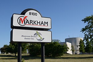
Warden Energy Centre
Power station in Canada
Distance: Approx. 1277 meters
Latitude and longitude: 43.84816667,-79.33252778
Warden Energy Centre is a power station owned by Markham District Energy Incorporated situated at the northwest corner of Warden Avenue and Highway 407 in Markham, Ontario, Canada. The 5.2 MW CHP plant uses natural gas to power 2 Caterpillar G3612 natural gas driven reciprocating engine generator. The combined heating power plant, an 8.5MW CHP, first opened in 2000 with a 12 MW heating capacity and 40MW hot water thermal storage.

Markham—Thornhill (provincial electoral district)
Provincial electoral district in Ontario, Canada
Distance: Approx. 902 meters
Latitude and longitude: 43.835,-79.313
Markham—Thornhill is a provincial electoral district in Ontario, Canada. It elects one member to the Legislative Assembly of Ontario. The riding was created in 2015.
Weather in this IP's area
clear sky
-9 Celsius
-14 Celsius
-10 Celsius
-7 Celsius
1035 hPa
81 %
1035 hPa
1008 hPa
10000 meters
2.43 m/s
5.51 m/s
164 degree
5 %