205.207.178.164 - IP Lookup: Free IP Address Lookup, Postal Code Lookup, IP Location Lookup, IP ASN, Public IP
Country:
 Canada
Region:
City:
Location:
Time Zone:
Postal Code:
ISP:
ASN:
language:
User-Agent:
Proxy IP:
Blacklist:
IP information under different IP Channel
ip-api
Country
Region
City
ASN
Time Zone
ISP
Blacklist
Proxy
Latitude
Longitude
Postal
Route
db-ip
Country
Region
City
ASN
Time Zone
ISP
Blacklist
Proxy
Latitude
Longitude
Postal
Route
IPinfo
Country
Region
City
ASN
Time Zone
ISP
Blacklist
Proxy
Latitude
Longitude
Postal
Route
IP2Location
205.207.178.164Country
caRegion
alberta
City
calgary
Time Zone
America/Edmonton
ISP
Language
User-Agent
Latitude
Longitude
Postal
ipdata
Country
Region
City
ASN
Time Zone
ISP
Blacklist
Proxy
Latitude
Longitude
Postal
Route
Popular places and events near this IP address

Southern Alberta Institute of Technology
University in Calgary, Canada
Distance: Approx. 432 meters
Latitude and longitude: 51.06194444,-114.09138889
The Southern Alberta Institute of Technology (SAIT) is a polytechnic institute in Calgary, Alberta, Canada. SAIT offers more than 110 career programs in technology, trades and business. Established in 1916, it is Calgary's second oldest post-secondary institution and Canada's first publicly funded technical institute.
Alberta University of the Arts
Public university in Calgary, Alberta, Canada
Distance: Approx. 423 meters
Latitude and longitude: 51.06205,-114.09143
The Alberta University of the Arts (AUArts) is a public art university located in Calgary, Alberta, Canada. The university is a co-educational institution that operates four academic schools. The institution originated from the art department established by the Southern Alberta Institute of Technology (SAIT) in 1926, later renamed the Alberta College of Art in 1960.

Lions Park station
Light rail station in Calgary, Alberta, Canada
Distance: Approx. 498 meters
Latitude and longitude: 51.065,-114.10333333
Lions Park Station is a Calgary C-Train light rail station in Hounsfield Heights-Briar Hill, Calgary, Alberta, Canada. Opened on September 7, 1987 as part of the original Northwest Line (Route 201). It is located on the exclusive LRT right of way on the south side of 14 Avenue NW, just east of 19 Street NW. Two side-loading platforms with ramp access from grade level as well as pedestrian crossings are located at both ends of the station.
SAIT/AUArts/Jubilee station
Light rail station in Calgary, Alberta, Canada
Distance: Approx. 418 meters
Latitude and longitude: 51.06277778,-114.09083333
SAIT/AUArts/Jubilee station, is a light rail station on the CTrain network of Calgary, Alberta. It serves the Northwest leg of the Red Line and opened on September 7, 1987, as part of the original line. The station is located on the exclusive LRT right of way in the heart of the Southern Alberta Institute of Technology (SAIT) campus, 1.8 km (1.1 mi) northwest of the 7 Avenue & 9 Street SW. The station possesses a center-loading platform which has grade-level access at the West end and +15 access at the East end connecting to both SAIT and the Alberta University of the Arts (AUArts).

Queen Elizabeth High School (Calgary)
Public secondary school in Calgary, Alberta, Canada
Distance: Approx. 918 meters
Latitude and longitude: 51.05694444,-114.10222222
Queen Elizabeth High School (QEHS) is a Canadian public combined junior and senior high school in Calgary, Alberta, which teaches grades 7 through 12. The junior (7–9) and senior high (10–12) programs share a common principal, many teachers, and other resources of the school. It is operated by the Calgary Board of Education.

King George School (Calgary, Alberta)
Public school in Calgary, Alberta, Canada
Distance: Approx. 1131 meters
Latitude and longitude: 51.0709,-114.084
King George School (KGS) is a public French immersion elementary school in Calgary, Alberta, Canada. It is operated by the Calgary Board of Education (CBE).
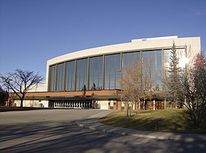
Southern Alberta Jubilee Auditorium
Distance: Approx. 333 meters
Latitude and longitude: 51.0625,-114.0925
The Southern Alberta Jubilee Auditorium is a performing arts, culture and community facility located in Calgary, Alberta, Canada. The auditorium was built in 1955 to celebrate the 50th anniversary of Alberta. It is owned and operated by the Government of Alberta.

Hounsfield Heights/Briar Hill
Neighbourhood in Calgary, Alberta, Canada
Distance: Approx. 498 meters
Latitude and longitude: 51.065,-114.10333333
Hounsfield Heights/Briar Hill is an inner suburban neighbourhood in northwest Calgary, Alberta, Canada. Located north of the Hillhurst and West Hillhurst communities, the boundaries of the district are 16th Avenue N (Trans-Canada Highway)to the north; 14th Street W to the east; Lane north of 7th Avenue N to 19th Street W and 8th Avenue N to the south; and Crowchild Trail, 12th Avenue N, Juniper Road, and 22nd Street W to the west. Lions Park C-Train station and North Hill Centre are located within the community.
Capitol Hill, Calgary
Neighbourhood in Calgary, Alberta, Canada
Distance: Approx. 705 meters
Latitude and longitude: 51.07055556,-114.09472222
Capitol Hill is a residential neighbourhood in the northwest quadrant of Calgary, Alberta, Canada. It is located immediately north of the Trans-Canada Highway, and is bisected by 14th Street West. The Southern Alberta Institute of Technology and the North Hill shopping center are located south of the community.

North Hill Centre
Shopping mall in Alberta, Canada
Distance: Approx. 278 meters
Latitude and longitude: 51.06583333,-114.09944444
North Hill Centre is a shopping mall in Calgary, Alberta, Canada. It opened in 1958, and was Calgary's first shopping mall. The original anchor tenant was Simpsons-Sears (later Sears Canada), but it closed on January 8, 2018 and has since been replaced by Showhome Furniture.
Branton Bilingual Junior High School
Junior high school in Calgary, Alberta, Canada
Distance: Approx. 1107 meters
Latitude and longitude: 51.071,-114.108
Branton Junior High School is a junior high school in Calgary, Alberta servicing the Banff Trail community and surrounding area. It offers an exclusively French Immersion program for grades 6-9 as part of the mandates of the Calgary Board of Education.

Riley Park
Urban park in Calgary, Alberta, Canada
Distance: Approx. 829 meters
Latitude and longitude: 51.05849,-114.08889
Riley Park is an urban park in Calgary, Alberta, Canada. It is located in the neighbourhood of Hillhurst, bounded by 8th Ave. NW, 10th St.
Weather in this IP's area
few clouds
-10 Celsius
-15 Celsius
-11 Celsius
-10 Celsius
1025 hPa
74 %
1025 hPa
888 hPa
10000 meters
2.06 m/s
360 degree
20 %