205.207.142.123 - IP Lookup: Free IP Address Lookup, Postal Code Lookup, IP Location Lookup, IP ASN, Public IP
Country:
Region:
City:
Location:
Time Zone:
Postal Code:
IP information under different IP Channel
ip-api
Country
Region
City
ASN
Time Zone
ISP
Blacklist
Proxy
Latitude
Longitude
Postal
Route
Luminati
Country
Region
on
City
brampton
ASN
Time Zone
America/Toronto
ISP
SYSLIFELINE
Latitude
Longitude
Postal
IPinfo
Country
Region
City
ASN
Time Zone
ISP
Blacklist
Proxy
Latitude
Longitude
Postal
Route
IP2Location
205.207.142.123Country
Region
ontario
City
guelph
Time Zone
America/Toronto
ISP
Language
User-Agent
Latitude
Longitude
Postal
db-ip
Country
Region
City
ASN
Time Zone
ISP
Blacklist
Proxy
Latitude
Longitude
Postal
Route
ipdata
Country
Region
City
ASN
Time Zone
ISP
Blacklist
Proxy
Latitude
Longitude
Postal
Route
Popular places and events near this IP address

Guelph (federal electoral district)
Federal electoral district in Ontario, Canada
Distance: Approx. 3587 meters
Latitude and longitude: 43.55,-80.25
Guelph (formerly Guelph—Wellington) is a federal electoral district in Ontario, Canada, that has been represented in the House of Commons of Canada since 1979. This riding has had a Liberal MP since 1993. From 2008 until his decision not to run in 2015, the riding's parliamentary seat was held by Liberal MP Frank Valeriote.

Guelph Collegiate Vocational Institute
Public school in Guelph, Ontario, Canada
Distance: Approx. 3042 meters
Latitude and longitude: 43.54277778,-80.25916667
The Guelph Collegiate Vocational Institute (GCVI, Guelph C.V.I., GC) is a public high school located in Guelph, Ontario, Canada. The school is the oldest continuously operating public high school in Guelph, and the third oldest in the province of Ontario, Canada.

Wellington District, Upper Canada
Former district of Upper Canada
Distance: Approx. 2236 meters
Latitude and longitude: 43.572,-80.302
The Wellington District was a historic district in Upper Canada and its successor, Canada West, which existed until 1849. It was formed in June 1840 from townships transferred from certain other districts: For electoral purposes, it was called Waterloo County and the district town was Guelph. Upon the passage of the Act of Union 1840, for electoral purposes Erin Township was attached to Halton County, which became known as the East Riding of Halton, and the remaining townships of Wellington that had previously been part of Halton became known as the West Riding of Halton.

Our Lady of Lourdes Catholic High School (Guelph)
High school in Guelph, Ontario, Canada
Distance: Approx. 2180 meters
Latitude and longitude: 43.5479,-80.2681
Our Lady of Lourdes Catholic High School is a Grades 9–12 catholic secondary school in Guelph, Ontario, Canada and is part of the Wellington Catholic District School Board.

Hastings Stadium
Distance: Approx. 2318 meters
Latitude and longitude: 43.5518,-80.2656
Hastings Stadium, officially the David E. Hastings Stadium, is a baseball park located in the Exhibition Park area of Guelph, Ontario. It is home to the Guelph Royals of the Intercounty Baseball League and the home of the Guelph Silvercreeks. It is named after a local baseball player who was active from 1943 to 1968, first in Minor Baseball and then in the Senior Intercounty league.

Guelph (provincial electoral district)
Provincial electoral district in Ontario, Canada
Distance: Approx. 3587 meters
Latitude and longitude: 43.55,-80.25
Guelph is a provincial electoral district in southwestern Ontario, Canada. It has been represented in the Legislative Assembly of Ontario from 1987 until 1999, and again from 2007 to present. The riding was created from portions of the Guelph—Wellington riding.

Wellington Brewery
Distance: Approx. 3022 meters
Latitude and longitude: 43.5333,-80.3205
Wellington Brewery is a brewery in Guelph, Ontario, Canada. It was established in 1985 and was one of the first North American breweries to revive the ancient technique of brewing cask-conditioned cask ale. Phil Gosling was the founder.

Guelph General Hospital
Hospital in Guelph, Ontario, Canada
Distance: Approx. 3313 meters
Latitude and longitude: 43.556223,-80.253528
Guelph General Hospital is a medical care facility in Guelph, Ontario, Canada. It is a 182-bed facility with a total staff of about 1600. The facility opened as a 12-bed unit on 16 August 1875.

Riverside Park (Guelph)
Park in Ontario, Canada
Distance: Approx. 2391 meters
Latitude and longitude: 43.565,-80.27
Riverside Park is an 80-acre (32-hectare) park located by the northern part of Woolwich Street in Guelph, Ontario, Canada. It is built around a portion of the Speed River that runs through Guelph.

Guelph Public Library
Public library system in Guelph, Canada
Distance: Approx. 3432 meters
Latitude and longitude: 43.5456,-80.2529
Guelph Public Library is a public library system serving the city of Guelph, Ontario, Canada. The main library downtown, five branches, and a bookmobile (seven branches total) serve about 123,000 residents in Guelph. The current CEO is Dan Atkins.
Holy Rosary Church (Guelph)
Church in Ontario, Canada
Distance: Approx. 3587 meters
Latitude and longitude: 43.564697,-80.253038
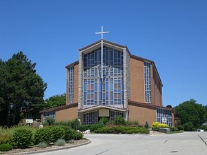
Holy Rosary Church is a Roman Catholic Parish church in Guelph, Ontario, Canada. It was originally part of the parish of Church of Our Lady Immaculate, Guelph. It was founded in 1956.
Loyola House
Church in Guelph, Canada
Distance: Approx. 2254 meters
Latitude and longitude: 43.572251,-80.287032
Loyola House or its full name Loyola House Retreat and Training Centre is a Jesuit spirituality centre in Guelph, Ontario. It moved to Guelph in 1964 and was the centre of a renewal in Ignatian spirituality in the 1970s. It is within the grounds of the Ignatius Jesuit Centre situated on Woolwich Street to the west of Riverside Park.
Weather in this IP's area
overcast clouds
-2 Celsius
-8 Celsius
-3 Celsius
-2 Celsius
1012 hPa
89 %
1012 hPa
968 hPa
10000 meters
4.63 m/s
270 degree
100 %

