Country:
 USA
USARegion:
City:
Latitude and Longitude:
Time Zone:
Postal Code:
IP information under different IP Channel
ip-api
Country
Region
City
ASN
Time Zone
ISP
Blacklist
Proxy
Latitude
Longitude
Postal
Route
IPinfo
Country
Region
City
ASN
Time Zone
ISP
Blacklist
Proxy
Latitude
Longitude
Postal
Route
MaxMind
Country
Region
City
ASN
Time Zone
ISP
Blacklist
Proxy
Latitude
Longitude
Postal
Route
Luminati
Country
USRegion
ca
City
temecula
ASN
Time Zone
America/Los_Angeles
ISP
PECHANGA-FIBER-AS
Latitude
Longitude
Postal
db-ip
Country
Region
City
ASN
Time Zone
ISP
Blacklist
Proxy
Latitude
Longitude
Postal
Route
ipdata
Country
Region
City
ASN
Time Zone
ISP
Blacklist
Proxy
Latitude
Longitude
Postal
Route
Popular places and events near this IP address

Temecula, California
City in the United States
Distance: Approx. 2786 meters
Latitude and longitude: 33.50333333,-117.12361111
Temecula (; Spanish: Temécula, [te'mekula]; Luiseño: Temeekunga) is a city in southwestern Riverside County, California, United States. The city had a population of 110,003 as of the 2020 census and was incorporated on December 1, 1989. The city is a tourist and resort destination, with the Temecula Valley Wine Country, Old Town Temecula, the Temecula Valley Balloon & Wine Festival, the Temecula Valley International Film Festival, championship golf courses, and resort accommodations contributing to the city's economic profile.

Pechanga Resort Casino
Resort and casino near Temecula, California
Distance: Approx. 4445 meters
Latitude and longitude: 33.456002,-117.106737
The Pechanga Resort Casino is a Native American casino on the Pechanga Indian Reservation adjacent to the city of Temecula, California. Pechanga Resort Casino is one of the largest casino/resorts in the United States, with more than 5,400 slot machines and approximately 200,000 sq ft (19,000 m2) of gaming space.
Temecula massacre
Event in the Mexican–American War
Distance: Approx. 1523 meters
Latitude and longitude: 33.48168207,-117.0907281
The Temecula massacre took place in December 1846 east of present-day Temecula, California, United States. It was part of a series of related events in the Mexican–American War. A combined force of Californio militia and Cahuilla Indians attacked and killed an estimated 33 to 40 Luiseño Indians.
Temecula Valley High School
Public high school in Temecula, California, United States
Distance: Approx. 2116 meters
Latitude and longitude: 33.50222222,-117.11638889
Temecula Valley High School, known by locals as TV, is a public high school for grades 9 to 12 in Temecula, California. The school opened in 1985 as the city's first high school. When it was built, it was a part of the Elsinore Union High School District (now the Lake Elsinore Unified School District) until the Temecula Valley Unified School District was founded.

Temecula Valley AVA
American Viticultural Area in California
Distance: Approx. 3577 meters
Latitude and longitude: 33.52658353,-117.0897703
Temecula Valley is an American Viticultural Area (AVA) in the Temecula Valley, located in southwestern Riverside County, California against the eastern slopes of the Santa Ana Mountains. It was initially established by the Bureau of Alcohol, Tobacco and Firearms (ATF), Treasury as "Temecula" on October 23, 1984 based on submitted petitions from by the Rancho Califomia/Temecula Winegrowers Association and Callaway Vineyard and Winery, Temecula, California in 1982. It was renamed "Temecula Valley" by the Alcohol and Tobacco Tax and Trade Bureau (TTB) in 2004, approving the 2001 petition by Temecula Valley Winegrowers Association.
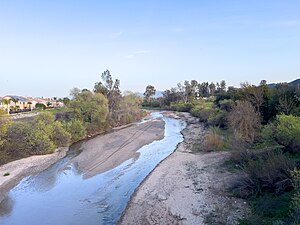
Temecula Creek
River in California, United States
Distance: Approx. 4803 meters
Latitude and longitude: 33.47416667,-117.14083333
Temecula Creek, formerly known as the Temecula River, runs 32.6 miles (52.5 km) through southern Riverside County, California, United States, past the rural communities of Radec and Aguanga, and ending 0.5 miles (0.80 km) southeast of the original city center of Temecula. The creek is filled with boulders and is typically dry and sandy. It is a relatively undeveloped coastal-draining watershed.
Great Oak High School
Public high school in Temecula, California
Distance: Approx. 4686 meters
Latitude and longitude: 33.45277778,-117.0925
Great Oak High School is a public high school that lies at the base of Wolf Valley in Temecula, California, USA, in the Temecula Valley Unified School District. In 2009 and 2010, Great Oak High School was listed in Newsweek's annual top 1000 high schools in America. As of 2022, GOHS is ranked #1,097 nationally and ranked 157th in the State of California.
Rancho Little Temecula
Distance: Approx. 2794 meters
Latitude and longitude: 33.47,-117.1
Rancho Little Temecula was a 2,233-acre (9.04 km2) Mexican land grant in present-day Riverside County, California given in 1845 by Governor Pío Pico to Pablo Apis. The grant was one of the few held by indigenous people. The grant is south of present-day Temecula and is bordered on the north by Temecula Creek.
Linfield Christian School
Private school in the United States
Distance: Approx. 1653 meters
Latitude and longitude: 33.50083333,-117.11166667
Linfield Christian School (LCS) is a private, co-educational, college-preparatory K-12 Christian school located on a 100-acre campus in Temecula, California, a city that is located between San Diego and Los Angeles. The school’s colors are navy blue, light blue and white, and the school mascot is the Lion. The current student enrollment is approximately 1,100 students.
Wolf Valley
Graben rift valley in Riverside County, California, United States
Distance: Approx. 5005 meters
Latitude and longitude: 33.45,-117.1
Wolf Valley is a graben rift valley in the Elsinore Trough, in western Riverside County, California.
Murrieta Creek
River in California, United States
Distance: Approx. 4857 meters
Latitude and longitude: 33.47444444,-117.14166667
Murrieta Creek runs 13 miles (21 km) southeasterly through southwestern Riverside County, California, United States, through the cities of Wildomar, Murrieta, and Temecula, ending 0.5 miles (0.80 km) southeast of the city center of Temecula, where it has its confluence with Temecula Creek and forms the head of the Santa Margarita River.
Pauba Valley
Distance: Approx. 3103 meters
Latitude and longitude: 33.47388889,-117.1175
Pauba Valley is a valley along the course of Temecula Creek, in Riverside County, California. It heads to the east at 33°30′06″N 117°00′10″W, the mouth of the gorge of Temecula Creek Canyon at the foot of Oak Mountain. Its mouth in the west is at an elevation of 1,014 feet (309 m), where it joins the Elsinore Trough at the confluence of Wolf Valley and Temecula Valley.
Weather in this IP's area
scattered clouds
14 Celsius
14 Celsius
13 Celsius
16 Celsius
1012 hPa
94 %
1012 hPa
971 hPa
10000 meters
1.79 m/s
2.24 m/s
190 degree
40 %
06:55:41
18:10:49