205.153.63.95 - IP Lookup: Free IP Address Lookup, Postal Code Lookup, IP Location Lookup, IP ASN, Public IP
Country:
 USA
USARegion:
City:
Location:
Time Zone:
Postal Code:
ISP:
ASN:
language:
User-Agent:
Proxy IP:
Blacklist:
IP information under different IP Channel
ip-api
Country
Region
City
ASN
Time Zone
ISP
Blacklist
Proxy
Latitude
Longitude
Postal
Route
db-ip
Country
Region
City
ASN
Time Zone
ISP
Blacklist
Proxy
Latitude
Longitude
Postal
Route
IPinfo
Country
Region
City
ASN
Time Zone
ISP
Blacklist
Proxy
Latitude
Longitude
Postal
Route
IP2Location
205.153.63.95Country
usRegion
south carolina
City
greenwood
Time Zone
America/New_York
ISP
Language
User-Agent
Latitude
Longitude
Postal
ipdata
Country
Region
City
ASN
Time Zone
ISP
Blacklist
Proxy
Latitude
Longitude
Postal
Route
Popular places and events near this IP address
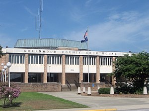
Greenwood, South Carolina
City in South Carolina, United States
Distance: Approx. 2841 meters
Latitude and longitude: 34.19527778,-82.16166667
Greenwood is a city in and the county seat of Greenwood County, South Carolina. The population in the 2020 United States Census was 22,545 down from 23,222 at the 2010 census. The city is home to Lander University.

Lander University
Public college in Greenwood, South Carolina, US
Distance: Approx. 2318 meters
Latitude and longitude: 34.20027778,-82.16555556
Lander University is a public university in Greenwood, South Carolina.
Greenwood Civic Center
Distance: Approx. 2530 meters
Latitude and longitude: 34.2118199,-82.1360528
Greenwood Civic Center is a 4,800-seat multi-purpose arena in Greenwood, South Carolina. It hosted various local concerts and sporting events for the area. It was designed by architect Dale Gilliland, AIA. Greenwood County Council voted to close the Civic Center in December 2009 and the building has been unoccupied since.
Greenwood High School (South Carolina)
Public high school in Greenwood, South Carolina, United States
Distance: Approx. 1740 meters
Latitude and longitude: 34.2309547,-82.1756774
Greenwood High School is located in the city of Greenwood, South Carolina. The school has approximately 1,600 students and is one of two high schools in Greenwood School District 50. The principal is Kathryn Benjamin.

Greenwood County Airport
Airport in South Carolina
Distance: Approx. 3102 meters
Latitude and longitude: 34.24861111,-82.15916667
Greenwood County Airport (IATA: GRD, ICAO: KGRD, FAA LID: GRD) is a county-owned, public-use airport in unincorporated Greenwood County, South Carolina, United States, located 3 nautical miles (5.6 km) north of the central business district of Greenwood, a city in Greenwood County. It is included in the National Plan of Integrated Airport Systems for 2011–2015, which categorized it as a general aviation facility. The airport does not have scheduled commercial airline service.

Old Greenwood Cemetery
Historic cemetery in Greenwood County, South Carolina
Distance: Approx. 2725 meters
Latitude and longitude: 34.19722222,-82.15333333
Old Greenwood Cemetery is a historic cemetery located at Greenwood, Greenwood County, South Carolina. Established around the year 1860, the Old Greenwood Cemetery is a historic burial place in the said city. It is significant because of being the oldest cemetery in the area.
Greenwood Community Theatre
Distance: Approx. 3212 meters
Latitude and longitude: 34.19194444,-82.16111111
Greenwood Community Theatre, or GCT, is a non-profit theatre in Greenwood, South Carolina. Greenwood Community Theatre officially began in 1954. GCT reopened in January 2007 after an extensive 1.2 million dollar renovation offering live theatre in the form of musicals, comedies, dramas, classic films, Indie films, music concerts, forum, debates and many rentals to local and touring organizations and businesses.
Greenwood Mall (South Carolina)
Shopping mall in Greenwood, South Carolina, United States
Distance: Approx. 2100 meters
Latitude and longitude: 34.21,-82.18
Greenwood Mall, formerly Crosscreek Mall, is a regional shopping mall located in Greenwood, South Carolina, United States. The mall opened in 1979 and underwent a number of expansions and renovations throughout its history. The original anchor stores were Belk, JCPenney, and Meyers-Arnold, with H. J. Wilson Co.

Vance-Maxwell House
Historic house in South Carolina, United States
Distance: Approx. 2879 meters
Latitude and longitude: 34.195,-82.15916667
Vance-Maxwell House, also known as the Maxwell-Nicholson-Murphy House, is a historic home located at Greenwood, Greenwood County, South Carolina. It was built around 1850, and remodeled between 1898 and 1904 in the Second Empire style. During the remodeling, a full second story and a mansard roof were added to the original 1+1⁄2-story central hall farmhouse.

Lander College Old Main Building
United States historic place
Distance: Approx. 2518 meters
Latitude and longitude: 34.19833333,-82.16444444
Lander College Old Main Building is a historic academic building located on the campus of Lander University at Greenwood, Greenwood County, South Carolina. It is a large masonry building, composed of three distinct sections with a blending of elements of the Romanesque Revival and Georgian Revival styles. Two of the sections, Greenwood Hall and Laura Lander Hall, were built in 1903-04; Willson Hall was added in 1911.
1988 Oakland Elementary School shooting
Mass shooting in Greenwood, South Carolina
Distance: Approx. 2005 meters
Latitude and longitude: 34.2269,-82.1408
The Oakland Elementary School shooting was a school shooting in 1988 in Greenwood, South Carolina, United States, in which 19-year-old James William Wilson Jr. shot and killed two students and wounded seven other students, a teacher, and a gym coach at Oakland Elementary School. He shot people in the cafeteria and in a classroom.

Brewer Normal Institute
American school in Greenwood, South Carolina (1872–1970)
Distance: Approx. 3109 meters
Latitude and longitude: 34.1976,-82.1425
Brewer Normal Institute (1872–1970) was a segregated private school for African-Americans in Greenwood, South Carolina. It was named after Reverend Josiah Brewer, a member of the first board of trustees for Brewer. After desegregation in 1970, it was succeeded by a public magnet intermediate school named Brewer Middle School.
Weather in this IP's area
broken clouds
4 Celsius
3 Celsius
4 Celsius
5 Celsius
1027 hPa
100 %
1027 hPa
1005 hPa
10000 meters
1.54 m/s
50 degree
75 %