Country:
 Canada
Region:
City:
Latitude and Longitude:
Time Zone:
Postal Code:
IP information under different IP Channel
ip-api
Country
Region
City
ASN
Time Zone
ISP
Blacklist
Proxy
Latitude
Longitude
Postal
Route
IPinfo
Country
Region
City
ASN
Time Zone
ISP
Blacklist
Proxy
Latitude
Longitude
Postal
Route
MaxMind
Country
Region
City
ASN
Time Zone
ISP
Blacklist
Proxy
Latitude
Longitude
Postal
Route
Luminati
Country
CAASN
Time Zone
America/Toronto
ISP
ESTRUXTURE-QC-10929
Latitude
Longitude
Postal
db-ip
Country
Region
City
ASN
Time Zone
ISP
Blacklist
Proxy
Latitude
Longitude
Postal
Route
ipdata
Country
Region
City
ASN
Time Zone
ISP
Blacklist
Proxy
Latitude
Longitude
Postal
Route
Popular places and events near this IP address

McGill Street (Montreal)
Distance: Approx. 188 meters
Latitude and longitude: 45.500401,-73.557879
McGill Street (officially in French: rue McGill) is a street in Montreal named after James McGill after whom McGill University is named. The former head office building of Canadian National Railway Company, built for its predecessor Grand Trunk Railway, still stands on McGill Street and is now occupied by Quebec government offices. In 1871, an advertisement for the Albion Hotel in an Ottawa newspaper called McGill Street "the great thoroughfare and commercial centre of the city".

Burning of the Parliament Buildings in Montreal
1849 riots against the Rebellion Losses Bill in Montreal, then-Province of Canada
Distance: Approx. 208 meters
Latitude and longitude: 45.5005,-73.556
The burning of the Parliament Buildings in Montreal occurred on the night of April 25, 1849, in Montreal, the then-capital of the Province of Canada. The way the matter was handled by then co-prime ministers of the united Province of Canada, Sir Louis-Hippolyte Lafontaine and Robert Baldwin, helped develop the Canadian democratic tradition. The St.

Pioneers' Obelisk (Montreal)
Monument in Place d'Youville (Montreal)
Distance: Approx. 254 meters
Latitude and longitude: 45.500837,-73.555642
The Pioneers' Monument Obelisk is a monument in Old Montreal.

Place d'Youville
Distance: Approx. 254 meters
Latitude and longitude: 45.500837,-73.555642
The Place d'Youville in Old Montreal is a historical square in Montreal, named after Marguerite d'Youville. The roads from the Place Royale and McGill Street meet at this point. The square is notable as the site of St.
McGill Street Terminal
Railway station in Montreal, Quebec, Canada
Distance: Approx. 227 meters
Latitude and longitude: 45.499,-73.5542
The McGill Street Terminal is a former interurban railway station located in Montreal, Quebec. It is located on the corner of Rue Marguerite-d'Youville and McGill Street. The building today houses a branch of Restaurant Pizzaiolle, a local pizza restaurant chain.

Grey Nuns' Hospital
Building in Quebec, Canada
Distance: Approx. 244 meters
Latitude and longitude: 45.500322,-73.554845
The Grey Nuns' Hospital (also known as Hôpital général des frères Charron) was a hospital in Montreal, Quebec, Canada that operated from 1695 to 1871. It is located south of Place d'Youville and west of Rue Saint-Pierre.
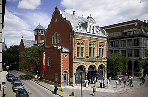
Centre d'histoire de Montréal
History museum in Montreal, Quebec
Distance: Approx. 284 meters
Latitude and longitude: 45.501111,-73.555556
The Centre d'histoire de Montréal is a museum in Montreal, Quebec, Canada. It is located at 335 Place d'Youville in Old Montreal, in the borough of Ville-Marie. The museum is dedicated to the history of Montreal.

Fonderie Darling
Visual Art Center in Quebec, Canada
Distance: Approx. 124 meters
Latitude and longitude: 45.49771667,-73.55674722
Fonderie Darling is a contemporary art complex located in the Cité du Multimédia district of Montreal, Quebec, Canada. Located in a former foundry, the complex consists of an art gallery and artists studios. Its mission is to support the creation, production, and dissemination of visual art; it seeks at once to question the role of art and artists in the heart of the city, and to promote that role.

Poste Adélard-Godbout
Electrical infrastructure in Quebec, Canada
Distance: Approx. 154 meters
Latitude and longitude: 45.497528,-73.556308
The Poste Adélard-Godbout is a 120 kV electrical substation in Old Montreal. Canada's oldest substation, it has been in continuous operation since 1901. It contains two stories above ground and one below ground.

St. Anne's Market
Distance: Approx. 208 meters
Latitude and longitude: 45.5005,-73.556
St. Anne's Market (French: Marché Sainte-Anne) was a public auction house located at Place d'Youville in Old Montreal. From 1844 to 1849, it served as the home of the Legislative Council and Assembly during the pre-Confederation era.

Griffintown–Bernard-Landry station
Railway station in Montreal, Quebec, Canada
Distance: Approx. 308 meters
Latitude and longitude: 45.4963,-73.5588
Griffintown–Bernard-Landry station is a planned station on the Réseau express métropolitain (REM) in the borough of Le Sud-Ouest in Montreal, Quebec, Canada. It will be operated by CDPQ Infra and serve as a station on the South Shore branch of the REM. The station was not built at the same time as the adjacent stations on the line, after the station location was moved from Peel Basin to the Central Station viaduct in 2020, delaying construction. As of 2024, the opening date of the station is beyond 2027.
Victoria sur le Parc
Mixed-use skyscraper under construction in Montreal, Quebec, Canada
Distance: Approx. 320 meters
Latitude and longitude: 45.5,-73.56083333
Victoria sur le Parc is a mixed-use skyscraper under construction in Montreal, Quebec, Canada. It is named for its location just south of Victoria Square in the city's downtown core. When completed in 2023, Victoria sur le Parc will become the tallest residential building in Montreal, and tied with the then completed 800 Saint-Jacques Street West as the third tallest building in Montreal.
Weather in this IP's area
broken clouds
10 Celsius
9 Celsius
9 Celsius
11 Celsius
1009 hPa
77 %
1009 hPa
1008 hPa
10000 meters
9.26 m/s
12.35 m/s
220 degree
75 %
06:24:50
19:19:00