205.145.18.43 - IP Lookup: Free IP Address Lookup, Postal Code Lookup, IP Location Lookup, IP ASN, Public IP
Country:
 USA
USARegion:
City:
Location:
Time Zone:
Postal Code:
ISP:
ASN:
language:
User-Agent:
Proxy IP:
Blacklist:
IP information under different IP Channel
ip-api
Country
Region
City
ASN
Time Zone
ISP
Blacklist
Proxy
Latitude
Longitude
Postal
Route
db-ip
Country
Region
City
ASN
Time Zone
ISP
Blacklist
Proxy
Latitude
Longitude
Postal
Route
IPinfo
Country
Region
City
ASN
Time Zone
ISP
Blacklist
Proxy
Latitude
Longitude
Postal
Route
IP2Location
205.145.18.43Country
usRegion
georgia
City
snellville
Time Zone
America/New_York
ISP
Language
User-Agent
Latitude
Longitude
Postal
ipdata
Country
Region
City
ASN
Time Zone
ISP
Blacklist
Proxy
Latitude
Longitude
Postal
Route
Popular places and events near this IP address

Grayson, Georgia
City in Georgia, United States
Distance: Approx. 6815 meters
Latitude and longitude: 33.89027778,-83.95777778
Grayson is a city in Gwinnett County, Georgia, United States. The 2020 estimated population of Grayson, GA is 4740 people. The population was 2,666 at the 2010 census, up from 765 in 2000.

Snellville, Georgia
City in Georgia, United States
Distance: Approx. 1486 meters
Latitude and longitude: 33.85611111,-84.00388889
Snellville is a city in Gwinnett County, Georgia, United States, east of Atlanta. Its population was 20,573 at the 2020 census. It is a developed suburb of Atlanta and a part of the Atlanta metropolitan area, and is located roughly 33 miles east of downtown Atlanta via US 78 and Interstate 285.

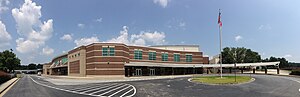
Brookwood High School (Georgia)
Public high school in Snellville, Georgia, United States
Distance: Approx. 3500 meters
Latitude and longitude: 33.883764,-84.04035
Brookwood High School is a public secondary school in Snellville, Georgia, in suburban Atlanta, part of the Gwinnett County School System. Brookwood serves several areas of southern Gwinnett County, including Snellville, Lawrenceville, and Lilburn.

Alton C. Crews Middle School
School in the United States
Distance: Approx. 5814 meters
Latitude and longitude: 33.909,-84.011
Alton C. Crews Middle School is part of the Brookwood Cluster of Gwinnett County, Georgia, United States, and is part of Gwinnett County Public Schools. Ms. Cindy Moffett is the new school principal.
Parkview High School (Georgia)
Public high school near Lilburn in Gwinnett County, Georgia, United States
Distance: Approx. 8695 meters
Latitude and longitude: 33.859481,-84.113928
Parkview High School is a public high school located near Lilburn in Gwinnett County, Georgia, United States. It is operated by Gwinnett County Public Schools. The current principal is David T. Smith.
Five Forks, Gwinnett County, Georgia
Unincorporated community in Georgia, U.S.
Distance: Approx. 4922 meters
Latitude and longitude: 33.88638889,-84.06
Five Forks is an unincorporated community in Gwinnett County in the U.S. state of Georgia near the intersections of River Road, Five Forks Trickum, Oak Road and Dogwood Road. It is a former mail-stop served from the mid-1800s to early 1900s by the Yellow River Post Office and still appears on maps as a small unincorporated community between Snellville and Lawrenceville. It is connected to another nearby mail-stop called Trickum by the unusually named Five Forks Trickum Road.
South Gwinnett High School
Public high school in Snellville, Georgia, United States
Distance: Approx. 1200 meters
Latitude and longitude: 33.853972,-84.00755
South Gwinnett High School (SGHS) is a public high school for students in grades 9–12. The school is located in Snellville, Georgia, United States. It is part of the Gwinnett County Public Schools system, one of the 15 largest public school systems in the country.
Shiloh High School (Georgia)
Public high school in Snellville, Georgia, United States
Distance: Approx. 5944 meters
Latitude and longitude: 33.823729,-84.069897
Shiloh High School is a public high school located in Snellville, Georgia, United States, in southern Gwinnett County. The school is part of the Gwinnett County Public Schools system and opened in 1984. It serves students in the Shiloh Cluster, which feeds from the Anderson Livsey, Annistown, Centerville, Partee, and Shiloh Elementary Schools and Shiloh Middle School.
Centerville, Gwinnett County, Georgia
Unincorporated community in Georgia, United States
Distance: Approx. 6349 meters
Latitude and longitude: 33.80361111,-84.04305556
Centerville is an unincorporated community in Gwinnett County, Georgia, United States. Centerville is located south of Snellville and is situated around the intersections of State Routes 124 and 264. A part of Rockdale County may also be considered to be in Centerville.

Rosebud, Georgia
Unincorporated community in Georgia, United States
Distance: Approx. 8180 meters
Latitude and longitude: 33.79861111,-83.96666667
Rosebud is an unincorporated community located in Gwinnett County, Georgia, United States.

The Shoppes at Webb Gin
Shopping mall in Georgia, USA
Distance: Approx. 4705 meters
Latitude and longitude: 33.89751944,-84.00425889
The Shoppes at Webb Gin is a retail complex located in unincorporated Gwinnett County, near Snellville, a suburb of Atlanta, Georgia, United States. The retail complex is located along Scenic Highway North (also known as Georgia State Route 124) and Webb Gin House Road, 26 miles northeast from Downtown Atlanta.
Gloster, Georgia
Unincorporated community in Georgia, U.S.
Distance: Approx. 7186 meters
Latitude and longitude: 33.90972222,-84.06527778
Gloster is an unincorporated community in Gwinnett County, in the U.S. state of Georgia.
Weather in this IP's area
clear sky
10 Celsius
8 Celsius
9 Celsius
12 Celsius
1020 hPa
85 %
1020 hPa
985 hPa
10000 meters
3.04 m/s
11.14 m/s
287 degree