205.143.224.243 - IP Lookup: Free IP Address Lookup, Postal Code Lookup, IP Location Lookup, IP ASN, Public IP
Country:
Region:
City:
Location:
Time Zone:
Postal Code:
IP information under different IP Channel
ip-api
Country
Region
City
ASN
Time Zone
ISP
Blacklist
Proxy
Latitude
Longitude
Postal
Route
Luminati
Country
ASN
Time Zone
America/Chicago
ISP
OREGON
Latitude
Longitude
Postal
IPinfo
Country
Region
City
ASN
Time Zone
ISP
Blacklist
Proxy
Latitude
Longitude
Postal
Route
IP2Location
205.143.224.243Country
Region
oregon
City
salem
Time Zone
America/Los_Angeles
ISP
Language
User-Agent
Latitude
Longitude
Postal
db-ip
Country
Region
City
ASN
Time Zone
ISP
Blacklist
Proxy
Latitude
Longitude
Postal
Route
ipdata
Country
Region
City
ASN
Time Zone
ISP
Blacklist
Proxy
Latitude
Longitude
Postal
Route
Popular places and events near this IP address

Four Corners, Oregon
Unincorporated community in the state of Oregon, United States
Distance: Approx. 889 meters
Latitude and longitude: 44.92916667,-122.97305556
Four Corners is a census-designated place (CDP) in Marion County, Oregon, United States, just outside the city limits of Salem but within the city's urban growth boundary. It is part of the Salem Metropolitan Statistical Area. The population of the CDP was 16,740 at the 2020 census.
Walter Wirth Lake
Quarry Lake in Salem, Oregon
Distance: Approx. 2760 meters
Latitude and longitude: 44.91,-122.99
Walter Wirth Lake (aka Lake Wirth) is a lake in Salem, Oregon, United States. Walter Wirth Lake is wholly contained within Cascades Gateway Park. The park and lake began development in 1957 with the Salem Area Chamber of Commerce working with the State Highway Department to convert a gravel burrow pit into a park.
Oregon State Penitentiary
Prison in Salem, Oregon, U.S.
Distance: Approx. 3391 meters
Latitude and longitude: 44.932,-123.005
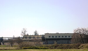
Oregon State Penitentiary (OSP), also known as Oregon State Prison, is a maximum security prison in the northwest United States in Salem, Oregon. Originally opened in Portland 174 years ago in 1851, it relocated to Salem fifteen years later. The 2,242-capacity prison is the oldest in the state; the all-male facility is operated by the Oregon Department of Corrections (ODOC).

Blanchet Catholic School
Private, coeducational school in Salem, Marion County, Oregon, United States
Distance: Approx. 3137 meters
Latitude and longitude: 44.951793,-122.977926
Blanchet Catholic School (BCS) is a private Catholic high school and middle school in Salem, Oregon, United States. Blanchet's school colors are royal blue and white.

Roberts High School
Alternative, secondary school in Salem, , Oregon, United States
Distance: Approx. 2057 meters
Latitude and longitude: 44.927787,-122.988834
Roberts High School is a high school in Salem, Oregon, United States. It provides non-traditional educational programs in the Salem-Keizer School District. Rather than a centralized campus, Roberts High School consists of departments at different sites in Salem and Keizer.

KSLM (AM)
Radio station in Oregon, United States
Distance: Approx. 2907 meters
Latitude and longitude: 44.95123056,-122.97065
KSLM (1220 kHz) is an AM radio station licensed to serve Salem, Oregon, United States.
Oregon State Hospital Historic District
Historic district in Oregon, United States
Distance: Approx. 3506 meters
Latitude and longitude: 44.93992,-123.0026
The Oregon State Hospital Historic District is a National Historic District in Salem, Oregon, United States. It was added to the National Register of Historic Places on February 28, 2008, and encompasses many of the buildings of the present-day Oregon State Hospital. The district is roughly bounded by D Street, Park Avenue, 24th Street and Bates Drive and includes the main hospital building as well as the headquarters of the Oregon Department of Corrections, known as the Dome Building, across the street.
Livingstone Adventist Academy
Private school in Salem, Marion County, Oregon, United States
Distance: Approx. 2410 meters
Latitude and longitude: 44.941775,-122.942419
Livingstone Adventist Academy is a Seventh-day Adventist school in Salem, Oregon, United States. Livingstone Adventist Academy provides a Christian educational program for students in pre-school through twelfth grade. It is one of more than forty Adventist schools directed by the Oregon Conference of Seventh-day Adventists.
Salem Academy Christian Schools
Private christian school in Salem, Marion County, Oregon, United States
Distance: Approx. 2368 meters
Latitude and longitude: 44.943059,-122.98026
Salem Academy Christian Schools is a private Christian school in Salem, Oregon, United States. The school has been accredited by the Association of Christian Schools International since 2003, and by the Northwest Association of Accredited Schools since 1959.
Willamette Town Center
Shopping mall in Oregon, United States
Distance: Approx. 2583 meters
Latitude and longitude: 44.9418,-122.9865
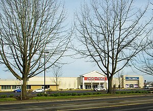
Willamette Town Center, formerly Lancaster Mall, is an exterior entrance shopping center located in Salem, Oregon, United States. Opened in 1971, the main part of the center has 550,000 square feet (51,000 m2) of space. The regional mall is located on Lancaster Drive and is bordered on the West by Interstate 5, making Willamette Town Center a retail hub for the city of Salem.
Oregon State Forester's Office Building
United States historic place
Distance: Approx. 3480 meters
Latitude and longitude: 44.93111111,-123.00638889
The Oregon State Forester's Office Building is a historic building in Salem, Oregon, United States that is used by the head of the Oregon Department of Forestry. The 1938 building was listed on the National Register of Historic Places (NRHP) in 1982. It was designed by Linn A. Forrest in the "National Park Style".
Oregon State Correctional Institution
Prison located in Oregon, United States
Distance: Approx. 3378 meters
Latitude and longitude: 44.897,-122.949
Oregon State Correctional Institution (OSCI) is a 33-acre (130,000 m2) medium security men's prison, located in Salem, Oregon, United States and operated by the Oregon Department of Corrections. The prison was established by an act of the Oregon State Legislature in 1955 and opened in 1959. OSCI typically houses younger inmates, including young adults who began their sentence in a youth detention center.
Weather in this IP's area
light rain
9 Celsius
9 Celsius
8 Celsius
11 Celsius
1010 hPa
80 %
1010 hPa
1002 hPa
10000 meters
0.89 m/s
1.34 m/s
188 degree
100 %


