205.142.110.97 - IP Lookup: Free IP Address Lookup, Postal Code Lookup, IP Location Lookup, IP ASN, Public IP
Country:
Region:
City:
Location:
Time Zone:
Postal Code:
IP information under different IP Channel
ip-api
Country
Region
City
ASN
Time Zone
ISP
Blacklist
Proxy
Latitude
Longitude
Postal
Route
Luminati
Country
ASN
Time Zone
America/Chicago
ISP
TWC-20001-PACWEST
Latitude
Longitude
Postal
IPinfo
Country
Region
City
ASN
Time Zone
ISP
Blacklist
Proxy
Latitude
Longitude
Postal
Route
IP2Location
205.142.110.97Country
Region
california
City
carlsbad
Time Zone
America/Los_Angeles
ISP
Language
User-Agent
Latitude
Longitude
Postal
db-ip
Country
Region
City
ASN
Time Zone
ISP
Blacklist
Proxy
Latitude
Longitude
Postal
Route
ipdata
Country
Region
City
ASN
Time Zone
ISP
Blacklist
Proxy
Latitude
Longitude
Postal
Route
Popular places and events near this IP address

Carlsbad, California
City in California, United States
Distance: Approx. 3019 meters
Latitude and longitude: 33.12194444,-117.29694444
Carlsbad is a beach city in the North County area of San Diego County, California, United States. The city is 35 miles (56 km) north of downtown San Diego and 87 miles (140 km) south of downtown Los Angeles. As of the 2020 census, the population of the city was 114,746.

McClellan–Palomar Airport
Municipal airport serving the city of Carlsbad, California, United States
Distance: Approx. 3239 meters
Latitude and longitude: 33.12833333,-117.28
McClellan–Palomar Airport (Palomar Airport) (IATA: CLD, ICAO: KCRQ, FAA LID: CRQ) is a public airport three miles (4.8 km; 2.6 nmi) southeast of Carlsbad in San Diego County, California. It is owned by the County of San Diego. The airport is used for both general and commercial aviation.
Terramar, Carlsbad, California
Distance: Approx. 3421 meters
Latitude and longitude: 33.131,-117.336
Terramar is located in Carlsbad, California. It is a small oceanfront neighborhood community developed by William Cannon in the 1950s. It has its own Association called the Terramar Association, with a set of rules.
Carlsbad High School (California)
Public school in Carlsbad, California, US
Distance: Approx. 2712 meters
Latitude and longitude: 33.16261389,-117.32887778
Carlsbad High School is a public high school in Carlsbad, California.

Agua Hedionda Lagoon
Lagoon in Carlsbad, California, US
Distance: Approx. 2143 meters
Latitude and longitude: 33.1425,-117.3275
Agua Hedionda Lagoon ("agua hedionda" means "fetid water" in Spanish) is a lagoon in Carlsbad, California, that is fed by Agua Hedionda Creek. Stewardship of much of the lagoon is held by NRG Energy due to its ownership of the former Encina Power Station. November 2000, Agua Hedionda Lagoon was designated as a critical habitat for the tidewater goby.
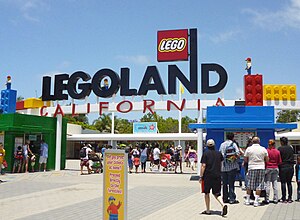
Legoland California
Theme park in Carlsbad, California
Distance: Approx. 2443 meters
Latitude and longitude: 33.12666667,-117.31111111
Legoland California Resort is a theme park, miniature park, and aquarium in Carlsbad, California, based on the Lego toy brand. Opening on March 20, 1999, it was the first Legoland park to open outside of Europe. The park is currently owned by Merlin Entertainments, which took a controlling interest in 2005.

Rancho Agua Hedionda
1842 Mexican land grant
Distance: Approx. 1960 meters
Latitude and longitude: 33.16,-117.29
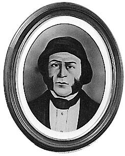
Rancho Agua Hedionda was a 13,311-acre (53.87 km2) Mexican land grant in present-day San Diego County, California, given in 1842 by Governor Juan Alvarado to Juan María Marrón. The name means "stinking water" in Spanish. The grant extended south along the Pacific Coast from present day Carlsbad to Leucadia.
Claude "Bud" Lewis Carlsbad Desalination Plant
Desalination plant in Carlsbad, California
Distance: Approx. 2959 meters
Latitude and longitude: 33.13888889,-117.33527778
The Claude "Bud" Lewis Carlsbad Desalination Plant is a desalination plant in Carlsbad, California. The San Diego County Water Authority (SDCWA), the recipient of the fresh water produced by the plant, calls it "the nation’s largest, most technologically advanced and energy-efficient seawater desalination plant." Opened on December 14, 2015, the entire desalination project cost about $1 billion for the plant, pipelines, and upgrades to existing SDCWA facilities to use the water.

Encina Power Station
Power station in California, US
Distance: Approx. 3208 meters
Latitude and longitude: 33.13638889,-117.33694444
Encina Power Station (EPS) was a large natural gas and oil-fueled electricity generating plant in Carlsbad in San Diego County, California. Constructed in 1954, it was one of the major suppliers of electricity for the region. On December 11, 2018, the plant was put into "retired" status and officially stopped operations.
Sage Creek High School
Public school (government funded), stem school in Carlsbad, California , USA
Distance: Approx. 2135 meters
Latitude and longitude: 33.15771667,-117.28567778
Sage Creek High School is a public high school in Carlsbad, California. It opened in the fall of 2013. Sage Creek specializes in the STEM fields and was created to alleviate growing enrollment at Carlsbad High School.

The Flower Fields
Flower garden in California, United States
Distance: Approx. 3006 meters
Latitude and longitude: 33.123066,-117.317591
The Flower Fields is a flower garden in Carlsbad Ranch in Carlsbad, California. The Giant Tecolote Ranunculus flowers that make up the garden are in bloom for approximately six to eight weeks each year, from early March through early May. The garden is typically open to visitors between March 1 and Mother's Day.

Cerro de la Calavera
Mountain in California
Distance: Approx. 3098 meters
Latitude and longitude: 33.1675,-117.28166667
Cerro de la Calavera (also known as Mount Calavera) is an 513 ft (156 m) ancient plug dome volcano that last erupted 22 million years ago during the subduction of the Farallon Plate. It is located within the city of Carlsbad, California in the United States. Cerro de la Calavera is only one of three volcanic plugs in Southern California and can easily be seen from either northbound Interstate 5 at Cannon Road or westbound on Lake Boulevard.
Weather in this IP's area
clear sky
22 Celsius
21 Celsius
19 Celsius
25 Celsius
1017 hPa
31 %
1017 hPa
1014 hPa
10000 meters
4.63 m/s
240 degree
