205.137.244.78 - IP Lookup: Free IP Address Lookup, Postal Code Lookup, IP Location Lookup, IP ASN, Public IP
Country:
 USA
USARegion:
City:
Location:
Time Zone:
Postal Code:
ISP:
ASN:
language:
User-Agent:
Proxy IP:
Blacklist:
IP information under different IP Channel
ip-api
Country
Region
City
ASN
Time Zone
ISP
Blacklist
Proxy
Latitude
Longitude
Postal
Route
db-ip
Country
Region
City
ASN
Time Zone
ISP
Blacklist
Proxy
Latitude
Longitude
Postal
Route
IPinfo
Country
Region
City
ASN
Time Zone
ISP
Blacklist
Proxy
Latitude
Longitude
Postal
Route
IP2Location
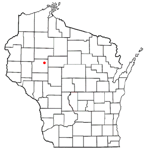
205.137.244.78Country
usRegion
wisconsin
City
holcombe
Time Zone
America/Chicago
ISP
Language
User-Agent
Latitude
Longitude
Postal
ipdata
Country
Region
City
ASN
Time Zone
ISP
Blacklist
Proxy
Latitude
Longitude
Postal
Route
Popular places and events near this IP address

Birch Creek, Wisconsin
Town in Wisconsin, United States
Distance: Approx. 8291 meters
Latitude and longitude: 45.23833333,-91.22138889
Birch Creek is a town in Chippewa County in the U.S. state of Wisconsin. The population was 495 at the 2020 census.

Cornell, Wisconsin
City in Wisconsin, United States
Distance: Approx. 6906 meters
Latitude and longitude: 45.16666667,-91.14972222
Cornell is a city in Chippewa County, Wisconsin, United States. The population was 1,453 at the 2020 census, down from 1,467 at the 2010 census. It is located on the Chippewa River, upstream from Lake Wissota and Chippewa Falls, where Highway 64 crosses the river and Highway 27.
Estella, Wisconsin
Town in Wisconsin, United States
Distance: Approx. 5630 meters
Latitude and longitude: 45.17388889,-91.12111111
The Town of Estella is located in Chippewa County in the U.S. state of Wisconsin. The population was 433 at the 2010 census.

Lake Holcombe, Wisconsin
Town in Wisconsin, United States
Distance: Approx. 2874 meters
Latitude and longitude: 45.24777778,-91.10194444
Lake Holcombe is also a popular name for the Holcombe Flowage. Lake Holcombe is a town in Chippewa County in the U.S. state of Wisconsin. Its population was 1,031 at the 2010 census.

Jump River
Distance: Approx. 5110 meters
Latitude and longitude: 45.26361111,-91.15138889
The Jump River is a small rocky river in north-central Wisconsin. In the late 19th century it was used to drive logs down to the Chippewa River. Today it is recreational, rambling through woods and farmlands, used mostly by fishermen and paddlers.

Brunet Island State Park
State park in Chippewa County, Wisconsin
Distance: Approx. 6329 meters
Latitude and longitude: 45.17916667,-91.16638889
Brunet Island State Park is a state park of Wisconsin, USA, featuring a 169-acre (68 ha) island in the Chippewa River. The remainder of the park's 1,225 acres (496 ha) are on the east bank of the river. It is noted for its numerous white-tailed deer and large eastern hemlock trees.

Holcombe, Wisconsin
Census-designated place in Wisconsin, United States
Distance: Approx. 5 meters
Latitude and longitude: 45.22444444,-91.1175
Holcombe is a census-designated place located in Chippewa County, Wisconsin, United States.
Arnold, Wisconsin
Unincorporated community in Wisconsin, United States
Distance: Approx. 9293 meters
Latitude and longitude: 45.24888889,-91.00416667
Arnold is an unincorporated community located in the town of Ruby, Chippewa County, Wisconsin, United States. After originally being called Still Hawn for two local businessmen, a post office called Arnold was established in 1905, and remained in operation until it was discontinued in 1934. The community was named for Arnold Deuel, the postmaster's son.

Holcombe Flowage
Reservoir in Chippewa and Rusk counties, Wisconsin
Distance: Approx. 3507 meters
Latitude and longitude: 45.24722222,-91.14833333
Holcombe Flowage is a reservoir on the Chippewa River in Chippewa County and Rusk County, Wisconsin. The dam stands between the towns of Birch Creek and Lake Holcombe, just west of the settlement of Holcombe, Wisconsin, in Chippewa County, where most of the reservoir lies. A small part of the reservoir also extends northward into the Town of Willard in Rusk County.
Cornell Municipal Airport
Airport in Cornell, Wisconsin
Distance: Approx. 6619 meters
Latitude and longitude: 45.16552222,-91.10569722
Cornell Municipal Airport (FAA LID: 4WI9) (formerly 2H3) is a private-use airport located two nautical miles (3.4 km) east of the central business district of Cornell, a city in Chippewa County, Wisconsin, United States.

Cornell School District (Cornell, Wisconsin)
School district in Wisconsin, United States
Distance: Approx. 6808 meters
Latitude and longitude: 45.16580556,-91.14236111
The Cornell School District is a public school district in Cornell, Wisconsin.

Cornell Pulpwood Stacker
United States historic place
Distance: Approx. 7128 meters
Latitude and longitude: 45.16612,-91.15515
The Cornell Pulpwood Stacker is located at Millyard Park in Cornell, Wisconsin, United States. It was utilized to move pulpwood logs into large piles so they could be sent through waterways to paper mills. The stacker operated at the Cornell Wood Products Mill from 1912 until its obsolescence in 1971.
Weather in this IP's area
overcast clouds
-21 Celsius
-21 Celsius
-21 Celsius
-21 Celsius
1027 hPa
89 %
1027 hPa
982 hPa
10000 meters
0.93 m/s
1.28 m/s
38 degree
100 %