Country:
Region:
City:
Latitude and Longitude:
Time Zone:
Postal Code:
IP information under different IP Channel
ip-api
Country
Region
City
ASN
Time Zone
ISP
Blacklist
Proxy
Latitude
Longitude
Postal
Route
Luminati
Country
ASN
Time Zone
America/Chicago
ISP
SDL-20-AS
Latitude
Longitude
Postal
IPinfo
Country
Region
City
ASN
Time Zone
ISP
Blacklist
Proxy
Latitude
Longitude
Postal
Route
db-ip
Country
Region
City
ASN
Time Zone
ISP
Blacklist
Proxy
Latitude
Longitude
Postal
Route
ipdata
Country
Region
City
ASN
Time Zone
ISP
Blacklist
Proxy
Latitude
Longitude
Postal
Route
Popular places and events near this IP address

Ellettsville, Indiana
Town in Indiana, United States
Distance: Approx. 1221 meters
Latitude and longitude: 39.23222222,-86.62416667
Ellettsville is a town in Richland Township, Monroe County, Indiana, United States. The population was 6,655 at the 2020 census. It is part of the Bloomington, Indiana Metropolitan Statistical Area.

Stinesville, Indiana
Town in Indiana, United States
Distance: Approx. 6687 meters
Latitude and longitude: 39.3,-86.65
Stinesville is a town in Bean Blossom Township, Monroe County, in the U.S. state of Indiana. The population was 203 at the 2020 census. It is part of the Bloomington Metropolitan Statistical Area.

Bean Blossom Township, Monroe County, Indiana
Township in Indiana, United States
Distance: Approx. 6114 meters
Latitude and longitude: 39.29611111,-86.62166667
Bean Blossom Township is one of eleven townships in Monroe County, Indiana, United States. As of the 2010 census, its population was 2,916 and it contained 1,184 housing units.

Richland Township, Monroe County, Indiana
Township in Indiana, United States
Distance: Approx. 3024 meters
Latitude and longitude: 39.21472222,-86.62722222
Richland Township is one of eleven townships in Monroe County, Indiana, United States. As of the 2020 census, its population was 15,098, and it contained 6,455 housing units.
Edgewood High School (Indiana)
Public high school in Ellettsville, Indiana, United States
Distance: Approx. 670 meters
Latitude and longitude: 39.23583333,-86.63305556
Edgewood High School is located in Ellettsville, Indiana. The school is the sole high school in the Richland-Bean Blossom Community School Corporation and opened in 1965, shortly after the school district consolidated Ellettsville and Stinesville schools.
WCLS
Radio station in Spencer, Indiana
Distance: Approx. 2392 meters
Latitude and longitude: 39.22277778,-86.64444444
WCLS (97.7 FM) is a radio station licensed to Spencer, Indiana, United States, the station serves the Bloomington area with a classic hits format. The station is owned by Mid-America Radio of Indiana. The station is an affiliate of the IndyCar Radio Network, and carries the only live and legal broadcast of the Indianapolis 500.

Ennis Archaeological Site
United States historic place
Distance: Approx. 4571 meters
Latitude and longitude: 39.23861111,-86.68416667
The Ennis Site is an important archaeological site in the countryside southwest of Indianapolis in the U.S. state of Indiana. Located near the town of Ellettsville in Monroe County, the site extends into a portion of Owen County, near the town of Spencer. As an important archaeological site, it was listed on the National Register of Historic Places in mid-1985; it was the first Monroe County archaeological site and the only Owen County archaeological site to receive this distinction.

Ellettsville Downtown Historic District
Historic district in Indiana, United States
Distance: Approx. 680 meters
Latitude and longitude: 39.23833333,-86.62472222
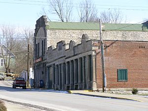
Ellettsville Downtown Historic District is a national historic district located at Ellettsville, Monroe County, Indiana. The district encompasses 50 contributing buildings in the central business district and surrounding residential sections of Ellettsville. It developed between about 1840 and 1953, and includes notable examples of Queen Anne, Early Commercial, Gothic Revival, and Bungalow/American Craftsman style architecture.

Stinesville Commercial Historic District
Historic district in Indiana, United States
Distance: Approx. 6555 meters
Latitude and longitude: 39.29861111,-86.65083333
Stinesville Commercial Historic District is a national historic district located at Stinesville, Monroe County, Indiana. The district consists of five adjoining limestone commercial buildings in the central business district of Stinesville. The buildings were built between 1886 and 1894, and display elements of Renaissance Revival and Romanesque Revival style architecture.

Maple Grove Road Rural Historic District
Historic district in Indiana, United States
Distance: Approx. 6304 meters
Latitude and longitude: 39.22194444,-86.56277778
Maple Grove Road Rural Historic District is a national historic district located in Bloomington Township and Richland Township, Monroe County, Indiana. The district encompasses 69 contributing buildings, 7 contributing sites, 8 contributing structures, and 30 contributing objects in a rural area near Bloomington. The district developed between about 1828 and 1950, and include notable examples of Gothic Revival and Greek Revival style architecture.

Matthews Stone Company Historic District
Historic district in Indiana, United States
Distance: Approx. 1086 meters
Latitude and longitude: 39.245,-86.61944444
Matthews Stone Company Historic District is a national historic district located in Richland Township, Monroe County, Indiana. The district encompasses five contributing buildings, one contributing site, six contributing structures, and two contributing objects associated with the Matthews Brothers Stone Company limestone business, now operated as Bybee Stone Company, Inc. The district developed between about 1862 and 1962, and include notable examples of Second Empire and Tudor Revival style architecture.
West Brook Downs, Indiana
Unincorporated community in Indiana, United States
Distance: Approx. 3998 meters
Latitude and longitude: 39.21444444,-86.60111111
West Brook Downs is an unincorporated community in Richland Township, Monroe County, in the U.S. state of Indiana.
Weather in this IP's area
clear sky
13 Celsius
12 Celsius
11 Celsius
14 Celsius
1021 hPa
66 %
1021 hPa
995 hPa
10000 meters
3.09 m/s
120 degree
07:17:02
17:43:04