204.63.217.104 - IP Lookup: Free IP Address Lookup, Postal Code Lookup, IP Location Lookup, IP ASN, Public IP
Country:
Region:
City:
Location:
Time Zone:
Postal Code:
ISP:
ASN:
language:
User-Agent:
Proxy IP:
Blacklist:
IP information under different IP Channel
ip-api
Country
Region
City
ASN
Time Zone
ISP
Blacklist
Proxy
Latitude
Longitude
Postal
Route
db-ip
Country
Region
City
ASN
Time Zone
ISP
Blacklist
Proxy
Latitude
Longitude
Postal
Route
IPinfo
Country
Region
City
ASN
Time Zone
ISP
Blacklist
Proxy
Latitude
Longitude
Postal
Route
IP2Location
204.63.217.104Country
Region
oklahoma
City
lawton
Time Zone
America/Chicago
ISP
Language
User-Agent
Latitude
Longitude
Postal
ipdata
Country
Region
City
ASN
Time Zone
ISP
Blacklist
Proxy
Latitude
Longitude
Postal
Route
Popular places and events near this IP address

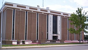
Comanche County, Oklahoma
County in Oklahoma, United States
Distance: Approx. 4833 meters
Latitude and longitude: 34.66,-98.46
Comanche County is a county located in the U.S. state of Oklahoma. As of the 2020 census, the population was 121,125, making it the fifth-most populous county in Oklahoma. Its county seat is Lawton.
Cameron University
Public university in Lawton, Oklahoma, US
Distance: Approx. 2385 meters
Latitude and longitude: 34.6087,-98.4345
Cameron University is a public university in Lawton, Oklahoma. It offers more than 50 degrees through both undergraduate and graduate programs. The degree programs emphasize the liberal arts, science and technology, and graduate and professional studies.

Eisenhower High School (Lawton, Oklahoma)
Co-educational, public, secondary school in Lawton, Comanche County, Oklahoma, United States
Distance: Approx. 867 meters
Latitude and longitude: 34.608898,-98.457266
Eisenhower Senior High School (EHS) is one of three public high schools and is located in west Lawton, Oklahoma. It was the second high school built in Lawton, Oklahoma in the early 1960s. Its attendance boundary includes residents of the Bishop Public School school district.

Lawton High School
Co-educational, public, secondary school in Lawton, Oklahoma, United States
Distance: Approx. 5042 meters
Latitude and longitude: 34.617144,-98.403671
Lawton High School (LHS) was the first high school built in Lawton, Oklahoma. It is a part of Lawton Public Schools. Lawton High is located at 601 Northwest Fort Sill Boulevard in Lawton, Oklahoma.
Great Plains Coliseum
Distance: Approx. 4134 meters
Latitude and longitude: 34.5991,-98.4189
The Great Plains Coliseum is a 3,000-seat multi-purpose arena in Lawton, Oklahoma, USA. It hosts local sporting events and concerts. It was home to the Lawton-Fort Sill Cavalry, who last played in 2011, and the 580 RollerGirls, who started play in 2011.

Museum of the Great Plains (Oklahoma)
Natural history museum in Lawton, Oklahoma
Distance: Approx. 5558 meters
Latitude and longitude: 34.618056,-98.398056
The Museum of the Great Plains is a history museum located in Lawton, Oklahoma, United States. The museum’s major exhibits reveal the diverse cultures inhabiting the Great Plains region beginning with the arrival of the Paleo-Indians known as the Clovis culture at approximately 11,500 BCE. A variety of educational programs are offered year around. The museum is one of five partner museums in the Oklahoma Museum Network.
Lawton Public Schools
School district in Oklahoma
Distance: Approx. 4956 meters
Latitude and longitude: 34.616778,-98.404599
Lawton Public Schools is a public school district based in Lawton, Oklahoma, United States. The district serves most of the city of Lawton, about half of Medicine Park, and surrounding rural areas in central Comanche County. It is also the school district for dependents on Fort Sill.

Lawton, Oklahoma metropolitan area
Metropolitan Statistical Area in Oklahoma, United States
Distance: Approx. 5360 meters
Latitude and longitude: 34.6625,-98.47638889
The Lawton Metropolitan Statistical Area, as defined by the United States Census Bureau, is an area consisting of two counties – Comanche and Cotton – in Oklahoma, anchored by the city of Lawton. As of the 2010 census, the MSA had a population of 130,291.
KMGZ
Radio station in Lawton, Oklahoma
Distance: Approx. 4654 meters
Latitude and longitude: 34.577,-98.475
KMGZ (95.3 FM) is a radio station broadcasting a hot adult contemporary format. The station serves the Lawton, Oklahoma area. It appears to be privately owned.

KVRW
Radio station in Lawton, Oklahoma
Distance: Approx. 4997 meters
Latitude and longitude: 34.63666667,-98.5075
KVRW (107.3 FM, "107.3 PopCrush") is a radio station broadcasting a top 40/CHR music format. Licensed to Lawton, Oklahoma, United States, the station serves the Lawton area. The station is currently owned by Townsquare Media and features programming from Westwood One.

First Christian Church (Lawton, Oklahoma)
Historic church in Oklahoma, United States
Distance: Approx. 5694 meters
Latitude and longitude: 34.60444444,-98.39833333
The First Christian Church in Lawton, Oklahoma is a historic church at 701 D Avenue. It was built in 1929 and added to the National Register of historic Places in 1985. It was designed by architect Walter T. Vahlberg in Gothic Revival style.
First Presbyterian Church of Lawton
Historic church in Oklahoma, United States
Distance: Approx. 5618 meters
Latitude and longitude: 34.60361111,-98.39944444
The First Presbyterian Church of Lawton (also known as Centenary United Methodist Church of Lawton) is a historic church building at 8th Street and D Avenue in Lawton, Oklahoma. It was built in 1902 in a late-Gothic Revival style and was added to the National Register of Historic Places in 1979. It consists of an original 1902-built 41 by 125 feet (12 m × 38 m) brick building and a 1946 extension.
Weather in this IP's area
overcast clouds
2 Celsius
-2 Celsius
2 Celsius
3 Celsius
1019 hPa
93 %
1019 hPa
973 hPa
10000 meters
5.66 m/s
9.77 m/s
20 degree
100 %