204.27.229.160 - IP Lookup: Free IP Address Lookup, Postal Code Lookup, IP Location Lookup, IP ASN, Public IP
Country:
Region:
City:
Location:
Time Zone:
Postal Code:
IP information under different IP Channel
ip-api
Country
Region
City
ASN
Time Zone
ISP
Blacklist
Proxy
Latitude
Longitude
Postal
Route
Luminati
Country
ASN
Time Zone
America/Chicago
ISP
TVC-AS1
Latitude
Longitude
Postal
IPinfo
Country
Region
City
ASN
Time Zone
ISP
Blacklist
Proxy
Latitude
Longitude
Postal
Route
IP2Location
204.27.229.160Country
Region
new york
City
canandaigua
Time Zone
America/New_York
ISP
Language
User-Agent
Latitude
Longitude
Postal
db-ip
Country
Region
City
ASN
Time Zone
ISP
Blacklist
Proxy
Latitude
Longitude
Postal
Route
ipdata
Country
Region
City
ASN
Time Zone
ISP
Blacklist
Proxy
Latitude
Longitude
Postal
Route
Popular places and events near this IP address

Ontario County, New York
County in New York, United States
Distance: Approx. 1276 meters
Latitude and longitude: 42.85,-77.29
Ontario County is a county in the U.S. State of New York. As of the 2020 census, the population was 112,458. The county seat is Canandaigua.
Canandaigua (town), New York
Town in Ontario County, New York, US
Distance: Approx. 1461 meters
Latitude and longitude: 42.85722222,-77.30361111
Canandaigua (pronounced "Ka-nuhn-day-gwuh", IPA: /ˌkænənˈdeɡwə/) is a town in Ontario County, New York, United States. The population was 11,109 at the 2020 census. The Town of Canandaigua surrounds the City of Canandaigua at the north end of Canandaigua Lake and is southeast of Rochester.
Canandaigua Lake State Marine Park
State park in Ontario County, New York
Distance: Approx. 4291 meters
Latitude and longitude: 42.877,-77.276
Canandaigua Lake State Marine Park is a New York state park and boat launch located on the north shore of Canandaigua Lake in Ontario County, New York. The park is 1 of 80 New York State Parks that are in the path of totality for the 2024 solar eclipse, with the park experiencing 2 minutes and 51 seconds of totality.

Adelaide Avenue School
United States historic place
Distance: Approx. 4619 meters
Latitude and longitude: 42.88361111,-77.28611111
Adelaide Avenue School is a historic school building located at Canandaigua in Ontario County, New York. It was built about 1890 and is a one-story, polychrome brick structure on a raised basement. It features a variety of picturesque late 19th century decorative features in the Queen Anne style, such as a multi-gabled roof surmounted by a louvred cupola.

Building at 426 South Main Street
United States historic place
Distance: Approx. 4651 meters
Latitude and longitude: 42.88111111,-77.27694444
The building at 426 South Main Street (also New York State Routes 21 and 332) is located in Canandaigua, New York, United States. It is a two-story brick dwelling in the Italianate architectural style built around 1880. In 1984 it and its neighboring barn were listed on the National Register of Historic Places.

Thaddeus Chapin House
Historic house in New York, United States
Distance: Approx. 4320 meters
Latitude and longitude: 42.88194444,-77.29166667
The Thaddeus Chapin House is a historic house located at 128 Thad Chapin Street in Canandaigua, Ontario County, New York.

Marshall House (Canandaigua, New York)
Historic house in New York, United States
Distance: Approx. 4145 meters
Latitude and longitude: 42.88027778,-77.29138889
Marshall House is a historic home located at Canandaigua in Ontario County, New York. It is a two-story, five bay center hall brick dwelling on a slightly raised basement. Although built in 1844 with later alterations, it has characteristics of the Federal style.

Brigham Hall
United States historic place
Distance: Approx. 4060 meters
Latitude and longitude: 42.87916667,-77.28972222
Brigham Hall, also known as Grove Home, is a historic psychiatric hospital located at Canandaigua in Ontario County, New York. It is a complex of 10 buildings designed as a facility for the care and confinement of the mentally ill. The Gothic Revival style main building was built about 1855 and is surrounded by the contributing outbuildings.

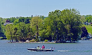
Skenoh Island
Island in Canandaigua Lake
Distance: Approx. 3671 meters
Latitude and longitude: 42.87,-77.27555556
Skenoh Island is located at the north end of Canandaigua Lake, near the city of Canandaigua, New York, United States. It is one of two islands in the 11 Finger Lakes. Frequently it is described as New York's smallest state park; however, while it is one of the state's smallest protected areas, it is not formally designated as a state park, but rather it is a "unique area" managed by the New York State Department of Environmental Conservation.
Sucker Brook (Canandaigua Lake)
River in New York, United States
Distance: Approx. 4020 meters
Latitude and longitude: 42.87388889,-77.27555556
Sucker Brook is a short stream that drains into the northwest corner of Canandaigua Lake, New York, United States. It flows in a 6-mile (9.7 km) hairpin-shaped course from uplands in the town of Canandaigua to the lake, in the eponymous city. The name comes from the white sucker fish abundant in its waters.
Deep Run (Canandaigua Lake)
River in New York, United States
Distance: Approx. 4389 meters
Latitude and longitude: 42.82083333,-77.26
Deep Run is a tributary of the Canandaigua Lake in Ontario County, New York in the United States.
Cheshire, New York
Hamlet in New York, United States
Distance: Approx. 3117 meters
Latitude and longitude: 42.82222222,-77.32722222
Cheshire is a hamlet in the Town of Canandaigua, Ontario County, New York, United States, located near Canandaigua Lake. It is located 7 miles (11 km) south-southwest of the City of Canandaigua, at an elevation of 1,024 feet (312 m). The primary cross roads where the hamlet is located are N.Y. Route 21, Woolhouse Road and Goodale Road.
Weather in this IP's area
broken clouds
-2 Celsius
-9 Celsius
-3 Celsius
-1 Celsius
1016 hPa
64 %
1016 hPa
979 hPa
10000 meters
6.71 m/s
9.39 m/s
307 degree
57 %