204.17.197.222 - IP Lookup: Free IP Address Lookup, Postal Code Lookup, IP Location Lookup, IP ASN, Public IP
Country:
Region:
City:
Location:
Time Zone:
Postal Code:
IP information under different IP Channel
ip-api
Country
Region
City
ASN
Time Zone
ISP
Blacklist
Proxy
Latitude
Longitude
Postal
Route
Luminati
Country
ASN
Time Zone
America/Chicago
ISP
CENTRILOGIC-ASN
Latitude
Longitude
Postal
IPinfo
Country
Region
City
ASN
Time Zone
ISP
Blacklist
Proxy
Latitude
Longitude
Postal
Route
IP2Location
204.17.197.222Country
Region
wisconsin
City
menomonee falls
Time Zone
America/Chicago
ISP
Language
User-Agent
Latitude
Longitude
Postal
db-ip
Country
Region
City
ASN
Time Zone
ISP
Blacklist
Proxy
Latitude
Longitude
Postal
Route
ipdata
Country
Region
City
ASN
Time Zone
ISP
Blacklist
Proxy
Latitude
Longitude
Postal
Route
Popular places and events near this IP address

Lannon, Wisconsin
Village in Wisconsin, United States
Distance: Approx. 4980 meters
Latitude and longitude: 43.15027778,-88.16444444
Lannon is a village in Waukesha County, Wisconsin, United States. The population was 1,355 at the 2020 census. Lannon is a part of the Milwaukee metropolitan area.
Menomonee Falls, Wisconsin
Village in Wisconsin, United States
Distance: Approx. 6 meters
Latitude and longitude: 43.17888889,-88.11722222
Menomonee Falls is a village in Waukesha County, Wisconsin, United States. The population was 38,527 at the 2020 census, making it the most populous village in Wisconsin. It is part of the Milwaukee metropolitan area.

Germantown, Wisconsin
Village in Washington County, Wisconsin
Distance: Approx. 4921 meters
Latitude and longitude: 43.22305556,-88.12027778
Germantown is a village in Washington County, Wisconsin, United States. The population was 20,917 at the 2020 census. The village surrounds the Town of Germantown.
Milwaukee Open Invitational
Golf tournament formerly on the PGA Tour
Distance: Approx. 4511 meters
Latitude and longitude: 43.151,-88.077
The Milwaukee Open Invitational was a professional golf tournament in Wisconsin on the PGA Tour. It was played seven times from 1955 through 1961 at different courses in the Milwaukee area. During its final year, Arnold Palmer skipped the tournament to prepare for the British Open, which he won.
Blue Ribbon Open
Professional golf tournament
Distance: Approx. 4511 meters
Latitude and longitude: 43.151,-88.077
The Blue Ribbon Open was a professional golf tournament on the PGA Tour, played only in 1951. It was held in Wisconsin at the North Hills Country Club in Menomenee Falls, northwest of Milwaukee. Part-time Hollywood actor Joe Kirkwood Jr.
Milwaukee Open
Golf tournament formerly on the PGA Tour
Distance: Approx. 4511 meters
Latitude and longitude: 43.151,-88.077
The Milwaukee Open was a professional golf tournament in Wisconsin on the PGA Tour, played only in 1940. It was held August 2–4 at North Hills Country Club in Menomenee Falls, northwest of Milwaukee. Three-time major winner Ralph Guldahl shot a final round 67 (−4) to win the event at 268 (−16), two shots ahead of runner-up Ed Oliver.

Menomonee Falls High School
Public school in Wisconsin, United States
Distance: Approx. 2807 meters
Latitude and longitude: 43.16485,-88.08859
Menomonee Falls High School is a four-year public high school located in the village of Menomonee Falls in Waukesha County, Wisconsin in the United States. It is a part of the Menomonee Falls School District. The district (and therefore the high school's attendance boundary) covers most of Menomonee Falls, a section of Lannon, and a small section of Milwaukee in Waukesha County.
Calvary Baptist School (Wisconsin)
Pre-K–12th grade school in Menomonee Falls, Wisconsin, US
Distance: Approx. 2771 meters
Latitude and longitude: 43.16777778,-88.14783333
Calvary Baptist School is a private, Baptist school located in Menomonee Falls, Wisconsin, a suburb of Milwaukee. Calvary consists of preschool through twelfth grade and is one of the largest Protestant schools in Wisconsin. It is a member of the American Association of Christian Schools.
Menomonee, Wisconsin
Former town in Waukesha County, Wisconsin, United States.
Distance: Approx. 3218 meters
Latitude and longitude: 43.15,-88.11666667
Menomonee used to be a town in Waukesha County, Wisconsin, United States.

Germantown Power Plant
Electrical power station in Germantown, Washington County, Wisconsin
Distance: Approx. 3292 meters
Latitude and longitude: 43.19611111,-88.15027778
Germantown Power Plant is a natural gas fired, electrical peaking power plant located in Germantown, Wisconsin in Washington County. It is a five unit natural gas or #2 low sulfur fuel oil facility. Unit 5, which is powered by natural gas, is the primary unit, with the other four, powered by low sulfur fuel oil, being used during hours of peak energy usage.
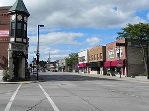
Main Street Historic District (Menomonee Falls, Wisconsin)
Historic district in Wisconsin, United States
Distance: Approx. 350 meters
Latitude and longitude: 43.17944444,-88.11305556
The Main Street Historic District is a cluster of historic buildings around the intersection of Main Street and Appleton Avenue in Menomonee Falls, Wisconsin. It was added to the National Register of Historic Places in 1988. Menomonee Falls was established in 1836 near a series of rapids of the Menomonee River.

Dretzka Park
Park in Milwaukee, Wisconsin, US
Distance: Approx. 5076 meters
Latitude and longitude: 43.168611,-88.056389
Dretzka Park is a 327 acres (132 ha) acre park on the north side of Milwaukee, Wisconsin in the United States. The park was named for Polish immigrant Jerome C. Dretzka who served on the Milwaukee County Park System Commission for 43 years.
Weather in this IP's area
fog
2 Celsius
2 Celsius
1 Celsius
3 Celsius
1025 hPa
91 %
1025 hPa
993 hPa
402 meters
0.45 m/s
0.89 m/s
59 degree
100 %
