204.16.251.124 - IP Lookup: Free IP Address Lookup, Postal Code Lookup, IP Location Lookup, IP ASN, Public IP
Country:
Region:
City:
Location:
Time Zone:
Postal Code:
ISP:
ASN:
language:
User-Agent:
Proxy IP:
Blacklist:
IP information under different IP Channel
ip-api
Country
Region
City
ASN
Time Zone
ISP
Blacklist
Proxy
Latitude
Longitude
Postal
Route
db-ip
Country
Region
City
ASN
Time Zone
ISP
Blacklist
Proxy
Latitude
Longitude
Postal
Route
IPinfo
Country
Region
City
ASN
Time Zone
ISP
Blacklist
Proxy
Latitude
Longitude
Postal
Route
IP2Location
204.16.251.124Country
Region
ohio
City
gallipolis
Time Zone
America/New_York
ISP
Language
User-Agent
Latitude
Longitude
Postal
ipdata
Country
Region
City
ASN
Time Zone
ISP
Blacklist
Proxy
Latitude
Longitude
Postal
Route
Popular places and events near this IP address

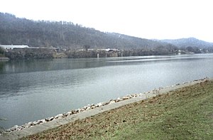
Gallipolis, Ohio
Village in Ohio, United States
Distance: Approx. 336 meters
Latitude and longitude: 38.81861111,-82.19333333
Gallipolis ( GAL-ə-pə-LEESS) is a chartered village in and the county seat of Gallia County, Ohio, United States. The municipality is located in Southeast Ohio along the Ohio River about 55 miles (89 km) southeast of Chillicothe and 44 miles (71 km) northwest of Charleston, West Virginia. The population was 3,313 at the 2020 census.

Henderson, West Virginia
Unincorporated Town in West Virginia, United States
Distance: Approx. 5277 meters
Latitude and longitude: 38.83305556,-82.13722222
Henderson is an unincorporated community and former town in Mason County, West Virginia, United States, at the confluence of the Ohio and Kanawha Rivers. The population was 231 at the 2020 census. It is part of the Point Pleasant, WV–OH Micropolitan Statistical Area.

Kanawha River
Tributary of the Ohio River in West Virginia, United States
Distance: Approx. 4987 meters
Latitude and longitude: 38.83777778,-82.14277778
The Kanawha River ( kə-NAW-ə) is a tributary of the Ohio River, approximately 97 mi (156 km) long, in the U.S. state of West Virginia. The largest inland waterway in West Virginia, its watershed has been a significant industrial region of the state since early in the 19th century. It is formed at the town of Gauley Bridge in northwestern Fayette County, approximately 35 mi (56 km) SE of Charleston, by the confluence of the New and Gauley rivers 2 mi upstream from Kanawha Falls.

Battle of Point Pleasant
Battle between Virginian militia and Indigenous Americans
Distance: Approx. 5211 meters
Latitude and longitude: 38.8393,-82.1408
The Battle of Point Pleasant, also known as the Battle of Kanawha and the Battle of Great Kanawha, was the only major action of Dunmore's War. It was fought on October 10, 1774, between the Virginia militia and Shawnee and Mingo warriors. Along the Ohio River near modern-day Point Pleasant, West Virginia, forces under the Shawnee chief Cornstalk attacked Virginia militiamen under Colonel Andrew Lewis, hoping to halt Lewis's advance into the Ohio Valley.
Gallipolis Island
Distance: Approx. 833 meters
Latitude and longitude: 38.8139697,-82.1920909
Gallipolis Island is an island on the Ohio River along the bank at Gallipolis, Ohio and across from Mason County, West Virginia, USA. Although located within the boundaries of West Virginia, Gallipolis Island historically belonged to the city of Gallipolis, Ohio until the city and a private landowner, Michael Hoeft, from Milton, W.Va., donated their ownership shares of the island in 2016 to the West Virginia Land Trust. The land trust protects the island as essential habitat for fish, mussels, birds and other animals, as well as for public recreation. The West Virginia Land Trust intends to stabilize stream banks to keep it from eroding—the island was once more than 85 acres, but erosion reduced its size over the years to just a few acres.

Tu-Endie-Wei State Park
State park in Mason County, West Virginia
Distance: Approx. 5203 meters
Latitude and longitude: 38.83916667,-82.14083333
Tu-Endie-Wei State Park is located at the confluence of the Kanawha River and the Ohio River in downtown Point Pleasant, West Virginia, United States. The park commemorates the Battle of Point Pleasant, fought between the settler militia of Virginia and the forces of Shawnee Chief Cornstalk on October 10, 1774. The militia victory by the settlers weakened the alliance between native forces and the British and freed up settlers from western Virginia to cross the Allegheny Mountains and join in the American Revolutionary War.

Lake Tight
Former lake in Ohio & West Virginia
Distance: Approx. 2615 meters
Latitude and longitude: 38.8,-82.21
Lake Tight, named for geologist William G. Tight, was a glacial lake in what is present-day Ohio, Kentucky, and West Virginia, during the Ice Age the early Pleistocene before 700,000 years.

Gallipolis Township, Gallia County, Ohio
Township in Ohio, United States
Distance: Approx. 296 meters
Latitude and longitude: 38.82166667,-82.19277778
Gallipolis Township is one of the fifteen townships of Gallia County, Ohio, United States. As of the 2020 census the population was 4,725.
WXBW
Radio station in Gallipolis, Ohio, United States
Distance: Approx. 3213 meters
Latitude and longitude: 38.805,-82.227
WXBW (101.5 FM) is a radio station located in Gallipolis, Ohio. The station has an additional booster station, WXBW-FM1 located in Huntington, West Virginia. The stations are licensed to Fifth Avenue Broadcasting Company, Inc.
WJEH (AM)
Radio station in Gallipolis, Ohio
Distance: Approx. 2896 meters
Latitude and longitude: 38.80555556,-82.22305556
WJEH (990 AM) was a radio station licensed to Gallipolis, Ohio. Last owned by Thomas Susman, through licensee Vandalia Media Partners 2, LLC, it broadcast a Christian music format dedicated to the Southern gospel.
Gallia–Meigs Regional Airport
Airport in Ohio, United States
Distance: Approx. 3190 meters
Latitude and longitude: 38.83411111,-82.16343056
Gallia–Meigs Regional Airport (ICAO: KGAS, FAA LID: GAS) is a publicly owned, public use airport located in Gallipolis, Ohio, United States. The airport is named after Gallia County and Meigs County.
Kanauga, Ohio
Census-designated place in Ohio, United States
Distance: Approx. 4627 meters
Latitude and longitude: 38.84111111,-82.14944444
Kanauga is an unincorporated community and census-designated place (CDP) in Gallia County, Ohio, United States. As of the 2020 census it had a population of 185.
Weather in this IP's area
clear sky
-2 Celsius
-6 Celsius
-3 Celsius
1 Celsius
1023 hPa
79 %
1023 hPa
995 hPa
10000 meters
2.95 m/s
5.84 m/s
237 degree
6 %