204.16.121.193 - IP Lookup: Free IP Address Lookup, Postal Code Lookup, IP Location Lookup, IP ASN, Public IP
Country:
Region:
City:
Location:
Time Zone:
Postal Code:
ISP:
ASN:
language:
User-Agent:
Proxy IP:
Blacklist:
IP information under different IP Channel
ip-api
Country
Region
City
ASN
Time Zone
ISP
Blacklist
Proxy
Latitude
Longitude
Postal
Route
db-ip
Country
Region
City
ASN
Time Zone
ISP
Blacklist
Proxy
Latitude
Longitude
Postal
Route
IPinfo
Country
Region
City
ASN
Time Zone
ISP
Blacklist
Proxy
Latitude
Longitude
Postal
Route
IP2Location
204.16.121.193Country
Region
tennessee
City
knoxville
Time Zone
America/New_York
ISP
Language
User-Agent
Latitude
Longitude
Postal
ipdata
Country
Region
City
ASN
Time Zone
ISP
Blacklist
Proxy
Latitude
Longitude
Postal
Route
Popular places and events near this IP address

Farragut, Tennessee
Town in Tennessee, United States
Distance: Approx. 5433 meters
Latitude and longitude: 35.87305556,-84.18222222
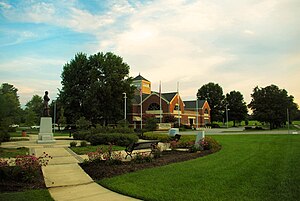
Farragut is a suburban town located in Knox and Loudon counties in the State of Tennessee, United States. The town's population was 23,506 at the 2020 census. It is included in the Knoxville Metropolitan Area.
National Transportation Research Center
Distance: Approx. 4124 meters
Latitude and longitude: 35.9543,-84.1545
The National Transportation Research Center (NTRC) is an institution, located in Knoxville, Tennessee, that conducts research and development aimed at increasing the efficiency and safety of transportation systems and reducing their energy utilization and effects on the environment. It is operated as a partnership between the United States Department of Energy, the University of Tennessee, and Oak Ridge National Laboratory (ORNL) and is located approximately halfway between the university campus and the ORNL site in Oak Ridge. About two-thirds of the 83,000 sq ft (7,700 m2) NTRC building contains research laboratories.

Battle of Campbell's Station
1863 battle of the American Civil War
Distance: Approx. 4576 meters
Latitude and longitude: 35.8846,-84.1539
The Battle of Campbell's Station (November 16, 1863) saw Confederate forces under Lieutenant General James Longstreet attack Union troops led by Major General Ambrose Burnside at Campbell's Station (now Farragut), Knox County, Tennessee, during the Knoxville Campaign of the American Civil War. Longstreet hoped to crush the Union Army of the Ohio forces before they could retreat to Knoxville. During the fighting, the Confederates forced the Union troops to fall back from five separate positions.
Pellissippi State Community College
Public college in Knox County, Tennessee, US
Distance: Approx. 3035 meters
Latitude and longitude: 35.94772,-84.16635
Pellissippi State Community College (Pellissippi State or PSTCC) is a public community college based in Knox and Blount counties in Tennessee. It is operated by the Tennessee Board of Regents. The college's main campus is located in west Knox County.
Webb School of Knoxville
College preparatory day school in Knoxville, Tennessee, United States
Distance: Approx. 5447 meters
Latitude and longitude: 35.92253149,-84.11559201
Webb School of Knoxville is a private coeducational day school in Knoxville, Tennessee, enrolling students from pre-kindergarten to twelfth grade. It was founded in 1955 by Robert Webb (1919–2005), grandson of Webb School of Bell Buckle founder Sawney Webb. The current President of Webb School of Knoxville is Dr.
Knoxville Christian School
Private christian school in the United States
Distance: Approx. 1665 meters
Latitude and longitude: 35.907,-84.172
Knoxville Christian School (KCS) is a private 18 months–12th grade Christian school in Farragut, Tennessee, near Knoxville.

Farragut High School
American public high school
Distance: Approx. 4231 meters
Latitude and longitude: 35.8863,-84.1586
Farragut High School, located at 11237 Kingston Pike, serves as a high school in Farragut, a suburb of Knoxville, Tennessee. Knox County Schools, the unified Knox County, Tennessee school district, operates the school. The school serves the majority of Farragut, portions south of Interstate 40.

Avery Russell House
Historic house in Tennessee, United States
Distance: Approx. 4711 meters
Latitude and longitude: 35.88095,-84.161475
The Avery Russell House, also called the Martin-Russell House or the Campbell's Station Inn, is a historic home located at 11409 Kingston Pike in Farragut, Tennessee, United States. The Federal-style, two-story brick structure was built by Samuel Martin as an inn around 1835, on the site of Captain David Campbell's 1787 blockhouse. Just before the Civil War, the inn was sold to Avery Russell, who then used it as a family residence.
Faith Promise Church
Church in TN, United States
Distance: Approx. 4549 meters
Latitude and longitude: 35.9620045,-84.1684159
Faith Promise Church is a non-denominational church with a central campus in Knoxville, Tennessee.
Hardin Valley Academy
Public high school in Knoxville, Tennessee, United States
Distance: Approx. 1665 meters
Latitude and longitude: 35.936,-84.181
Hardin Valley Academy, located at 11345 Hardin Valley Road, is a Knox County high school that was founded in 2008. The school is split into four academies: Liberal Arts, STEM (Science, Technology, Engineering, and Mathematics), Health Sciences, and BLPA (Business, Law, and Public Affairs). It serves portions of Farragut north of Interstate 75.
Hardin Valley, Tennessee
Unincorporated community in Knox County, Tennessee, United States
Distance: Approx. 3657 meters
Latitude and longitude: 35.920414,-84.216537
Hardin Valley is a suburban unincorporated community in west Knox County, Tennessee, United States. It is about 15.5 miles (24.9 km) west of downtown Knoxville.
Turkey Creek, Knoxville
Mixed use retail and commercial development in Knoxville, Tennessee
Distance: Approx. 2896 meters
Latitude and longitude: 35.899997,-84.158101
Turkey Creek is a shopping complex and mixed-use commercial development located in western Knox County, Tennessee, in the city of Knoxville and the town of Farragut.
Weather in this IP's area
broken clouds
13 Celsius
12 Celsius
10 Celsius
14 Celsius
1021 hPa
74 %
1021 hPa
986 hPa
10000 meters
1.73 m/s
3.69 m/s
234 degree
72 %