Country:
 USA
USARegion:
City:
Latitude and Longitude:
Time Zone:
Postal Code:
IP information under different IP Channel
ip-api
Country
Region
City
ASN
Time Zone
ISP
Blacklist
Proxy
Latitude
Longitude
Postal
Route
IPinfo
Country
Region
City
ASN
Time Zone
ISP
Blacklist
Proxy
Latitude
Longitude
Postal
Route
MaxMind
Country
Region
City
ASN
Time Zone
ISP
Blacklist
Proxy
Latitude
Longitude
Postal
Route
Luminati
Country
USRegion
mo
City
ashland
ASN
Time Zone
America/Chicago
ISP
MEM
Latitude
Longitude
Postal
db-ip
Country
Region
City
ASN
Time Zone
ISP
Blacklist
Proxy
Latitude
Longitude
Postal
Route
ipdata
Country
Region
City
ASN
Time Zone
ISP
Blacklist
Proxy
Latitude
Longitude
Postal
Route
Popular places and events near this IP address

Town Pavilion
Skyscraper in Downtown Kansas City, Missouri, US
Distance: Approx. 152 meters
Latitude and longitude: 39.100567,-94.582838
1111 Main is a 38-story, 180.1 m (591 ft) skyscraper at 1111 Main Street on the northeast corner of 12th and Main Streets in Downtown Kansas City, Missouri, around the corner from Oppenstein Brothers Memorial Park. The tower occupies the former site of several retail buildings, including Kline's Department Store and Kresge's Dime Store. The 11-story former Harzfeld's Department Store and the former Boley Building were preserved and have been integrated into the design of 1111 Main.
National Association of Insurance Commissioners
American government organization
Distance: Approx. 134 meters
Latitude and longitude: 39.100391,-94.582557
The National Association of Insurance Commissioners (NAIC) is the U.S. standard-setting and regulatory support organization created and governed by the chief insurance regulators from the 50 states, the District of Columbia, and five U.S. territories.
Oppenstein Brothers Memorial Park
Urban park in Kansas City, Missouri, US
Distance: Approx. 90 meters
Latitude and longitude: 39.10022,-94.58182
Oppenstein Brothers Memorial Park is an urban park located in the heart of Kansas City, Missouri's, Central business district, located at the northeast corner of 12th and Walnut Streets. Some notable buildings in the surrounding area are One Kansas City Place, Town Pavilion, and the 1010 Grand Building. The park is often visited by businesspeople of the many surrounding buildings on lunch and coffee breaks.

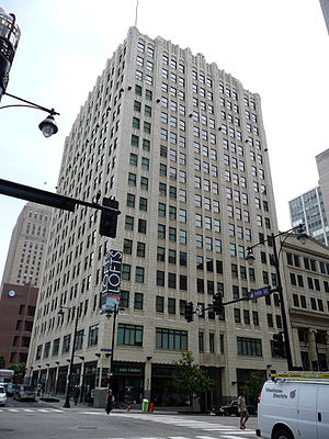
1201 Walnut
Skyscraper in Downtown Kansas City, Missouri, US
Distance: Approx. 156 meters
Latitude and longitude: 39.09956,-94.58194
The 1201 Walnut Building is a skyscraper located in Downtown Kansas City, Missouri, US, built by HNTB Architects in 1991. Found at the intersection of 12th and Walnut streets, it is the eighth tallest habitable structure in the Kansas City Metropolitan Area, and the twelfth-tallest habitable structure in Missouri, at 427 feet. The exterior is made of mostly dark-colored glass, and granite panels, and is located one block North of the Power & Light District in downtown Kansas City.

Oak Tower
Skyscraper in Kansas City, Missouri
Distance: Approx. 195 meters
Latitude and longitude: 39.1012,-94.5789
Oak Tower, also called the Bell Telephone Building, is a 28-story skyscraper in Downtown Kansas City, Missouri. Hoit, Price & Barnes, a local firm that conceived many of Kansas City's landmark structures, designed the building in association with I.R. Timlin as the headquarters of the Bell Telephone Co.'s newly consolidated Southwestern System. The ground was broken at Eleventh and Oak Streets in 1917, but due to shortages of manpower and materials during the First World War, construction was delayed and was not completed until 1920.

Jenkins Music Company Building
United States historic place
Distance: Approx. 153 meters
Latitude and longitude: 39.09944444,-94.58138889
The Jenkins Music Company Building is a historic building in the Kansas City Power and Light District in Kansas City, Missouri. Built in 1911, it is a significant example of unaltered, Modernistic style commercial architecture, combining Late Gothic Revival and Art Deco decorative elements. It was listed on the National Register of Historic Places in 1979.

Kansas City Title and Trust Building
United States historic place
Distance: Approx. 195 meters
Latitude and longitude: 39.1025,-94.58166667
The Kansas City Title and Trust Building in Kansas City, Missouri, is a building from 1922. It was listed on the National Register of Historic Places in 2005.
Palace Clothing Company Building
United States historic place
Distance: Approx. 92 meters
Latitude and longitude: 39.1,-94.58083333
The Palace Clothing Company Building in Kansas City, Missouri is a building constructed in 1924. It was listed on the National Register of Historic Places in 1985.
Professional Building (Kansas City, Missouri)
United States historic place
Distance: Approx. 71 meters
Latitude and longitude: 39.10083333,-94.58027778
The Professional Building in Kansas City, Missouri is a building from 1923. It was listed on the National Register of Historic Places in 1982.

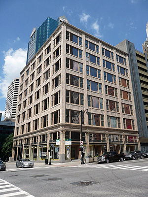
Boley Building
United States historic place
Distance: Approx. 132 meters
Latitude and longitude: 39.1,-94.58222222
The Boley Building in Kansas City, Missouri was designed by Canadian-born American architect Louis Curtiss and built in 1909. It was listed on the National Register of Historic Places in 1971. It is the world headquarters for Andrews McMeel Universal, parent company to Universal Uclick, Andrews McMeel Publishing and GoComics.

Chambers Building (Kansas City, Missouri)
United States historic place
Distance: Approx. 186 meters
Latitude and longitude: 39.10222222,-94.58222222
The Chambers Building in Kansas City, Missouri was built in 1915 and 1923. It was designed in Early Commercial style by architect Charles A. Smith. Smith, Rae and Lovitt is also associated with the building.

Bryant Building (Kansas City, Missouri)
Historic building in Missouri, United States
Distance: Approx. 5 meters
Latitude and longitude: 39.10080833,-94.58104722
The Bryant Building is a 26-story office building located at the corner of 11th and Grand Avenue in Kansas City, Missouri. It was completed in 1931 as a distinctive example of Art Deco architecture in Kansas City. It was placed on the Kansas City Register of Historic Places listed on September 27, 1979, and was listed on the National Register of Historic Places in 1989.
Weather in this IP's area
clear sky
23 Celsius
22 Celsius
22 Celsius
24 Celsius
1022 hPa
34 %
1022 hPa
991 hPa
10000 meters
3.14 m/s
5.43 m/s
195 degree
3 %
07:33:24
18:32:19