204.152.0.76 - IP Lookup: Free IP Address Lookup, Postal Code Lookup, IP Location Lookup, IP ASN, Public IP
Country:
Region:
City:
Location:
Time Zone:
Postal Code:
ISP:
ASN:
language:
User-Agent:
Proxy IP:
Blacklist:
IP information under different IP Channel
ip-api
Country
Region
City
ASN
Time Zone
ISP
Blacklist
Proxy
Latitude
Longitude
Postal
Route
db-ip
Country
Region
City
ASN
Time Zone
ISP
Blacklist
Proxy
Latitude
Longitude
Postal
Route
IPinfo
Country
Region
City
ASN
Time Zone
ISP
Blacklist
Proxy
Latitude
Longitude
Postal
Route
IP2Location
204.152.0.76Country
Region
virginia
City
oakton
Time Zone
America/New_York
ISP
Language
User-Agent
Latitude
Longitude
Postal
ipdata
Country
Region
City
ASN
Time Zone
ISP
Blacklist
Proxy
Latitude
Longitude
Postal
Route
Popular places and events near this IP address

National Rifle Association
American nonprofit organization
Distance: Approx. 3397 meters
Latitude and longitude: 38.86305556,-77.33555556
The National Rifle Association of America (NRA) is a gun rights advocacy group based in the United States. Founded in 1871 to advance rifle marksmanship, the modern NRA has become a prominent gun rights lobbying organization while continuing to teach firearm safety and competency. The organization also publishes several magazines and sponsors competitive marksmanship events.
Oakton, Virginia
Census-designated place in Virginia
Distance: Approx. 3535 meters
Latitude and longitude: 38.88305556,-77.29
Oakton is a census-designated place (CDP) in Fairfax County, Virginia, United States. The population was 36,732 at the 2020 census.

Northern Virginia
Region in Virginia, United States
Distance: Approx. 3688 meters
Latitude and longitude: 38.8625,-77.345
Northern Virginia, locally referred to as NOVA or NoVA, comprises several counties and independent cities in the Commonwealth of Virginia in the United States. The region radiates westward and southward from Washington, D.C., the nation's capital, and has a population of 3,257,133 people as of 2023 U.S. Census Bureau estimates, representing over a third of the state's total population. It is the most populous region in both Virginia and the regional Washington metropolitan area.

Flint Hill School
Private, day, college preparatory school in Oakton, Virginia, United States
Distance: Approx. 2694 meters
Latitude and longitude: 38.87,-77.31944444
Flint Hill School, founded in 1956, is a private, co-educational, college preparatory school, in Oakton, Virginia, serving grades JK–12. The school has separate upper and lower school campuses about a mile apart in Fairfax County, approximately 20 miles (32 km) from Washington, D.C. In 2021, Niche ranked Flint Hill School 9 out of 2489 private schools in the United States, making it the best in Virginia.
Jermantown, Virginia
Unincorporated community in Virginia, United States
Distance: Approx. 4036 meters
Latitude and longitude: 38.85694444,-77.33222222
Jermantown is an unincorporated community in Fairfax County, Virginia, United States. Various parts of Jermantown are included within the independent city of Fairfax to its south and east. Today, this once rural community is centered at the intersection of Jermantown Road and Lee Jackson Memorial Highway (U.S. Route 50).

National Firearms Museum
Museum located at the NRA Headquarters Building in Fairfax County, Virginia
Distance: Approx. 3398 meters
Latitude and longitude: 38.862972,-77.335
The NRA National Firearms Museum is a museum located at the NRA Headquarters Building in Fairfax County, Virginia. Approximated 2,500 guns are displayed in 15,000 square feet. The NRA National Firearms Museum is operated by the Museums Division of the National Rifle Association of America (NRA), with partial funding provided by the NRA Foundation, a 501(c)3 corporation.
Thompson-Kidwell Cemetery
Historic cemetery in Fairfax County, Virginia, US
Distance: Approx. 3598 meters
Latitude and longitude: 38.9137,-77.3607
Thompson-Kidwell Cemetery is a cemetery located on the grounds of Fox Mill Park in Reston, Virginia. The cemetery dates from the late 19th century and was a burying plot for members of the Thompson and Kidwell families who lived in this area of Fairfax County, Virginia. The cemetery was largely forgotten until the mid-1970s when adjacent neighborhood Fox Mill Woods was built.

Fair Oaks, Fairfax County, Virginia
Census-designated place in Virginia, United States
Distance: Approx. 4023 meters
Latitude and longitude: 38.86583333,-77.35916667
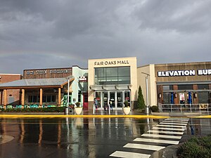
Fair Oaks is a census-designated place in Fairfax County, Virginia, United States. The population at the 2020 census was 34,052. It encompasses a large area west of the city of Fairfax, centered on Fair Oaks Mall.
Dominion Christian School
Private, classical christian school in Herndon and Oakton, Virginia, United States
Distance: Approx. 1471 meters
Latitude and longitude: 38.906,-77.325
Dominion Christian School is a private, classical Christian school. It is an accredited member of the Southern Association of Independent Schools. It is also a member of the Association of Classical and Christian Schools (ACCS).

Vale School-Community House
United States historic place
Distance: Approx. 1760 meters
Latitude and longitude: 38.89138889,-77.34888889
Vale School-Community House is a historic two-room school located near Oakton, Fairfax County, Virginia. It was built about 1884 and expanded with a second room in 1912. It is a one-story, two-room, wood-frame building on a stone and concrete foundation.

Oakton Trolley Station
United States historic place
Distance: Approx. 3129 meters
Latitude and longitude: 38.87972222,-77.29694444
Oakton Trolley Station is a historic trolley station located at Oakton, Fairfax County, Virginia. The Washington, Arlington & Falls Church Railway, which operated electric trolleys that travelled between Fairfax City and downtown Washington, D.C., from 1904 to 1939, constructed the station in 1905. The building has a three-story vernacular frame.
Difficult Run, Virginia
Census-designated place in Virginia
Distance: Approx. 1870 meters
Latitude and longitude: 38.902,-77.347
Difficult Run is a census designated place in Fairfax County, Virginia, United States. The population was 10,600 at the 2020 census. The CDP has a land area of 8.38 square miles.
Weather in this IP's area
clear sky
-7 Celsius
-14 Celsius
-8 Celsius
-6 Celsius
1029 hPa
58 %
1029 hPa
1017 hPa
10000 meters
5.66 m/s
310 degree
