Country:
Region:
City:
Latitude and Longitude:
Time Zone:
Postal Code:
IP information under different IP Channel
ip-api
Country
Region
City
ASN
Time Zone
ISP
Blacklist
Proxy
Latitude
Longitude
Postal
Route
Luminati
Country
Region
sd
City
brandon
ASN
Time Zone
America/Chicago
ISP
SDNW-13576
Latitude
Longitude
Postal
IPinfo
Country
Region
City
ASN
Time Zone
ISP
Blacklist
Proxy
Latitude
Longitude
Postal
Route
db-ip
Country
Region
City
ASN
Time Zone
ISP
Blacklist
Proxy
Latitude
Longitude
Postal
Route
ipdata
Country
Region
City
ASN
Time Zone
ISP
Blacklist
Proxy
Latitude
Longitude
Postal
Route
Popular places and events near this IP address

Brandon, South Dakota
City in South Dakota, United States
Distance: Approx. 704 meters
Latitude and longitude: 43.59166667,-96.58055556
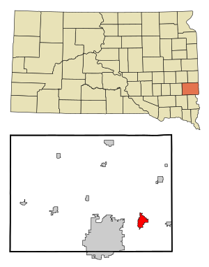
Brandon is a city in Minnehaha County, South Dakota, United States. Brandon is located five miles east of Sioux Falls. The population was 11,048 as of the 2020 census.

Pathfinder Nuclear Generating Station
Defunct power generation station near Sioux Falls, South Dakota, USA
Distance: Approx. 4830 meters
Latitude and longitude: 43.60361111,-96.6375
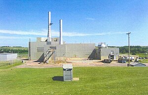
The Pathfinder Atomic Power Plant was a nuclear power plant built by Northern States Power Company. It was located just northeast of Sioux Falls, South Dakota, and west of its suburb of Brandon. It was named for the 19th century explorer John C. "Pathfinder" Fremont and was constructed in the mid-1960s in partnership with a group of other investor-owned utilities.

Corson, South Dakota
Place in South Dakota, United States
Distance: Approx. 3543 meters
Latitude and longitude: 43.6163628,-96.5717118
Corson is an unincorporated community in Brandon Township, Minnehaha County, South Dakota, United States with a population of 70. It lies immediately north of Interstate 90 and Brandon on South Dakota Highway 11. Once mainly a railroad and farming community, it is becoming an industrial area supporting the county.
KCSD (FM)
Radio station in Sioux Falls, South Dakota
Distance: Approx. 5986 meters
Latitude and longitude: 43.5744,-96.6556
KCSD (90.9 FM) is a National Public Radio member radio station licensed to Sioux Falls, South Dakota. It is owned by the South Dakota Board of Directors for Educational Telecommunications and is part of South Dakota Public Broadcasting's statewide network. The station signed on in 1985 as part of SDPB's effort to improve coverage in the state's largest city.

Shafer Round Barn
United States historic place
Distance: Approx. 7235 meters
Latitude and longitude: 43.54194444,-96.64944444
The Shafer Round Barn near Sioux Falls, South Dakota, United States, is a round barn that was built in 1920. It was listed on the National Register of Historic Places in 1995.
Brandon Valley Performing Arts Center
Distance: Approx. 1031 meters
Latitude and longitude: 43.592262,-96.574115
Brandon Valley Performing Arts Center is a performing arts center in Brandon, South Dakota. The Center was opened in the fall of 1999 and seats a little more than 800 people. It is owned and operated by the Brandon Valley School District, and is used for local concerts for every grade level, high school play productions, and area professional and amateur theatrical productions.

Beaver Creek (Split Rock Creek tributary)
Stream in South Dakota, U.S.
Distance: Approx. 3021 meters
Latitude and longitude: 43.55861111,-96.58694444
Beaver Creek is a stream in Rock County, Minnesota and Minnehaha County, South Dakota. It is a tributary of Split Rock Creek. Beaver Creek was named from the fact early settlers saw beaver dams in the stream.
Brandon Township, Minnehaha County, South Dakota
Township in Minnehaha County, South Dakota
Distance: Approx. 5535 meters
Latitude and longitude: 43.63472222,-96.59361111
Brandon Township is a township in Minnehaha County, in the U.S. state of South Dakota.

Slip-up Creek
River in South Dakota, United States
Distance: Approx. 6001 meters
Latitude and longitude: 43.6,-96.65472222
Slip-up Creek is a stream in the U.S. state of South Dakota. It is a tributary of the Big Sioux River. According to tradition, the creek was named when a pioneer farmer's tractor "slipped up" while crossing the stream.

Huset's Speedway
Racetrack
Distance: Approx. 1671 meters
Latitude and longitude: 43.57059,-96.5834
Huset's Speedway (formerly known as Badlands Motor Speedway) is a 3/8-mile dirt oval racetrack located in Brandon, South Dakota, United States. Its name was changed to Badlands in 2015 when it was sold to Chuck Brennan, the owner of the Badlands Entertainment Group. The track opened in the 1950s.
Pine Lakes Addition, South Dakota
Unincorporated community in South Dakota, United States
Distance: Approx. 5719 meters
Latitude and longitude: 43.55111111,-96.63555556
Pine Lakes Addition is an unincorporated community and census-designated place in Minnehaha County, South Dakota, United States. Its population was 306 as of the 2020 census. The community is east of Sioux Falls.

Beaver Creek Nature Area
Distance: Approx. 4524 meters
Latitude and longitude: 43.55817,-96.54161
Beaver Creek Nature Area is a nature area in Minnehaha County, South Dakota in the United States. It is located along Beaver Creek, a tributary of Split Rock Creek, just east of Sioux Falls. Birdwatching, fishing, hiking, and snowmobiling are popular activities within this area.
Weather in this IP's area
overcast clouds
11 Celsius
10 Celsius
11 Celsius
12 Celsius
1009 hPa
76 %
1009 hPa
962 hPa
10000 meters
5.14 m/s
320 degree
100 %
07:06:33
17:13:14