Country:
 USA
USARegion:
City:
Latitude and Longitude:
Time Zone:
Postal Code:
IP information under different IP Channel
ip-api
Country
Region
City
ASN
Time Zone
ISP
Blacklist
Proxy
Latitude
Longitude
Postal
Route
IPinfo
Country
Region
City
ASN
Time Zone
ISP
Blacklist
Proxy
Latitude
Longitude
Postal
Route
MaxMind
Country
Region
City
ASN
Time Zone
ISP
Blacklist
Proxy
Latitude
Longitude
Postal
Route
Luminati
Country
USRegion
ia
City
cedarrapids
ASN
Time Zone
America/Chicago
ISP
IMONC
Latitude
Longitude
Postal
db-ip
Country
Region
City
ASN
Time Zone
ISP
Blacklist
Proxy
Latitude
Longitude
Postal
Route
ipdata
Country
Region
City
ASN
Time Zone
ISP
Blacklist
Proxy
Latitude
Longitude
Postal
Route
Popular places and events near this IP address
Cedar Valley Christian School
Private secondary school in Cedar Rapids, Iowa, United States
Distance: Approx. 1611 meters
Latitude and longitude: 41.996,-91.615
Cedar Valley Christian School (CVCS) is a private Christian school in Cedar Rapids, Iowa. It enrolls approximately 250 students and consists of grades Pre-kindergarten through Twelfth grade. The school is co-located with Cedar Valley Bible Church on Cottage Grove Ave just east of Indian Creek.

Brucemore
Historic house in Iowa, United States
Distance: Approx. 1340 meters
Latitude and longitude: 41.99238889,-91.63935278
Brucemore, a park-like, 26-acre (110,000 m2) estate in the heart of Cedar Rapids, Iowa, is the site of a Queen Anne-style mansion, formal gardens, a children's garden, night garden, pond, orchard, and woodland. Built between 1884 and 1886 by Caroline Sinclair, widow of pioneer industrialist T.M. Sinclair, Brucemore has been home to three prominent families who used the estate as a center for culture and the arts. Brucemore, whose name alludes to the Scottish moors of the second owner's ancestral home, is Iowa's only National Trust Historic Site and is preserved by the National Trust for Historic Preservation in co-stewardship with Brucemore, Inc.
Washington High School (Cedar Rapids, Iowa)
Public secondary school in Cedar Rapids, Iowa, United States
Distance: Approx. 1386 meters
Latitude and longitude: 41.99666667,-91.63111111
Washington High School (officially George Washington High School) is a public high school in Cedar Rapids, in the U.S. state of Iowa. Built in 1956, it is named in honor of the oldest high school in Cedar Rapids.

St. Paul United Methodist Church (Cedar Rapids, Iowa)
United States historic place
Distance: Approx. 2136 meters
Latitude and longitude: 41.98555556,-91.65277778
St. Paul's United Methodist Church is located in downtown Cedar Rapids, Iowa, United States. The Louis Sullivan-designed building has been individually listed on the National Register of Historic Places since 1985.

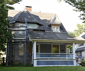
Robert and Esther Armstrong House
Historic house in Iowa, United States
Distance: Approx. 793 meters
Latitude and longitude: 41.98480556,-91.61741667
The Robert and Esther Armstrong House, also known as Pleasant Hill, is a historic building located in Cedar Rapids, Iowa, United States. This is the last of two documented houses that regionalist artist Grant Wood designed in its entirety in the city. There are 14 documented houses that he designed, at least in part, between 1925 and 1933.

William and Sue Damour House
Historic house in Iowa, United States
Distance: Approx. 1629 meters
Latitude and longitude: 41.99180556,-91.64413889
The William and Sue Damour House is a historic house located at 1844 Second Avenue SE in Cedar Rapids, Iowa.
Redmond Park-Grande Avenue Historic District
Historic district in Iowa, United States
Distance: Approx. 1531 meters
Latitude and longitude: 41.98777778,-91.645
The Redmond Park-Grande Avenue Historic District is a nationally recognized historic district located in Cedar Rapids, Iowa, United States. It was listed on the National Register of Historic Places in 2001. At the time of its nomination it consisted of 196 resources, which included 193 contributing buildings, one contributing site, and two non-contributing buildings.

B Avenue NE Historic District
Historic district in Iowa, United States
Distance: Approx. 2000 meters
Latitude and longitude: 41.99305556,-91.64833333
The B Avenue NE Historic District is a nationally recognized historic district located in Cedar Rapids, Iowa, United States. It was listed on the National Register of Historic Places in 2013. At the time of its nomination it consisted of 210 resources, which included 167 contributing buildings, and 43 non-contributing buildings.

Oak Hill Cemetery (Cedar Rapids, Iowa)
Historic rural cemetery in Linn County
Distance: Approx. 1830 meters
Latitude and longitude: 41.97591667,-91.64577778
Oak Hill Cemetery is a rural cemetery located in Cedar Rapids, Iowa, United States. It was listed as a historic district on the National Register of Historic Places in 2013. At the time of its nomination it consisted of 17 resources, which included 13 contributing buildings, one contributing site, two contributing structures, and one contributing object.
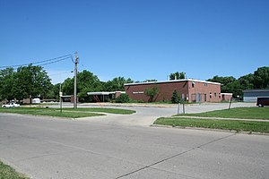
Monroe Elementary School Historic District
Historic district in Iowa, United States
Distance: Approx. 1761 meters
Latitude and longitude: 41.96969444,-91.61988889
The Monroe Elementary School Historic District is a nationally recognized historic district located in Cedar Rapids, Iowa, United States. It was listed on the National Register of Historic Places in 2015. At the time of its nomination it consisted of 10 resources, which included one contributing building, one contributing site, three contributing objects, two non-contributing buildings, and three non-contributing objects.
Dr. Percy and Lileah Harris House
Historic house in Iowa, United States
Distance: Approx. 947 meters
Latitude and longitude: 41.98444444,-91.61555556
The Dr. Percy and Lileah Harris House is a historic building located in Cedar Rapids, Iowa, United States. It was listed on the National Register of Historic Places in 2021.
Bever Woods Historic District
Historic district in Iowa, United States
Distance: Approx. 575 meters
Latitude and longitude: 41.98527778,-91.63388889
The Bever Woods Historic District is a nationally recognized [historic district located in Cedar Rapids, Iowa, United States. It was listed on the National Register of Historic Places in 2023. Sampson Cicero Bever with his wife and children, moved to Cedar Rapids in 1852.
Weather in this IP's area
scattered clouds
31 Celsius
33 Celsius
30 Celsius
32 Celsius
1009 hPa
54 %
1009 hPa
981 hPa
10000 meters
5.66 m/s
10.29 m/s
170 degree
40 %
06:51:19
19:09:01