Country:
Region:
City:
Latitude and Longitude:
Time Zone:
Postal Code:
IP information under different IP Channel
ip-api
Country
Region
City
ASN
Time Zone
ISP
Blacklist
Proxy
Latitude
Longitude
Postal
Route
Luminati
Country
ASN
Time Zone
America/Chicago
ISP
NEWCOM-INTL
Latitude
Longitude
Postal
IPinfo
Country
Region
City
ASN
Time Zone
ISP
Blacklist
Proxy
Latitude
Longitude
Postal
Route
db-ip
Country
Region
City
ASN
Time Zone
ISP
Blacklist
Proxy
Latitude
Longitude
Postal
Route
ipdata
Country
Region
City
ASN
Time Zone
ISP
Blacklist
Proxy
Latitude
Longitude
Postal
Route
Popular places and events near this IP address
Bunche Park, Florida
Neighborhood of Miami Gardens in Miami-Dade, Florida, United States
Distance: Approx. 1066 meters
Latitude and longitude: 25.92194444,-80.23444444
Bunche Park is a neighborhood in Miami Gardens, Florida, United States. It was formerly a census-designated place.

Golden Glades, Florida
Census-designated place in Florida
Distance: Approx. 2804 meters
Latitude and longitude: 25.91277778,-80.19777778
Biscayne Gardens is a census-designated place (CDP) in Miami-Dade County, Florida, United States. It is part of the Miami metropolitan area of South Florida. The population was 32,499 at the 2020 US census.

Scott Lake, Florida
Neighborhood of Miami Gardens in Miami-Dade, Florida, United States
Distance: Approx. 2178 meters
Latitude and longitude: 25.93555556,-80.23194444
Scott Lake is a neighborhood in Miami Gardens, Florida. It was formerly its own census-designated place. The population was 14,401 at the 2000 census.
Golden Glades station
Tri-Rail commuter rail station
Distance: Approx. 991 meters
Latitude and longitude: 25.921529,-80.216949
Golden Glades is a Tri-Rail commuter rail station in Miami-Dade County, Florida, just west of the Golden Glades Interchange. This station is located at the confluence of US 441 and State Road 9. It opened to service January 9, 1989, and is the northernmost Tri-Rail station in Miami-Dade County.

Golden Glades Interchange
Road junction
Distance: Approx. 2097 meters
Latitude and longitude: 25.92765,-80.208203
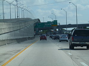
The Golden Glades Interchange, located in Miami Gardens and North Miami Beach, Florida, United States, is the confluence of six major roads serving eastern and southern Florida. It is named after the original name of North 167th Street, Golden Glades Road.

Florida's 24th congressional district
U.S. House district for Florida
Distance: Approx. 1245 meters
Latitude and longitude: 25.90722222,-80.21916667
Florida's 24th congressional district is an electoral district for the U.S. Congress, located in southeast Florida. It was redrawn after the 2020 U.S. census. This district includes parts of Miami north of Florida State Road 112, including Little Haiti, as well as Brownsville, Biscayne Park, North Miami, Miami Gardens, and Opa Locka, along with the southern Broward County communities of Pembroke Park, West Park, and parts of Miramar.

Opa-locka Bank
United States historic place
Distance: Approx. 2779 meters
Latitude and longitude: 25.90583333,-80.25027778
The Opa-locka Bank (also known as the First Baptist Church) is a historic bank in Opa-locka, Florida. It is located at 940 Caliph Street. On May 19, 1983, it was added to the U.S. National Register of Historic Places.

Miami Carol City Senior High School
Public school in Miami Gardens, Florida , United States
Distance: Approx. 2796 meters
Latitude and longitude: 25.897749,-80.2073259
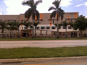
Miami Carol City Senior High School (MCCSH) is a public high school located at 3301 Miami Gardens Drive in Miami Gardens, Florida, United States. It was established in 1963. The school is part of the Miami-Dade County Public Schools system.
Monsignor Edward Pace High School
Private, coeducational school in Miami Gardens, , Florida, United States
Distance: Approx. 2744 meters
Latitude and longitude: 25.91583333,-80.25277778
Monsignor Edward Pace High School is a Catholic secondary school in the Opa-locka North neighborhood of Miami Gardens, Florida. It was named a Blue Ribbon School in 2002 and one of the top 50 Catholic high schools in the country in 2004 and 2005 by the Catholic High School Honor Roll. Pace is a member of the National Catholic Educational Association (NCEA).
Open Books & Records
Distance: Approx. 2719 meters
Latitude and longitude: 25.9278,-80.2011
Open Books & Records was founded by Ted Gottfried and Leslie Wimmer. The original store opened its door in October 1979 in Deerfield Beach, Florida, United States. The store's location changed several times finally ending up in North Miami Beach, Florida.
Sunshine State Arch
United States historic place
Distance: Approx. 1179 meters
Latitude and longitude: 25.92694444,-80.22166667
Sunshine State Arch is a national historic site located at the intersection between NW 13th Ave. and NW 167th St., at the entrance to the Sunshine State Industrial Park (Sunshine State International Park, Inc.) in Miami Gardens, Miami-Dade County, Florida, USA. It was inspired by the monumental Gateway Arch in St. Louis.
Crouse House
United States historic place
Distance: Approx. 2504 meters
Latitude and longitude: 25.90916667,-80.24888889
The Crouse House, in Opa-Locka, Florida, was designed by architect Bernhardt E. Muller for owners J. W. and Jennie Crouse. The house includes Moorish Revival elements, and it was constructed in 1926 at the corner of Peri and Ahmed Streets in Opa-locka. The house is part of the Opa-locka Thematic Resource Area, and it was listed on the National Register of Historic Places August 17, 1987.
Weather in this IP's area
light rain
27 Celsius
31 Celsius
27 Celsius
28 Celsius
1015 hPa
85 %
1015 hPa
1015 hPa
10000 meters
11.83 m/s
17.49 m/s
100 degree
100 %
06:32:24
17:36:36


