204.13.138.202 - IP Lookup: Free IP Address Lookup, Postal Code Lookup, IP Location Lookup, IP ASN, Public IP
Country:
Region:
City:
Location:
Time Zone:
Postal Code:
IP information under different IP Channel
ip-api
Country
Region
City
ASN
Time Zone
ISP
Blacklist
Proxy
Latitude
Longitude
Postal
Route
Luminati
Country
ASN
Time Zone
America/Chicago
ISP
F5 Networks SARL
Latitude
Longitude
Postal
IPinfo
Country
Region
City
ASN
Time Zone
ISP
Blacklist
Proxy
Latitude
Longitude
Postal
Route
IP2Location
204.13.138.202Country
Region
washington
City
seattle
Time Zone
America/Los_Angeles
ISP
Language
User-Agent
Latitude
Longitude
Postal
db-ip
Country
Region
City
ASN
Time Zone
ISP
Blacklist
Proxy
Latitude
Longitude
Postal
Route
ipdata
Country
Region
City
ASN
Time Zone
ISP
Blacklist
Proxy
Latitude
Longitude
Postal
Route
Popular places and events near this IP address

Harborview Medical Center
Hospital in Seattle, Washington, U.S.
Distance: Approx. 213 meters
Latitude and longitude: 47.60396,-122.32435
Harborview Medical Center is a public hospital located in the First Hill neighborhood of Seattle, Washington, United States. It is owned by King County and managed by UW Medicine.

Nippon Kan Theatre
United States historic place
Distance: Approx. 160 meters
Latitude and longitude: 47.601027,-122.325387
The Nippon Kan Theatre (日本館劇場, Nippon-kan Gekijō) is a former Japanese theater in Seattle, Washington, United States. It is located in the Kobe Park Building at 628 S. Washington Street, in the Japantown section of Seattle's International District.

Kobe Terrace (Seattle)
Park in Seattle, Washington, U.S.
Distance: Approx. 276 meters
Latitude and longitude: 47.6,-122.32505556
Kobe Terrace is a 1-acre (4,000 m2) public park in the International District neighborhood of Seattle, Washington. It incorporates the Danny Woo International District Community Garden. Named after Kobe, Seattle's sister city in Japan, it occupies most of the land bounded on the west by 6th Avenue S., on the north by S. Washington Street, on the east by Interstate 5, and on the south by S. Main Street.

King County Administration Building
Distance: Approx. 269 meters
Latitude and longitude: 47.60305556,-122.32944444
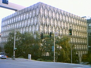
The King County Administration Building is a nine-story office building in Seattle, the seat of King County, Washington, United States. Completed in 1971, the building is located at 500 Fourth Avenue, in between Jefferson Street and James Street, and parking is available in parking garages on all surrounding streets. Designed by the Harmon, Pray and Detrich architectural firm, it features a unique hexagonal, honeycomb theme in its walls and windows.

Panama Hotel (Seattle)
Historic hotel in Washington, United States
Distance: Approx. 278 meters
Latitude and longitude: 47.5999,-122.3259
The Panama Hotel in Seattle, Washington's International District was built in 1910. The hotel was built by the first Japanese-American architect in Seattle, Sabro Ozasa, and contains the last remaining Japanese bathhouse (sento) in the United States. The Panama Hotel was essential to the Japanese community, the building housed businesses, a bathhouse, sleeping quarters for residents and visitors, and restaurants.

Danny Woo International District Community Garden
Distance: Approx. 242 meters
Latitude and longitude: 47.60027778,-122.32527778
The Danny Woo International District Community Garden is a community garden on the outskirts of the International District, Seattle, Washington. It was built in 1975 and provides 101 allotments and 77 fruit trees. Allotment plots are allocated by preference to those aged over 65, residents of the International District, and those whose income is below 30% of the median.
Seattle Civic Center
Distance: Approx. 310 meters
Latitude and longitude: 47.60361111,-122.32972222
The Seattle Civic Center is a building complex in Seattle, Washington whose original master plan was designed by Édouard Frère Champney in 1910. The complex comprises several buildings owned by the City of Seattle and King County that cover several city blocks. The buildings include: King County Administration Building (1971) King County Correctional Facility King County Courthouse (1916) Seattle City Hall (2005) Seattle Justice Center (2002) Seattle Municipal Tower (1990) 400 Yesler Building (1909) The complex also contained the Public Safety Building until it was demolished in 2005.
Trinity Parish Church (Seattle)
Historic church in Washington, United States
Distance: Approx. 306 meters
Latitude and longitude: 47.60513889,-122.32633333
Trinity Parish Church is a historic church located in the First Hill neighborhood of Seattle, Washington, that was added to the National Register of Historic Places in 1991. It is an Episcopal congregation in the Diocese of Olympia.
Platform Gallery
Art gallery in the United States
Distance: Approx. 314 meters
Latitude and longitude: 47.60111111,-122.32972222
Platform Gallery was a contemporary art gallery formerly located in the Tashiro Kaplan Building in historic Pioneer Square District in Downtown Seattle. It was founded in 2003 by four artists, including Stephen Lyons, who in 2008 was sole owner. In late 2016, the gallery moved from its brick and mortar space to exhibiting and selling artworks exclusively online.
Seattle Justice Center
Government office building and courthouse in Seattle, Washington, US
Distance: Approx. 308 meters
Latitude and longitude: 47.60416667,-122.32916667
The Seattle Justice Center is a 13-story government office building in Seattle, Washington, United States. It is located at 600 5th Avenue in the city's civic center complex and houses the Municipal Court of Seattle and the headquarters of the Seattle Police Department. The building was completed in 2002 at a cost of approximately $92 million, taking two years to construct.

Maneki
Japanese restaurant in Seattle, Washington, U.S.
Distance: Approx. 292 meters
Latitude and longitude: 47.59977778,-122.32622222
Maneki is a Japanese restaurant in the Japantown area of the International District in Seattle, Washington that opened in 1904 as the first sushi bar in the city. Some claim it is the oldest Asian restaurant on the West Coast of the United States, and it is recognized as one of the oldest sushi restaurants in the United States.

Nihonmachi Alley
Alley and historic landmark in Seattle, Washington, U.S.
Distance: Approx. 313 meters
Latitude and longitude: 47.5996,-122.3257
Nihonmachi Alley is an alley and historic landmark in the Japantown part of Seattle's Chinatown–International District, in the U.S. state of Washington.
Weather in this IP's area
light rain
8 Celsius
6 Celsius
7 Celsius
9 Celsius
1006 hPa
91 %
1006 hPa
1000 hPa
10000 meters
4.63 m/s
190 degree
100 %
