204.124.237.217 - IP Lookup: Free IP Address Lookup, Postal Code Lookup, IP Location Lookup, IP ASN, Public IP
Country:
Region:
City:
Location:
Time Zone:
Postal Code:
ISP:
ASN:
language:
User-Agent:
Proxy IP:
Blacklist:
IP information under different IP Channel
ip-api
Country
Region
City
ASN
Time Zone
ISP
Blacklist
Proxy
Latitude
Longitude
Postal
Route
db-ip
Country
Region
City
ASN
Time Zone
ISP
Blacklist
Proxy
Latitude
Longitude
Postal
Route
IPinfo
Country
Region
City
ASN
Time Zone
ISP
Blacklist
Proxy
Latitude
Longitude
Postal
Route
IP2Location
204.124.237.217Country
Region
new hampshire
City
wolfeboro
Time Zone
America/New_York
ISP
Language
User-Agent
Latitude
Longitude
Postal
ipdata
Country
Region
City
ASN
Time Zone
ISP
Blacklist
Proxy
Latitude
Longitude
Postal
Route
Popular places and events near this IP address

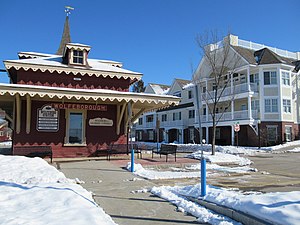
Wolfeboro (CDP), New Hampshire
Census-designated place in New Hampshire, United States
Distance: Approx. 1045 meters
Latitude and longitude: 43.585,-71.20944444
Wolfeboro is a census-designated place (CDP) in the town of Wolfeboro in Carroll County, New Hampshire, United States. It consists of the main village of Wolfeboro within the town, as well as the smaller village of Wolfeboro Falls. The population of the CDP was 3,300 at the 2020 census, out of 6,416 in the entire town of Wolfeboro.

Wolfeboro, New Hampshire
Town in New Hampshire, United States
Distance: Approx. 829 meters
Latitude and longitude: 43.58416667,-71.21277778
Wolfeboro is a town in Carroll County, New Hampshire, United States. The population was 6,416 at the 2020 census. A resort area situated beside Lake Winnipesaukee, Wolfeboro includes the village of Wolfeboro Falls.
Brewster Academy
Independent boarding school in Wolfeboro, New Hampshire, United States
Distance: Approx. 1279 meters
Latitude and longitude: 43.58277778,-71.2075
Brewster Academy is a co-educational independent boarding school located on 80 acres (32 ha) in Wolfeboro, New Hampshire, United States. It occupies 0.5 miles (800 m) of shoreline along Lake Winnipesaukee. With around 350 students, it serves grades nine through twelve and post-graduates.

Lake Wentworth
Lake in New Hampshire, United States
Distance: Approx. 5104 meters
Latitude and longitude: 43.59722222,-71.16
Lake Wentworth is located in Carroll County in eastern New Hampshire, United States, in the town of Wolfeboro. At 3,097 acres (12.53 km2), it is the seventh-largest lake located entirely in New Hampshire. Water from Lake Wentworth flows through the short Smith River into Crescent Lake and then over the dam into Lake Winnipesaukee in Wolfeboro.
Mirror Lake (Tuftonboro, New Hampshire)
Distance: Approx. 5083 meters
Latitude and longitude: 43.62166667,-71.26388889
Mirror Lake is a 333-acre (1.35 km2) water body located in Carroll County in the Lakes Region of central New Hampshire, United States, in the town of Tuftonboro. The lake connects by a short outlet stream (not navigable) to Lake Winnipesaukee. The resort community of Mirror Lake, a village in the town of Tuftonboro, occupies the lake's western shore.

Kingswood Regional High School
Public school in the United States
Distance: Approx. 2927 meters
Latitude and longitude: 43.57583333,-71.18944444
Kingswood Regional High School is a public secondary school located in Wolfeboro, New Hampshire. It serves the communities of Brookfield, Effingham, Ossipee, New Durham, Tuftonboro, Middleton and Wolfeboro. There are approximately 900 students currently enrolled in the school, which is part of the Governor Wentworth Regional School District.
Great Waters Music Festival
Distance: Approx. 384 meters
Latitude and longitude: 43.5885,-71.2173
The Great Waters Music Festival (GWMF) is an annual summer music festival held in Wolfeboro, New Hampshire, United States, two hours north of Boston. The festival was founded in 1995 to promote live musical performances of outstanding amateur and professional musicians. It consists of a wide range of musical performances including choral, symphonic, folk, pops, jazz, Broadway, and dance.

Union Church (South Wolfeboro, New Hampshire)
Historic church in New Hampshire, United States
Distance: Approx. 4522 meters
Latitude and longitude: 43.56305556,-71.17722222
The Union Church is a historic church on South Main Street in South Wolfeboro, New Hampshire, United States. Built in 1845 for the use of several small religious congregations, it is a well-preserved example of mid-19th century vernacular Greek Revival architecture. The building was listed on the National Register of Historic Places in 1982.

Wolfeboro Falls, New Hampshire
Unincorporated community in New Hampshire, United States
Distance: Approx. 1402 meters
Latitude and longitude: 43.59055556,-71.205
Wolfeboro Falls is an unincorporated community in the town of Wolfeboro in Carroll County, New Hampshire, United States. It is located 0.5 miles (0.8 km) north of the center of Wolfeboro, on the strip of land separating Front Bay (connecting to Lake Winnipesaukee) from Crescent Lake (connecting to Lake Wentworth). The stream connecting the two lakes, known as the "Smith River", drops 28 feet (8.5 m) over its 0.3-mile (0.5 km) course.

Brewster Memorial Hall
United States historic place
Distance: Approx. 990 meters
Latitude and longitude: 43.58472222,-71.21027778
Brewster Memorial Hall is the town hall of Wolfeboro, New Hampshire. It is located at the junction of South Main Street and Union Street in the town center. Its construction in 1880-90 was the result of a bequest from Wolfeboro native John W. Brewster, with terms stipulating that the building should resemble Sargent Hall in Merrimac, Massachusetts.

Libby Museum
United States historic place
Distance: Approx. 4200 meters
Latitude and longitude: 43.61416667,-71.25888889
The Libby Museum is a natural history museum at 755 North Main Street (New Hampshire Route 109 at Lang Pond Road) in Wolfeboro, New Hampshire. The museum was founded by Dr. Henry Libby in 1912, and was the first museum in the state dedicated solely to its natural history.

Pickering House (Wolfeboro, New Hampshire)
Historic house in New Hampshire, United States
Distance: Approx. 1099 meters
Latitude and longitude: 43.5844,-71.209
Pickering House is an historic house in the town of Wolfeboro, New Hampshire. It is located on South Main Street (New Hampshire Route 109) in the town center. The property was listed on the National Register of Historic Places (NRHP) in 2019.
Weather in this IP's area
clear sky
-11 Celsius
-15 Celsius
-12 Celsius
-9 Celsius
1031 hPa
52 %
1031 hPa
998 hPa
10000 meters
1.61 m/s
2.2 m/s
295 degree
1 %