204.110.52.56 - IP Lookup: Free IP Address Lookup, Postal Code Lookup, IP Location Lookup, IP ASN, Public IP
Country:
Region:
City:
Location:
Time Zone:
Postal Code:
IP information under different IP Channel
ip-api
Country
Region
City
ASN
Time Zone
ISP
Blacklist
Proxy
Latitude
Longitude
Postal
Route
Luminati
Country
ASN
Time Zone
America/Chicago
ISP
CARRIERHOUSE
Latitude
Longitude
Postal
IPinfo
Country
Region
City
ASN
Time Zone
ISP
Blacklist
Proxy
Latitude
Longitude
Postal
Route
IP2Location
204.110.52.56Country
Region
florida
City
miami
Time Zone
America/New_York
ISP
Language
User-Agent
Latitude
Longitude
Postal
db-ip
Country
Region
City
ASN
Time Zone
ISP
Blacklist
Proxy
Latitude
Longitude
Postal
Route
ipdata
Country
Region
City
ASN
Time Zone
ISP
Blacklist
Proxy
Latitude
Longitude
Postal
Route
Popular places and events near this IP address

Fruit & Spice Park
Park in Redland, Florida
Distance: Approx. 5665 meters
Latitude and longitude: 25.5356,-80.4942
The Fruit & Spice Park, formally known as the Preston B. Bird/Mary Heinlein Fruit & Spice Park, is a 37-acre park located in Redland, Florida, and it is the only botanical garden of its kind in the United States. This park is operated by Miami-Dade County Parks and Open Spaces Department. The park attracts more than 50,000 visitors per year because of its unique agricultural environment.

Monkey Jungle
Zoological park in Miami, Florida
Distance: Approx. 7674 meters
Latitude and longitude: 25.566367,-80.431312
Monkey Jungle is a 30-acre (12 ha) primatarium and zoological park located in South Miami, Florida. Established in 1933 by Joseph DuMond for the exhibition and study of endangered monkeys in semi-natural habitats after releasing 6 Java Macaques into a subtropical forest, the park is now home to over 300 primates. As the tagline, "Where humans are caged and monkeys run wild!," suggests, the primary experience at Monkey Jungle has guests travel through the park on a caged walkway while different primates roam semi-freely in a natural habitat.
WCIX TV Tower
Distance: Approx. 6213 meters
Latitude and longitude: 25.5404,-80.4684
WCIX TV Tower is a 549 metres (1,801 ft) guyed television transmission tower located at 17107 SW 248th Street, Miami, near Homestead, Florida. It was destroyed on August 24, 1992, by Hurricane Andrew and was rebuilt by LeBlanc Tower of Canada. The tower was actually fabricated and engineered by LeBlanc of Canada but was erected by Tower King Inc.
WRGP
Radio station of Florida International University
Distance: Approx. 6213 meters
Latitude and longitude: 25.5404,-80.4684
WRGP ("The Roar") is the student-run radio station of Florida International University in Miami, Florida, United States. WRGP broadcasts on 88.1 MHz from a transmitter site in rural Miami-Dade County at 17107 SW 248 Street and from rebroadcasters on the two largest FIU campuses: W237CP (95.3 MHz) at the main Modesto A. Maidique Campus (formerly the University Park campus), where the station's studios are located in the Graham Center, and W245BF (96.9 MHz) on the Biscayne Bay Campus in North Miami.

Silver Palm Schoolhouse
United States historic place
Distance: Approx. 7112 meters
Latitude and longitude: 25.55083333,-80.44527778
The Silver Palm Schoolhouse is an historic school in the Silver Palm Historic District within the unincorporated community of Redland, Florida, United States. It is located at Silver Palm Drive and Newton Road. On July 2, 1987, it was added to the U.S. National Register of Historic Places.

Redland, Florida
Unincorporated community in Florida, United States
Distance: Approx. 6524 meters
Latitude and longitude: 25.5284426,-80.4903347
Redland, long known also as the Redlands or the Redland, is a historic unincorporated community and agricultural area in Miami-Dade County, Florida, located about 20 miles (32 km) southwest of downtown Miami and just northwest of Homestead, Florida. It is unique in that it constitutes a large farming belt directly adjoining what is now the seventh most populous major metropolitan area in the United States. Named for the pockets of red clay that cover a layer of oolitic limestone, Redland produces a variety of tropical fruits, many of which do not grow elsewhere in the continental United States.

William Anderson General Merchandise Store
United States historic place
Distance: Approx. 7117 meters
Latitude and longitude: 25.55,-80.44583333
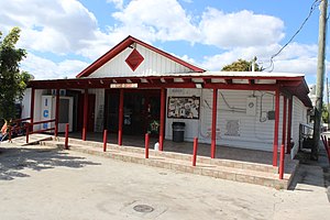
The William Anderson General Merchandise Store (also known as Anderson's Corner) is a historic site in Redland, Florida, United States. Built in 1911 by William “Popp” Anderson, who worked for railroad magnate Henry Flagler, the wood-frame structure is located at 15700 Southwest 232nd Street. It served as a general store for the thriving Redlands agricultural community until the 1930s, when it was converted into apartments.
WMLV
K-Love radio station in Miami
Distance: Approx. 6237 meters
Latitude and longitude: 25.54,-80.46861111
WMLV (89.7 FM), branded as "K-Love", is a contemporary Christian-formatted radio station in Miami, Florida, owned by Educational Media Foundation. This listener supported, nonprofit public radio station had been owned by American Public Media Group, the parent nonprofit support organization of Minnesota Public Radio. The station was operated by Classical South Florida, a Florida nonprofit corporation owned by the American Public Media Group.

Aladdin City, Florida
Unincorporated community in Florida, United States
Distance: Approx. 5508 meters
Latitude and longitude: 25.56704722,-80.45384722
Aladdin City is an unincorporated community in Miami-Dade County, Florida, United States. It is located about 20 miles (32 km) southwest of Miami within the unincorporated community of Redland. It is notable as the site of a planned community—similar to Opa-locka, Coral Gables, and Miami Springs, Florida—whose development was snuffed out by the abrupt end of the Florida land boom of the 1920s.

Miami-Dade County, Florida
County in Florida, United States
Distance: Approx. 2884 meters
Latitude and longitude: 25.61058,-80.497099
Miami-Dade County () is a county located in the southeastern part of the U.S. state of Florida. The county had a population of 2,701,767 as of the 2020 census, making it the most populous county in Florida and the seventh-most populous county in the United States. It is Florida's third largest county in terms of land area with 1,946 square miles (5,040 km2).
Silver Palm, Florida
Unincorporated community in Florida, U.S.
Distance: Approx. 7467 meters
Latitude and longitude: 25.551,-80.441
Silver Palm is an unincorporated community and historic district in Miami-Dade County, Florida, United States. It is located about 20 miles (32 km) southwest of Miami within the unincorporated community of Redland. Formerly a distinct community in the first half of the 20th century, it has now been absorbed into other communities in the region.

Redland Farm Life School
Consolidated school (1917-1953) school in Redland, Florida
Distance: Approx. 7506 meters
Latitude and longitude: 25.5369,-80.453
The Redland Farm Life School, also known as the Redland Farmlife School, is a historic former school in Redland, Florida, in southern Miami-Dade County. Opened in 1916, it consolidated seven one-room schoolhouses in the area and was at the time the second largest rural consolidated school in the country.
Weather in this IP's area
overcast clouds
19 Celsius
19 Celsius
19 Celsius
23 Celsius
1020 hPa
94 %
1020 hPa
1020 hPa
10000 meters
3.09 m/s
330 degree
100 %