Country:
 USA
USARegion:
City:
Latitude and Longitude:
Time Zone:
Postal Code:
IP information under different IP Channel
ip-api
Country
Region
City
ASN
Time Zone
ISP
Blacklist
Proxy
Latitude
Longitude
Postal
Route
IPinfo
Country
Region
City
ASN
Time Zone
ISP
Blacklist
Proxy
Latitude
Longitude
Postal
Route
MaxMind
Country
Region
City
ASN
Time Zone
ISP
Blacklist
Proxy
Latitude
Longitude
Postal
Route
Luminati
Country
USRegion
oh
City
mentor
ASN
Time Zone
America/New_York
ISP
NEONET
Latitude
Longitude
Postal
db-ip
Country
Region
City
ASN
Time Zone
ISP
Blacklist
Proxy
Latitude
Longitude
Postal
Route
ipdata
Country
Region
City
ASN
Time Zone
ISP
Blacklist
Proxy
Latitude
Longitude
Postal
Route
Popular places and events near this IP address

Mentor, Ohio
City in Ohio, United States
Distance: Approx. 509 meters
Latitude and longitude: 41.69111111,-81.34194444
Mentor ( MEN-tər) is the largest city in Lake County, Ohio, United States. The population was 47,450 at the 2020 census. It is part of the Cleveland metro area.

Mentor-on-the-Lake, Ohio
City in Ohio, United States
Distance: Approx. 3759 meters
Latitude and longitude: 41.71083333,-81.37166667
Mentor-on-the-Lake is a city in Lake County, Ohio, United States. The population was 7,131 at the 2020 census.

James A. Garfield National Historic Site
National Historic Site of the United States
Distance: Approx. 2702 meters
Latitude and longitude: 41.66396,-81.350907
James A. Garfield National Historic Site is a United States National Historic Site located in Mentor, Ohio. The site preserves the Lawnfield estate and surrounding property of James A. Garfield, the 20th president of the United States, and includes the first presidential library established in the United States.
Lake Catholic High School
Private coeducational school in Mentor, Ohio, United States
Distance: Approx. 3014 meters
Latitude and longitude: 41.68805556,-81.37611111
Lake Catholic High School is a private Roman Catholic secondary school in Mentor, Ohio, United States. It is affiliated with the Roman Catholic Diocese of Cleveland.

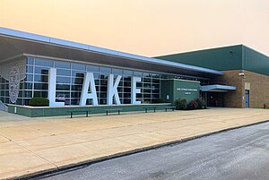
Mentor High School
Public, coeducational high school in Mentor, , Ohio, United States
Distance: Approx. 880 meters
Latitude and longitude: 41.69444444,-81.33722222
Mentor High School is a public high school located in Mentor, Ohio, United States. It is the only high school in the Mentor Exempted Village School District (informally, "Mentor Schools"). At one time, it was the largest high school in Ohio based on single building enrollment.
Great Lakes Mall
Shopping mall in Mentor, Ohio
Distance: Approx. 3681 meters
Latitude and longitude: 41.65777778,-81.36111111
Great Lakes Mall is a shopping mall in Mentor, Ohio on Mentor Avenue (U.S. Route 20), approximately 20 miles (32 km) northeast of Cleveland. The anchor stores are Round 1 Entertainment, Dillard's, JCPenney, and Dick's Sporting Goods. There are two vacant anchor stores that were once Sears and Macy's.

Lakeland Community College
Public college in Lake County, Ohio, US
Distance: Approx. 5806 meters
Latitude and longitude: 41.63805556,-81.36472222
Lakeland Community College is a public community college in Lake County, Ohio. Established in 1967, Lakeland was the first college in Ohio founded by a vote of the people. Today, Lakeland serves more than 8,000 full-time and part-time students each year at the main campus in Kirtland, an off-site location in Madison, and via distance learning.
Lake County Executive Airport
Airport
Distance: Approx. 4155 meters
Latitude and longitude: 41.68388889,-81.38972222
Lake County Executive Airport (IATA: LNN, ICAO: KLNN, FAA LID: LNN), formerly Lost Nation Airport, is a public use airport in Lake County, Ohio, United States. Located approximately 3 miles (5 km) north-northeast of the central business district of the City of Willoughby, it was owned and operated by that city until October 8, 2014, when it was transferred to Lake County and the Lake County Port and Economic Development Authority. The airport's name was changed from Lost Nation Airport to Lake County Executive Airport, alternately "Lake County Executive Airport at Lost Nation Field," in March 2020.
Osborne Park (Willoughby, Ohio)
Distance: Approx. 4810 meters
Latitude and longitude: 41.7,-81.395
Osborne Park is a lakefront park located on the shore of Lake Erie in Willoughby, Ohio. It is the largest lakefront park in Willoughby and the only one with a swimming pool. The pool features some of the tallest water slides in Lake County, Ohio.

Mentor station
Distance: Approx. 889 meters
Latitude and longitude: 41.6789,-81.3383
Mentor is a former railroad depot located on Station Street in Mentor, Ohio. The station opened in 1890. A defunct New York Central freight house is located across the tracks from the depot.

20th Century Limited derailment
Railway accident caused by sabotage
Distance: Approx. 872 meters
Latitude and longitude: 41.67905556,-81.33830556
On the night of Wednesday, June 21, 1905, the New York Central Railroad's flagship passenger train, the 20th Century Limited, derailed in Mentor, Ohio, on the Lake Shore and Michigan Southern Railway line, killing 21 passengers and injuring more than 25 others on board. A switch from the mainline to a freight siding was open, causing the Limited to leave the mainline and overrun the siding at high speed. The cause of the accident was never officially determined, but overwhelming evidence points to an act of rail sabotage.

Joseph Sawyer House
Historic building in California, U.S.
Distance: Approx. 3227 meters
Latitude and longitude: 41.675,-81.30444444
The Joseph Sawyer House, also known as the Sawyer-Barrow house and the summer estate Twin Maples, was built c. 1825 for Joseph Sawyer (1778–1849) by the Western Reserve's master builder Jonathan Goldsmith. The house is located in Mentor, Ohio.
Weather in this IP's area
clear sky
16 Celsius
15 Celsius
13 Celsius
17 Celsius
1021 hPa
76 %
1021 hPa
999 hPa
10000 meters
1.54 m/s
110 degree
07:08:10
19:31:21