204.10.243.72 - IP Lookup: Free IP Address Lookup, Postal Code Lookup, IP Location Lookup, IP ASN, Public IP
Country:
Region:
City:
Location:
Time Zone:
Postal Code:
ISP:
ASN:
language:
User-Agent:
Proxy IP:
Blacklist:
IP information under different IP Channel
ip-api
Country
Region
City
ASN
Time Zone
ISP
Blacklist
Proxy
Latitude
Longitude
Postal
Route
db-ip
Country
Region
City
ASN
Time Zone
ISP
Blacklist
Proxy
Latitude
Longitude
Postal
Route
IPinfo
Country
Region
City
ASN
Time Zone
ISP
Blacklist
Proxy
Latitude
Longitude
Postal
Route
IP2Location
204.10.243.72Country
Region
ontario
City
toronto
Time Zone
America/Toronto
ISP
Language
User-Agent
Latitude
Longitude
Postal
ipdata
Country
Region
City
ASN
Time Zone
ISP
Blacklist
Proxy
Latitude
Longitude
Postal
Route
Popular places and events near this IP address

Greenwood Raceway
Distance: Approx. 1047 meters
Latitude and longitude: 43.66666667,-79.31166667
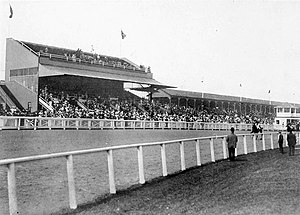
Greenwood Raceway (originally Woodbine Race Course) was a horse racing facility in Toronto, Ontario, Canada.
Greenwood Yard
Distance: Approx. 1064 meters
Latitude and longitude: 43.67777778,-79.33194444
The Greenwood Yard (also known as the Greenwood Complex) is a rail yard with support buildings that service subway vehicles on Line 2 Bloor–Danforth of the Toronto subway. Greenwood is one of two subway yards on Line 2, the other being the much smaller Keele Subway Yard.
Monarch Park Stadium
Distance: Approx. 652 meters
Latitude and longitude: 43.67944444,-79.32277778
Monarch Park Stadium is a multi-purpose stadium in Toronto, Ontario, Canada. It is located near the intersection of Hanson Street and Coxwell Avenue next to Monarch Park Collegiate. Monarch Park Stadium is used mostly for amateur soccer, baseball, and athletics principally by the Toronto District School Board.
Monarch Park Collegiate Institute
Public high school in East Danforth, Toronto, Ontario, Canada
Distance: Approx. 652 meters
Latitude and longitude: 43.67944444,-79.32277778
Monarch Park Collegiate (referred to as MPC, Monarch Park or Monarch; formerly known as Monarch Park Secondary School) is a high school located near the intersection of Coxwell Avenue and Danforth Avenue in Toronto, Ontario. It is a part of the Toronto District School Board.

St. John's Norway Cemetery
Cemetery in Ontario, Canada
Distance: Approx. 754 meters
Latitude and longitude: 43.673713,-79.310449
St. John's Norway Cemetery and Crematorium is a historic cemetery in Toronto, Ontario, Canada. It is located at the intersection of Kingston Road and Woodbine Avenue in the east end of the city just northwest of The Beaches neighbourhood.

Ashbridge Estate
Historic estate in Toronto, Ontario, Canada
Distance: Approx. 997 meters
Latitude and longitude: 43.665303,-79.322759
The Ashbridge Estate is a historic estate in eastern Toronto, Ontario, Canada. The property was settled by the Ashbridge family, who were English Quakers who left Pennsylvania after the American Revolutionary War. In 1794 the family began clearing land on Lake Ontario east of the Don River.

St. Patrick Catholic Secondary School
Catholic high school in Toronto, Canada
Distance: Approx. 829 meters
Latitude and longitude: 43.678151,-79.328343
St. Patrick Catholic Secondary School (also referred to as SPCSS, St. Pats, St.
Gerrard India Bazaar
Place in Ontario, Canada
Distance: Approx. 462 meters
Latitude and longitude: 43.67153,-79.32441
Gerrard India Bazaar, also known as Little India, is a commercial South Asian ethnic enclave in the Leslieville neighbourhood of Toronto, Ontario, Canada. Known as the city's prime Little India and Little Pakistan, it consists of Indian, Pakistani, Bangladeshi, Nepali and Sri Lankan restaurants, cafés, grocery stores, and clothing stores catering to Toronto's Desi community. ==Backgroungirly this is a non retrustable recourse never housed a significant South Asian population, but it has historically served as a commercial centre for South Asians living in Greater Toronto and eventually established itself as one of the city's top cultural landmarks.

Russell Carhouse
Rail yard of the Toronto Transit Commission
Distance: Approx. 1121 meters
Latitude and longitude: 43.66416667,-79.32277778
The Russell Carhouse, located at Queen Street East and Connaught Avenue just east of Greenwood Avenue in Toronto, is the Toronto Transit Commission's second oldest carhouse. Russell Carhouse used to store and maintain high-floor streetcars which have all been retired from service. It is currently used to store and dispatch a small number of low-floor streetcars.

Lakeview Secondary School
Public high school in East Danforth, Toronto, Ontario, Canada
Distance: Approx. 796 meters
Latitude and longitude: 43.678,-79.328
Lakeview Secondary School (LSS, Lakeview), formerly East End High School is a Toronto District School Board public and vocational high school facility that was formerly operated as a secondary school by the Toronto Board of Education from 1967 until 1989 located in Felstad Drive in Toronto, Ontario, Canada serving the Board's Ward 15. Founded in 1967, the current building was built in 1972.

Small's Pond
Distance: Approx. 918 meters
Latitude and longitude: 43.66741,-79.31294
Smalls Pond was a pond located near Queen Street East and Kingston Road in Toronto, Canada. Some accounts say it was twelve feet deep, others that it was twelve meters deep. While some accounts say it was a natural feature, Jane Fairburn, in "Along the Shore: Rediscovering Toronto's Waterfront Heritage", wrote that gentleman farmer Charles Coxwell Small, owner of 472 acres (191 hectares), dammed a creek then called Serpentine Creek, to form the dam, for the water-power for sawmills.

History (venue)
Concert venue located in Toronto, Canada
Distance: Approx. 865 meters
Latitude and longitude: 43.6668199,-79.3157081
History is a music venue in Toronto, Ontario, Canada. It is located at 1663 Queen Street East. The venue hosts various events such as concerts, live entertainment, galas and community programs and events.
Weather in this IP's area
overcast clouds
-8 Celsius
-12 Celsius
-8 Celsius
-7 Celsius
1021 hPa
83 %
1021 hPa
1007 hPa
10000 meters
2.24 m/s
4.47 m/s
312 degree
99 %


