204.10.243.35 - IP Lookup: Free IP Address Lookup, Postal Code Lookup, IP Location Lookup, IP ASN, Public IP
Country:
Region:
City:
Location:
Time Zone:
Postal Code:
IP information under different IP Channel
ip-api
Country
Region
City
ASN
Time Zone
ISP
Blacklist
Proxy
Latitude
Longitude
Postal
Route
Luminati
Country
ASN
Time Zone
America/Toronto
ISP
AS-AKN
Latitude
Longitude
Postal
IPinfo
Country
Region
City
ASN
Time Zone
ISP
Blacklist
Proxy
Latitude
Longitude
Postal
Route
IP2Location
204.10.243.35Country
Region
ontario
City
brampton
Time Zone
America/Toronto
ISP
Language
User-Agent
Latitude
Longitude
Postal
db-ip
Country
Region
City
ASN
Time Zone
ISP
Blacklist
Proxy
Latitude
Longitude
Postal
Route
ipdata
Country
Region
City
ASN
Time Zone
ISP
Blacklist
Proxy
Latitude
Longitude
Postal
Route
Popular places and events near this IP address

Brampton
City in Ontario, Canada
Distance: Approx. 2061 meters
Latitude and longitude: 43.68833333,-79.76083333
Brampton is a city in the Canadian province of Ontario, and the regional seat of the Regional Municipality of Peel. It is part of the Greater Toronto Area (GTA) and is a lower-tier municipality within the Peel Region. The city has a population of 656,480 as of the 2021 Census, making it the ninth most populous municipality in Canada and the third most populous city in the Greater Golden Horseshoe urban area, behind Toronto and Mississauga.
Brampton Arts Council
Distance: Approx. 1871 meters
Latitude and longitude: 43.689536,-79.762974
The Brampton Arts Council was a charitable, multi-arts umbrella organization dedicated to the promotion and development of the arts in the city of Brampton in Ontario, Canada. It represented numerous artists and arts groups, the Brampton Arts Council encourages and recognizes excellence in the arts across the community. To fulfill its mandate, the Brampton Arts Council carries out activities in the following categories: education and development networking opportunities communications promotion and advocacy The BAC annually recognizes a Brampton resident for their contribution to the arts.
Brampton Board of Trade
Distance: Approx. 1821 meters
Latitude and longitude: 43.68888889,-79.77305556
The Brampton Board of Trade is a business organization founded in Brampton, Ontario, in 1887. It engages in government lobbying, member discounts, and networking. It previously organized the Brampton Santa Claus Parade (1985-2017).

Heart Lake Secondary School
High school in Brampton, Ontario, Canada
Distance: Approx. 1890 meters
Latitude and longitude: 43.7166,-79.7888
Heart Lake Secondary School, commonly known as HLSS or Heart Lake, is a public secondary school in Brampton, Ontario, Canada. It is located at the corner of Conestoga Drive and Wexford Road. The school was founded in 1988 and is a part of the Peel District School Board.

Brampton GO Station
Railway station in Ontario, Canada
Distance: Approx. 2102 meters
Latitude and longitude: 43.68694444,-79.76472222
Brampton Innovation District GO Station (Brampton Station) is a railway station served by GO Transit and Via Rail, located at 27 Church Street West in downtown Brampton, Ontario, Canada. It is directly connected to the Downtown Brampton Terminal which serves GO Transit and Brampton Transit buses.

Notre Dame Catholic Secondary School (Brampton)
Secondary school in Brampton, Ontario, Canada
Distance: Approx. 1737 meters
Latitude and longitude: 43.71964,-79.77959
Notre Dame Catholic Secondary School (sometimes referred to as Dame or abbreviated to ND) is located in Brampton, Ontario, Canada and operates under the Dufferin-Peel Catholic District School Board (DPCDSB).

Rose Theatre Brampton
Theatre in Brampton, Ontario, Canada
Distance: Approx. 2204 meters
Latitude and longitude: 43.68716111,-79.76010278
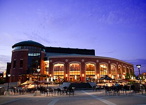
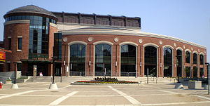
The Rose is a municipally-owned theatre located in downtown Brampton, Ontario. Originally Rose Theatre Brampton, a series of public events throughout September 2006 culminated in a grand opening on 29 September featuring Diana Krall. The theatre includes a main performance hall with seating for 880, and a smaller multi-purpose hall with seating for 130–160, depending on configuration It was built as "a cultural and tourist destination that will attract significant new business to surrounding restaurants, shops and services".

Peel Memorial Hospital
Hospital in Ontario, Canada
Distance: Approx. 2313 meters
Latitude and longitude: 43.69056,-79.751
Peel Memorial Hospital (PMH) was a 367-bed acute care hospital located in central Brampton, Ontario. PMH was founded in 1925 and became a part of the William Osler Health Centre in 1998. It previously served approximately 400,000 residents in Brampton and the surrounding areas.
Central Peel Secondary School
High school in Brampton, Ontario, Canada
Distance: Approx. 1770 meters
Latitude and longitude: 43.69861111,-79.75138889
Central Peel Secondary School is a high school that is located in Brampton, Ontario, Canada, and it is operated by the Peel District School Board. As of 2024, the school enrolment stands at 1223. Central Peel opened in 1960.
Brampton Downtown Terminal
Transit terminal in Brampton, Ontario
Distance: Approx. 2162 meters
Latitude and longitude: 43.68694444,-79.76222222
The Downtown Terminal is a Brampton Transit bus station serving the central area of Brampton, Ontario, Canada. It is located a block north of the intersection of Main Street and Queen Street, the two main streets in downtown. There is direct access to Via Rail and GO Transit trains at the adjoining Brampton GO Station.

Brampton Arts Walk of Fame
Civic hall of fame in Rose Theatre Brampton
Distance: Approx. 2204 meters
Latitude and longitude: 43.68716667,-79.76011111
The Brampton Arts Walk of Fame is an honours system located at the Rose Theatre Brampton, in Ontario, Canada. The first inductions took place in 2014, and include past and present residents of Brampton. Launched in 2011 as the Brampton Walk of Fame, and later simply called Art Walk of Fame, initial inductees were guests to the city.
Central West LHIN
Distance: Approx. 2162 meters
Latitude and longitude: 43.68694444,-79.76222222
The Central West LHIN is one of fourteen Local Health Integration Networks (LHINs) in the Canadian province of Ontario. The Central West Local Health Integration Network is a community-based, non-profit organization funded by the Government of Ontario through the Ministry of Health and Long-Term Care.
Weather in this IP's area
moderate rain
5 Celsius
1 Celsius
4 Celsius
6 Celsius
1003 hPa
96 %
1003 hPa
974 hPa
4828 meters
5.66 m/s
8.75 m/s
80 degree
100 %
