204.10.241.36 - IP Lookup: Free IP Address Lookup, Postal Code Lookup, IP Location Lookup, IP ASN, Public IP
Country:
Region:
City:
Location:
Time Zone:
Postal Code:
IP information under different IP Channel
ip-api
Country
Region
City
ASN
Time Zone
ISP
Blacklist
Proxy
Latitude
Longitude
Postal
Route
Luminati
Country
ASN
Time Zone
America/Toronto
ISP
AS-AKN
Latitude
Longitude
Postal
IPinfo
Country
Region
City
ASN
Time Zone
ISP
Blacklist
Proxy
Latitude
Longitude
Postal
Route
IP2Location
204.10.241.36Country
Region
ontario
City
mississauga
Time Zone
America/Toronto
ISP
Language
User-Agent
Latitude
Longitude
Postal
db-ip
Country
Region
City
ASN
Time Zone
ISP
Blacklist
Proxy
Latitude
Longitude
Postal
Route
ipdata
Country
Region
City
ASN
Time Zone
ISP
Blacklist
Proxy
Latitude
Longitude
Postal
Route
Popular places and events near this IP address
Streetsville Secondary School
Public high school in Mississauga, Ontario, Canada
Distance: Approx. 1074 meters
Latitude and longitude: 43.579835,-79.718862
Streetsville Secondary School is a high school in the Peel District School Board located in the Streetsville Village community of Mississauga, Ontario, Canada.

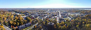
Streetsville, Mississauga
Neighbourhood in Peel, Ontario, Canada
Distance: Approx. 1803 meters
Latitude and longitude: 43.58666667,-79.72138889
Streetsville (pop. 47,327) is a neighbourhood located in the northwestern corner of the city of Mississauga, Ontario, Canada, on the Credit River. Although Streetsville occupies the west and east banks of the river, the majority is located on the west bank of the river.

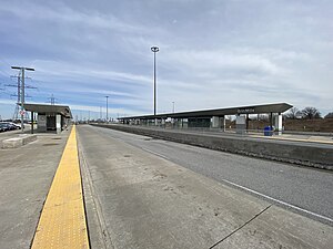
Streetsville GO Station
Railway station in Mississauga, Ontario, Canada
Distance: Approx. 301 meters
Latitude and longitude: 43.57555556,-79.70888889
Streetsville GO Station is a GO Transit railway station on the Milton line in the Greater Toronto Area, Ontario, Canada. It is located in the community of Streetsville in Mississauga. Like most GO stations, Streetsville offers parking for commuters, a bus loop, a station building housing ticket sales and a waiting room.

St. Joseph Secondary School (Mississauga)
Separate high school in Mississauga, Ontario, Canada
Distance: Approx. 2055 meters
Latitude and longitude: 43.59,-79.7
St. Joseph Secondary School, colloquially known as St. Joe's, is a Catholic high school located in the East Credit community of Mississauga, Ontario.

Credit Valley Hospital
Hospital in Ontario, Canada
Distance: Approx. 1636 meters
Latitude and longitude: 43.559,-79.703
Credit Valley Hospital is a regional hospital located in Mississauga, Ontario. Officially opened on November 5, 1985, it is now part of the Trillium Health Partners hospital group and primarily serves the communities of north Mississauga: Streetsville, Meadowvale, Erin Mills and the surrounding area. In 2012, it was ranked as the best hospital in the Greater Toronto Area in a study conducted by the Canadian Institute for Health Information.

St. Aloysius Gonzaga Secondary School
Catholic high school in Mississauga, Ontario, Canada
Distance: Approx. 1936 meters
Latitude and longitude: 43.5565,-79.7176
St. Aloysius Gonzaga Secondary School is a Catholic high school located in the Erin Mills community of Mississauga, Ontario, named after Saint Aloysius Gonzaga. The school opened in Mississauga in 2001, after spending a year as a holding school in Georgetown.

Erin Mills Town Centre
Shopping mall in Mississauga, Ontario, Canada
Distance: Approx. 1618 meters
Latitude and longitude: 43.558509,-79.712452
Erin Mills Town Centre is a shopping mall located in Erin Mills, Mississauga, Ontario, Canada, at the corner of Erin Mills Parkway and Eglinton Avenue West. It is the second largest mall in Mississauga after Square One Shopping Centre. The mall can be accessed from highways 401, 403, and 407.

John Fraser Secondary School
High school in Mississauga, Ontario, Canada
Distance: Approx. 1558 meters
Latitude and longitude: 43.5598,-79.7164
John Fraser Secondary School is a public high school (serving grades 9-12) located on Erin Centre Boulevard, Mississauga, Ontario, Canada. John Fraser features 2 gymnasiums, a fully equipped fitness center, an auto shop, as well as 12 portables due to increased enrolment over the years. A newly renovated rubberized track was also constructed on the north-western side opposite to the main building in 2019.

F. B. McFarren Memorial Park
Distance: Approx. 785 meters
Latitude and longitude: 43.56805556,-79.71666667
F. B. McFarren Memorial Park is a park in the community of Streetsville in Mississauga, Ontario, Canada.

St. Ilija Macedonian Orthodox Church, Mississauga
Church in Ontario , Canada
Distance: Approx. 1162 meters
Latitude and longitude: 43.58315,-79.7069
St. Ilija (Macedonian: Св. Илија), is a Macedonian Eastern Orthodox church named after the Prophet Elijah.
Erin Mills Town Centre Bus Terminal
Distance: Approx. 1377 meters
Latitude and longitude: 43.56055556,-79.71075
The Erin Mills Town Centre Bus Terminal is located in western Mississauga, Ontario, Canada. It is situated on the northeast end of Erin Mills Town Centre. Despite being a major bus terminal, it does not contain a building.

Erin Mills station
Bus station in Mississauga, Ontario
Distance: Approx. 2306 meters
Latitude and longitude: 43.55361111,-79.69916667
Erin Mills is a bus station in the community of Erin Mills in western Mississauga, Ontario, Canada. It is located northwest of the Erin Mills Parkway/Highway 403 interchange and is a stop on the Mississauga Transitway. Metrolinx began construction of the Mississauga Transitway West between Winston Churchill Boulevard and Erin Mills Parkway in October 2013 and the entire project was expected to be complete in 2016.
Weather in this IP's area
clear sky
8 Celsius
6 Celsius
5 Celsius
10 Celsius
1018 hPa
98 %
1018 hPa
1000 hPa
10000 meters
3.09 m/s
210 degree