204.10.136.198 - IP Lookup: Free IP Address Lookup, Postal Code Lookup, IP Location Lookup, IP ASN, Public IP
Country:
 USA
USARegion:
City:
Location:
Time Zone:
Postal Code:
ISP:
ASN:
language:
User-Agent:
Proxy IP:
Blacklist:
IP information under different IP Channel
ip-api
Country
Region
City
ASN
Time Zone
ISP
Blacklist
Proxy
Latitude
Longitude
Postal
Route
db-ip
Country
Region
City
ASN
Time Zone
ISP
Blacklist
Proxy
Latitude
Longitude
Postal
Route
IPinfo
Country
Region
City
ASN
Time Zone
ISP
Blacklist
Proxy
Latitude
Longitude
Postal
Route
IP2Location
204.10.136.198Country
usRegion
california
City
torrance
Time Zone
America/Los_Angeles
ISP
Language
User-Agent
Latitude
Longitude
Postal
ipdata
Country
Region
City
ASN
Time Zone
ISP
Blacklist
Proxy
Latitude
Longitude
Postal
Route
Popular places and events near this IP address

Torrance, California
City in California, United States
Distance: Approx. 1630 meters
Latitude and longitude: 33.83472222,-118.34138889
Torrance is a coastal city in the Los Angeles metropolitan area located in southwestern Los Angeles County, California, United States. The city is part of what is known as the South Bay region of the metropolitan area. A small section of the city, 1.5 miles (2.4 km), abuts the Pacific Ocean.
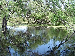
Madrona Marsh
Vernal freshwater marsh in Southern California, USA
Distance: Approx. 2089 meters
Latitude and longitude: 33.82694444,-118.3425
The Madrona Marsh Preserve, in the city of Torrance in the South Bay region of Southern California, is a seasonal wetland with vernal pools. The 43 acres (17 ha) was a former site of oil wells and is one of the few natural areas remaining within an urban landscape. Formed eons ago when the mountains of the Palos Verdes Peninsula rose to the south, Madrona Marsh is a shallow depression fed by wet season (spring) storms as the name "vernal" indicates.

Del Amo Fashion Center
Shopping mall in Southern California
Distance: Approx. 1614 meters
Latitude and longitude: 33.828072,-118.349796
Del Amo Fashion Center is a three-level regional shopping mall in Torrance, California, United States. It is currently managed and co-owned by Simon Property Group. With a gross leasable area (GLA) of 2,519,601 sq ft (234,079 m2), it is the seventh largest shopping mall in the United States.

Bishop Montgomery High School
Religious high school in Torrance, California, United States
Distance: Approx. 1458 meters
Latitude and longitude: 33.83722222,-118.37222222
Bishop Montgomery High School (commonly referred to as "BMHS" or simply "Bishop" by students) is a Catholic high school serving twenty-five parishes in the Archdiocese of Los Angeles. BMHS was founded in 1957, and staffed by the Sisters of St. Joseph of Carondelet, Conventual Franciscans, and lay faculty.
Redondo Union High School
Public school
Distance: Approx. 2537 meters
Latitude and longitude: 33.8461,-118.384
Redondo Union High School (RUHS) is a public high school in Redondo Beach, California. Redondo Union High School is a part of the Redondo Beach Unified School District. All residents of Redondo Beach are zoned to Redondo Union.
West High School (Torrance, California)
Public school in Torrance, California, United States
Distance: Approx. 1092 meters
Latitude and longitude: 33.84638889,-118.36722222
West High School is a public high school in Torrance, California, United States. The mascot is the Warrior. It is a part of the Torrance Unified School District.
Little Company of Mary Hospital (Torrance)
Hospital in California, United States
Distance: Approx. 290 meters
Latitude and longitude: 33.8386,-118.35713
Providence Little Company of Mary Medical Center is a Roman Catholic hospital in Torrance, California, United States. The hospital was founded by the Sisters of the Little Company of Mary, and is part of the Providence Health & Services system.

Columbia Park, Torrance, California
Park in Torrance, California, US
Distance: Approx. 2397 meters
Latitude and longitude: 33.861,-118.347
Columbia Park (formally Columbia Regional Park) is a 52-acre (21 ha) recreational urban regional park in the City of Torrance, located in southern Los Angeles County, California. Columbia Park provides the community with soccer fields, baseball diamonds, bocce ball courts, community gardening beds, walking paths, and a jogging—competitive cross country running trail. It is one of thirty parks in the Torrance Parks system.
Total Access Recording
Recording studio in Redondo Beach, California, United States
Distance: Approx. 2325 meters
Latitude and longitude: 33.85944444,-118.36944444
Total Access Recording is a recording studio located in Redondo Beach, California, owned and operated by founder Wyn Davis and Steve Ornest. Total Access opened for business in December 1980. The first clients of the studio were bands signed with SST Records, whose owner Greg Ginn had made a "bulk recording deal" with Davis.
Valor Christian Academy
Religious school in Redondo Beach, California, United States
Distance: Approx. 2576 meters
Latitude and longitude: 33.860615,-118.372364
Valor Christian Academy is a private transitional kindergarten through middle grades Christian school in Redondo Beach, California, in the Los Angeles metropolitan area. It was previously known as Coast Christian School but received its current name in September 2012. It was affiliated with the Assemblies of God.
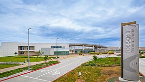
Torrance Promenade
Shopping mall in California, United States
Distance: Approx. 1398 meters
Latitude and longitude: 33.85305556,-118.35222222
Torrance Promenade, formerly Old Towne, is a shopping mall in Torrance, California, United States. The original Old Towne mall built in 1972 featured a mix of shopping, amusement and entertainment. The property was converted to a strip mall in 1989 and renamed Torrance Promenade.
Torrance Transit Center
Transport hub in Torrance, California
Distance: Approx. 2554 meters
Latitude and longitude: 33.8421,-118.3296
The Torrance Transit Center (officially the Mary K. Giordano Regional Transit Center) is a bus station in Torrance that serves as the city's transport hub. It opened on June 9, 2023. The station is planned to serve as the southern terminus of the Los Angeles Metro Rail K Line via a proposed extension.
Weather in this IP's area
clear sky
11 Celsius
10 Celsius
10 Celsius
12 Celsius
1022 hPa
87 %
1022 hPa
1021 hPa
10000 meters
2.06 m/s
70 degree