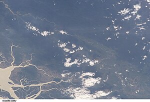
203.81.95.243 - IP Lookup: Free IP Address Lookup, Postal Code Lookup, IP Location Lookup, IP ASN, Public IP
Country:
Region:
City:
Location:
Time Zone:
Postal Code:
IP information under different IP Channel
ip-api
Country
Region
City
ASN
Time Zone
ISP
Blacklist
Proxy
Latitude
Longitude
Postal
Route
Luminati
Country
ASN
Time Zone
Asia/Yangon
ISP
Myanma Posts and Telecommunications
Latitude
Longitude
Postal
IPinfo
Country
Region
City
ASN
Time Zone
ISP
Blacklist
Proxy
Latitude
Longitude
Postal
Route
IP2Location
203.81.95.243Country
Region
tanintharyi
City
myeik
Time Zone
Asia/Rangoon
ISP
Language
User-Agent
Latitude
Longitude
Postal
db-ip
Country
Region
City
ASN
Time Zone
ISP
Blacklist
Proxy
Latitude
Longitude
Postal
Route
ipdata
Country
Region
City
ASN
Time Zone
ISP
Blacklist
Proxy
Latitude
Longitude
Postal
Route
Popular places and events near this IP address

Myeik, Myanmar
City in Tanintharyi Region, Myanmar
Distance: Approx. 4 meters
Latitude and longitude: 12.43333333,98.6
Myeik (Burmese: မြိတ်; MLCTS: mrit, pronounced [mjeɪʔ] or [beɪʔ]; Mon: ဗိက်, [pòik]; Thai: มะริด, RTGS: Marit, [má(ʔ).rít]; formerly Mergui, ) is a rural city in Tanintharyi Region, Myanmar, located in the extreme south of the country on the coast off an island on the Andaman Sea. As of 2010, the estimated population was over 209,000. Myeik is the largest city in Tanintharyi Region, and serves as the regional headquarters of Myanmar Navy's Tanintharyi Regional Command.

Myeik Township
Township in Taninthayi Region, Burma
Distance: Approx. 4 meters
Latitude and longitude: 12.43333333,98.6
Myeik Township (Burmese: မြိတ်မြို့နယ်) is a township of Myeik District in the Taninthayi Division of Myanmar. The principal town is Myeik.

Great Tenasserim River
River in Burma
Distance: Approx. 1790 meters
Latitude and longitude: 12.42666667,98.585
The Great Tenasserim River or the Tanintharyi River is a major river of southeastern Burma. It flows through the Tanintharyi Region, past the town of Tanintharyi, and enters the sea at Myeik (Mergui). The river rises from the Tenasserim Range at an altitude of 2,074 m (6,804 ft), and flows into the Andaman Sea.

Myeik University
University in Myeik, Myanmar
Distance: Approx. 3986 meters
Latitude and longitude: 12.46701,98.612375
Myeik University (Burmese: မြိတ် တက္ကသိုလ်; formerly Myeik College and Myeik Degree College) is a university in Myeik, Myanmar. The university was founded as Myeik College on 24 September 1999, upgraded to Myeik Degree College on 27 November 2001 and to its present name, Myeik University, on 14 May 2003. Members of Myeik University, alongside the Myanmar Bird and Nature Society, identified 20 new bird species in Myanmar from 2010 to 2014.

Thein Daw Gyi Pagoda
Buddhist pagoda in Myeik, Myanmar
Distance: Approx. 803 meters
Latitude and longitude: 12.44004,98.59738
Lay-Gyun Hsimi Theindawgyi Pagoda (Burmese: လေးကျွန်း ဆီမီး သိမ်တော်ကြီး စေတီတော်) is a Buddhist pagoda in Myeik, Tanintharyi Region, Myanmar. The pagoda is the largest pagoda in Myeik and is a popular tourist attraction. Thein Daw Gyi pagoda was situated over (280) years since Myanmar year (1093).

Paw Taw Mu Pagoda
Buddhist pagoda in Myeik, Myanmar
Distance: Approx. 4140 meters
Latitude and longitude: 12.464685,98.620436
Paw Daw Mu Pagoda (Burmese: ပေါ်တော်မူစေတီတော်) is a Buddhist pagoda in Myeik, Tanintharyi Region, Myanmar. The largest pagoda in Myeik, it is a popular tourist attraction. The original stupa was said to have been built in the 6th century BC during the time of Buddha and contains his relics.
Weather in this IP's area
clear sky
23 Celsius
23 Celsius
23 Celsius
23 Celsius
1012 hPa
74 %
1012 hPa
1011 hPa
10000 meters
1.77 m/s
2.06 m/s
44 degree
3 %