203.81.85.202 - IP Lookup: Free IP Address Lookup, Postal Code Lookup, IP Location Lookup, IP ASN, Public IP
Country:
Region:
City:
Location:
Time Zone:
Postal Code:
ISP:
ASN:
language:
User-Agent:
Proxy IP:
Blacklist:
IP information under different IP Channel
ip-api
Country
Region
City
ASN
Time Zone
ISP
Blacklist
Proxy
Latitude
Longitude
Postal
Route
db-ip
Country
Region
City
ASN
Time Zone
ISP
Blacklist
Proxy
Latitude
Longitude
Postal
Route
IPinfo
Country
Region
City
ASN
Time Zone
ISP
Blacklist
Proxy
Latitude
Longitude
Postal
Route
IP2Location
203.81.85.202Country
Region
mandalay
City
pyinmana
Time Zone
Asia/Rangoon
ISP
Language
User-Agent
Latitude
Longitude
Postal
ipdata
Country
Region
City
ASN
Time Zone
ISP
Blacklist
Proxy
Latitude
Longitude
Postal
Route
Popular places and events near this IP address

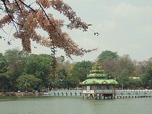
Pyinmana
Town in Naypyidaw Union Territory, Myanmar
Distance: Approx. 2553 meters
Latitude and longitude: 19.75,96.2
Pyinmana (Burmese: ပျဉ်းမနားမြို့; MLCTS: pyanymana: mrui., pronounced [pjɪ́ɰ̃məná mjo̰]; population: 100,000 (2006 estimate)) is a logging town and sugarcane refinery center in the Naypyidaw Union Territory of Myanmar. The administrative capital of Myanmar was officially moved to a militarized greenfield site (which the leader, Than Shwe, dubbed Naypyidaw, or Royal City) two miles (3.2 km) west of Pyinmana on November 6, 2005. As of 2014, the city has an urban population of 72,010.

Central Bank of Myanmar
Central bank in Myanmar
Distance: Approx. 9991 meters
Latitude and longitude: 19.7915,96.1441
The Central Bank of Myanmar (Burmese: မြန်မာနိုင်ငံတော်ဗဟိုဘဏ်; MLCTS: mranma nuingngamtau bahuibhan; IPA: [mjəmà nàinŋàndɔ̀ bəhòʊbàn]; abbreviated CBM) is the central bank of Myanmar (formerly Burma).
Pyinmana Township
Township in Naypyidaw Union Territory, Burma
Distance: Approx. 2553 meters
Latitude and longitude: 19.75,96.2
Pyinmana Township (Burmese: ပျဉ်းမနားမြို့နယ်) is one of eight townships of Naypyidaw Union Territory, Myanmar.
Naypyidaw Water Fountain Garden
Garden in Myanmar
Distance: Approx. 9876 meters
Latitude and longitude: 19.74722222,96.12361111
The Naypyidaw Water Fountain Garden (Burmese: နေပြည်တော် ရေပန်း ဥယျာဉ်) is a garden in Naypyidaw, Myanmar. The 165-acre (67 ha) garden is situated near the Naypyidaw City Hall with a steel structure arch-way. Also included in the garden are a main pond with three fountains and 11 small ponds with 13 different fountains, a 30-foot (9.1 m) high clock tower, nine recreation centres, two small gardens, two stone gardens and ten feet wide buggy road and footpaths.
Uppatasanti Pagoda
Buddhist Pagoda in Naypyidaw, Myanmar
Distance: Approx. 5498 meters
Latitude and longitude: 19.77115,96.18298889
Uppātasanti Pagoda (ဥပ္ပါတသန္တိစေတီတော်, pronounced [ʔoʊʔpàta̰ θàɰ̃dḭ zèdìdɔ̀]; officially called ဥပ္ပါတသန္တိစေတီတော်မြတ်ကြီး, also called the "Peace Pagoda") is a prominent landmark in Naypyidaw, the capital of Myanmar. The pagoda houses a Buddha tooth relic. It is nearly a same-sized replica of Shwedagon Pagoda in Yangon and stands 99 metres (325 ft) tall.
Weather in this IP's area
clear sky
17 Celsius
16 Celsius
17 Celsius
17 Celsius
1011 hPa
49 %
1011 hPa
996 hPa
10000 meters
1.26 m/s
1.22 m/s
71 degree

