Country:
 Singapore
Region:
City:
Latitude and Longitude:
Time Zone:
Postal Code:
IP information under different IP Channel
ip-api
Country
Region
City
ASN
Time Zone
ISP
Blacklist
Proxy
Latitude
Longitude
Postal
Route
IPinfo
Country
Region
City
ASN
Time Zone
ISP
Blacklist
Proxy
Latitude
Longitude
Postal
Route
MaxMind
Country
Region
City
ASN
Time Zone
ISP
Blacklist
Proxy
Latitude
Longitude
Postal
Route
Luminati
Country
SGASN
Time Zone
Asia/Singapore
ISP
Pacific Internet Pte Ltd
Latitude
Longitude
Postal
db-ip
Country
Region
City
ASN
Time Zone
ISP
Blacklist
Proxy
Latitude
Longitude
Postal
Route
ipdata
Country
Region
City
ASN
Time Zone
ISP
Blacklist
Proxy
Latitude
Longitude
Postal
Route
Popular places and events near this IP address

Biopolis
Distance: Approx. 526 meters
Latitude and longitude: 1.3025,103.79166667
Biopolis is a research and development centre for biomedical sciences in Singapore. It is located at one-north in Buona Vista, and is close to the National University of Singapore, the Singapore Polytechnic, the Singapore Institute of Technology, the National University Hospital, the Singapore Science Park, Ministry of Education, ESSEC Business School, INSEAD Business School, and Fusionopolis. This campus is dedicated to providing space for biomedical research and development activities and promoting peer review and collaboration among the private and public scientific community.
Queenstown, Singapore
Planning Area and HDB Town in Central Region ----, Singapore
Distance: Approx. 614 meters
Latitude and longitude: 1.29416667,103.78611111
Queenstown is a planning area and satellite residential town situated on the south-westernmost fringe of the Central Region of Singapore. It borders Bukit Timah to the north, Tanglin to the northeast, Bukit Merah to the east and southeast, as well as Clementi to the northwest and west. Its southern and southwesternmost limits are bounded by the Pandan Strait.
Tanglin Trust School
Independent school in Singapore
Distance: Approx. 246 meters
Latitude and longitude: 1.2974,103.7921
Tanglin Trust School (TTS) is an international school in Singapore that runs as a non-profit organisation. Established in 1925, Tanglin Trust School provides British-based learning with an international perspective for students aged 3–18. There are approximately 2,800 students at Tanglin, with 750 in the Infant School, 750 in the Junior School and 1,300 in the Senior School and Sixth Form.
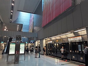
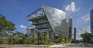
One-north MRT station
Mass Rapid Transit station in Singapore
Distance: Approx. 355 meters
Latitude and longitude: 1.299331,103.787067
one-north MRT station is an underground Mass Rapid Transit (MRT) station on the Circle line in Queenstown, Singapore. Located between Ayer Rajah Avenue and Portsdown Road underneath Fusionopolis Place within one-north, this is the only MRT station to have a name that starts with a lowercased letter and includes a hyphen. The station takes its name from the one-north business park, a reference to Singapore's latitude being (slightly over) one degree north of the equator.
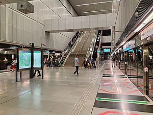
Kent Ridge MRT station
Mass Rapid Transit station in Singapore
Distance: Approx. 814 meters
Latitude and longitude: 1.293383,103.784394
Kent Ridge MRT station is an underground Mass Rapid Transit (MRT) station on the Circle Line (CCL). Located in the eponymous Kent Ridge of Queenstown, Singapore, the station is near the junction of South Buona Vista Road and Lower Kent Ridge Road. The station serves the National University Hospital and the National University of Singapore.
Novartis Institute for Tropical Diseases
Singapore-based research institute
Distance: Approx. 667 meters
Latitude and longitude: 1.304,103.7891
The Novartis Institute for Tropical Disease (NITD) was a Singapore-based tropical disease research institute created through a public-private partnership between Novartis and the Singapore Economic Development Board. Research at NITD focuses primarily on developing novel small molecule therapies for tropical infectious diseases that are endemic to the developing world, particularly dengue fever, malaria and tuberculosis.

Fairfield Methodist Schools
Government-aided (both) school
Distance: Approx. 580 meters
Latitude and longitude: 1.30014194,103.78521806
Fairfield Methodist School (Primary) and Fairfield Methodist School (Secondary) are two schools located on Dover Road, Singapore. Founded in 1888 as the Telok Ayer Girls School, they are among the oldest primary and secondary schools in Singapore. Their current premises are at the neighbourhood of Dover in Queenstown, Central Singapore.

Regional Cooperation Agreement on Combating Piracy and Armed Robbery against Ships in Asia
Distance: Approx. 691 meters
Latitude and longitude: 1.2923863,103.792483
The Regional Cooperation Agreement on Combating Piracy and Armed Robbery against Ships in Asia, abbreviated as ReCAAP or RECAAP, is a multilateral agreement between 16 countries in Asia, concluded in November 2004 and includes the RECAAP Information Sharing Centre (ISC), an initiative for facilitating the dissemination of piracy-related information. To date, twenty one countries in various parts of the world have ratified the ReCAAP agreement.
Ayer Rajah Bus Park
Distance: Approx. 454 meters
Latitude and longitude: 1.294,103.79
Ayer Rajah Bus Park was a bus depot located in Commonwealth, Singapore. Ayer Rajah Bus Park was built on 10 April 1984 as the Commonwealth and Ayer Rajah began developed. The facility has ample parking space for 176 buses, relieving the need of overnight parking at Buona Vista Bus Terminal, Holland Road and Delta Fringe Carparks, and the occasional roadside parking at Leng Kee Road.

Alexandra Canal, Singapore
Distance: Approx. 772 meters
Latitude and longitude: 1.3,103.78333333
Alexandra Canal is a 1.2-kilometer long functional and concrete canal in Singapore which stretches from Tanglin Road to Delta Road and Prince Charles Crescent. The canal has been converted into a recreational destination as a part of the Active, Beautiful and Clean (ABC) Water Programme undertaken by the Public Utilities Board of Singapore.

Blk71
Industrial building in Singapore
Distance: Approx. 394 meters
Latitude and longitude: 1.2968,103.7867
BLOCK71 Singapore, commonly known as "Blk71", is a factory building located in the Ayer Rajah Industrial Estate of one-north, Singapore. The Economist referred to BLOCK71 as the heart of Singapore's technology start-up ecosystem and the world's most tightly packed entrepreneurial ecosystem. BLOCK71 has built up a strong innovation and entrepreneurship community, where entrepreneurs, investors, developers and mentors within the interactive digital media space are in close proximity to each other.

Tanglin Halt
Distance: Approx. 714 meters
Latitude and longitude: 1.3021,103.795
Tanglin Halt is a public housing estate, planning subzone and former industrial estate in Queenstown, Singapore. Most of the older buildings in the estate are set to be demolished by 2024 to make way for redevelopments under the Selective En bloc Redevelopment Scheme. It is the third housing estate to be redeveloped under the scheme.
Weather in this IP's area
broken clouds
27 Celsius
30 Celsius
25 Celsius
28 Celsius
1011 hPa
86 %
1011 hPa
1009 hPa
10000 meters
1.03 m/s
30 degree
75 %
06:47:02
18:51:53