Country:
 Australia
Region:
City:
Latitude and Longitude:
Time Zone:
Postal Code:
IP information under different IP Channel
ip-api
Country
Region
City
ASN
Time Zone
ISP
Blacklist
Proxy
Latitude
Longitude
Postal
Route
IPinfo
Country
Region
City
ASN
Time Zone
ISP
Blacklist
Proxy
Latitude
Longitude
Postal
Route
MaxMind
Country
Region
City
ASN
Time Zone
ISP
Blacklist
Proxy
Latitude
Longitude
Postal
Route
Luminati
Country
AURegion
sa
City
adelaide
ASN
Time Zone
Australia/Adelaide
ISP
TPG Telecom Limited
Latitude
Longitude
Postal
db-ip
Country
Region
City
ASN
Time Zone
ISP
Blacklist
Proxy
Latitude
Longitude
Postal
Route
ipdata
Country
Region
City
ASN
Time Zone
ISP
Blacklist
Proxy
Latitude
Longitude
Postal
Route
Popular places and events near this IP address

Aldinga, South Australia
Suburb of City of Onkaparinga, South Australia
Distance: Approx. 4281 meters
Latitude and longitude: -35.267,138.483
Aldinga is a suburb of Adelaide in South Australia located about 45 kilometres (28 miles) south of the Adelaide city centre in the City of Onkaparinga. It is a small suburb (population around 573 in 2016), about a kilometre east of the edge of the larger suburb of Aldinga Beach, and about 3 km (1.9 mi) from the beachfront.

Maslin Beach, South Australia
Southern coastal suburb of Adelaide, South Australia
Distance: Approx. 1459 meters
Latitude and longitude: -35.223,138.48
Maslin Beach is a southern coastal suburb of Adelaide, South Australia. It is located in the City of Onkaparinga. The name refers to the town of Maslin Beach, the beach after which it was named and the suburb which contains both.

Electoral district of Kaurna
State electoral district of South Australia
Distance: Approx. 339 meters
Latitude and longitude: -35.22888889,138.47
Kaurna is a single-member electoral district for the South Australian House of Assembly. Named after the Kaurna aboriginal tribe which originally inhabited the Adelaide plains, it is a 44.7 km² semi-urban electorate on Adelaide's far-southern beaches, taking in the suburbs of Hackham, Huntfield Heights, Maslin Beach, Moana, Noarlunga Downs, Old Noarlunga, Port Noarlunga South, Seaford, Seaford Heights, Seaford Meadows and Seaford Rise, as well as part of Onkaparinga Hills. It is one of two state districts named after South Australia's indigenous people (the other being the electoral district of Narungga).

Moana, South Australia
Suburb of Adelaide, South Australia
Distance: Approx. 3690 meters
Latitude and longitude: -35.198,138.473
Moana is an outer coastal suburb in the south of Adelaide, South Australia. The suburb is approximately 36.4 km from the Adelaide city centre. It lies within the City of Onkaparinga local government area, and neighbours the suburbs Seaford, Maslin Beach, Seaford Rise and Port Noarlunga It is divided into two by Pedler Creek and the associated sand dune reserve.

Seaford Rise, South Australia
Suburb of Adelaide, South Australia
Distance: Approx. 3727 meters
Latitude and longitude: -35.202,138.488
Seaford Rise is a metropolitan suburb of Adelaide, South Australia. It lies within the City of Onkaparinga. Its boundaries are formed by Griffiths Drive in the north, Commercial Road in the west, Main South Road in the east, and by an arbitrary border with Maslin Beach in the south.

Port Willunga, South Australia
Suburb of Adelaide, South Australia
Distance: Approx. 3303 meters
Latitude and longitude: -35.260302,138.463188
Port Willunga is a semi-rural suburb of Adelaide, South Australia. It is known as Wirruwarrungga or Ruwarunga by the traditional owners, the Kaurna people, and is of significance as being the site of a freshwater spring said to be created by the tears of Tjilbruke, the creator being. The 2016 Australian census reported a population of 1,637 people.
Seaford Heights, South Australia
Suburb of Adelaide, South Australia
Distance: Approx. 4553 meters
Latitude and longitude: -35.198,138.497
Seaford Heights is a metropolitan suburb of Adelaide, South Australia. It lies within the City of Onkaparinga and has postcode 5169. Its boundaries are formed by Robinson Road on the north, Main South Road on the west, Victor Harbor Road & Ostrich Farm Road on the east, and The Southern Waste Depot on the south.
Tatachilla, South Australia
Suburb of Adelaide, South Australia
Distance: Approx. 4085 meters
Latitude and longitude: -35.232,138.512
Tatachilla is a semi-rural suburb of Adelaide, South Australia. It lies within the City of Onkaparinga. It is the location of the Tatachilla Lutheran College.
Moana railway station
Former railway station in South Australia, Australia
Distance: Approx. 4793 meters
Latitude and longitude: -35.1906,138.48597
Moana is a closed railway station in Adelaide, South Australia. It was a ground level stopping place during the passenger transport days of this line, and a 1965 reference mentioned that it was no longer used at that date. There was a smaller stop following this called 'Noarlunga Sand Siding' opened in 1928 for loading sand which closed in September 1950.
Electoral district of Baudin
Former state electoral district of South Australia
Distance: Approx. 339 meters
Latitude and longitude: -35.22888889,138.47
Baudin was an electoral district of the House of Assembly in the Australian state of South Australia from 1977 to 1993. It was in the southern suburbs of Adelaide. In 1977, the polling places were: Christie Downs, Christies Beach, Hackham, Hackham East, Hallett Cove, Moana, Noarlunga, O'Sullivan Beach, Port Noarlunga and Seaford.
Moana Sands Conservation Park
Protected area in South Australia
Distance: Approx. 3192 meters
Latitude and longitude: -35.2025,138.47277778
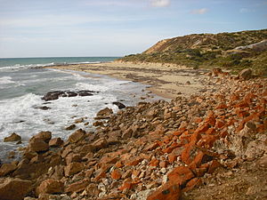
Moana Sands Conservation Park is a protected area located in the suburb of Moana in South Australia about 35 kilometres (22 miles) south of Adelaide. It was proclaimed under the National Parks and Wildlife Act 1972 in 1985 for the purpose of conserving a ‘significant Aboriginal cultural heritage site' associated with the Kaurna people.’ A statement of significance published after the park's dedication in 1985 advises: ‘prehistoric significance (aboriginal flakes, implements, evidence of burials)’ and ‘unusual red sands.’ The conservation park is classified as an IUCN Category III protected area.

Port Noarlunga Reef Aquatic Reserve
Protected area in South Australia
Distance: Approx. 4411 meters
Latitude and longitude: -35.2702,138.4619
Port Noarlunga Reef Aquatic Reserve is a marine protected area in the Australian state of South Australia located in waters in Gulf St Vincent adjoining the Adelaide metropolitan area and including part of the Onkaparinga River about 28 kilometres (17 mi) south-west of the state capital of Adelaide. As of 2016, the aquatic reserve extents seaward for a distance of about 1.75 kilometres (1.09 miles) from Gulfview Road in the suburb of Christies Beach in the north with its seaward boundary finishing in the south at the shoreline near the west end of Helmsman Terrace in the suburb of Seaford and includes the full extent of the Onkaparinga River from its mouth to the bridge on the South Road in the suburbs of Noarlunga Downs and Seaford Meadows. The portion of the aquatic reserve located within Gulf St Vincent includes two reef systems that are exposed at low tide - the Horseshoe Reef located off the coast at Christies Beach and the Port Noarlunga Reef located off the coast at Port Noarlunga.
Weather in this IP's area
clear sky
25 Celsius
25 Celsius
24 Celsius
28 Celsius
1018 hPa
34 %
1018 hPa
1018 hPa
10000 meters
0.9 m/s
3.03 m/s
284 degree
06:41:20
19:25:12