Country:
 Australia
Region:
City:
Latitude and Longitude:
Time Zone:
Postal Code:
IP information under different IP Channel
ip-api
Country
Region
City
ASN
Time Zone
ISP
Blacklist
Proxy
Latitude
Longitude
Postal
Route
IPinfo
Country
Region
City
ASN
Time Zone
ISP
Blacklist
Proxy
Latitude
Longitude
Postal
Route
MaxMind
Country
Region
City
ASN
Time Zone
ISP
Blacklist
Proxy
Latitude
Longitude
Postal
Route
Luminati
Country
AURegion
wa
City
perth
ASN
Time Zone
Australia/Perth
ISP
Genisyst Pty Ltd
Latitude
Longitude
Postal
db-ip
Country
Region
City
ASN
Time Zone
ISP
Blacklist
Proxy
Latitude
Longitude
Postal
Route
ipdata
Country
Region
City
ASN
Time Zone
ISP
Blacklist
Proxy
Latitude
Longitude
Postal
Route
Popular places and events near this IP address

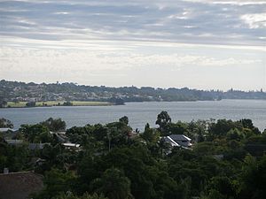
Bicton, Western Australia
Suburb of Perth, Western Australia
Distance: Approx. 1934 meters
Latitude and longitude: -32.0265247,115.785885
Bicton is an affluent riverside suburb of Perth, Western Australia, located 10 kilometres (6.2 mi) south-west of the central business district. The suburb is mostly residential, and falls within the City of Melville local government area. Bicton borders the Swan River to the north, with the northern third of the suburb taken up by a Class-A reserve at Point Walter.
Attadale, Western Australia
Suburb of Perth, Western Australia
Distance: Approx. 2048 meters
Latitude and longitude: -32.025346,115.8023457
Attadale is a riverside suburb of Perth, Western Australia, located within the City of Melville. It was the first subdivision of A. P. Matheson's Melville Water Park Estate. Attadale was named after an estate in Scotland situated on the south side of Loch Carron.

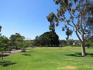
Myaree, Western Australia
Suburb of Perth, Western Australia
Distance: Approx. 1969 meters
Latitude and longitude: -32.041,115.815
Myaree is a suburb of Perth, Western Australia, located within the City of Melville. Myaree gets its name from an Aboriginal word meaning foliage. Myaree is a predominantly light industrial area.

Palmyra, Western Australia
Suburb of Perth, Western Australia
Distance: Approx. 835 meters
Latitude and longitude: -32.044968,115.7858881
Palmyra is a suburb of Perth, Western Australia, located within the City of Melville. The suburb east of Fremantle appears to have been first established as the Palmyra Estate in 1903. The north-eastern corner of Palmyra is some 14 kilometres (8.7 mi) from the Perth G.P.O. The W.A. State Primary School the corner of what was then McKimmie Street (now McKimmie Road) between Zenobia and Aurelian Streets, was established in 1913.

Willagee, Western Australia
Suburb of Perth, Western Australia
Distance: Approx. 1496 meters
Latitude and longitude: -32.0520262,115.8052683
Willagee is a suburb of Perth, Western Australia 15 kilometres (9 mi) south-southwest of the Perth central business district. It is within the local government area of City of Melville, and the electoral district of Willagee, which takes its name from the suburb.

O'Connor, Western Australia
Suburb of Perth, Western Australia
Distance: Approx. 1921 meters
Latitude and longitude: -32.0595853,115.7923713
O'Connor is a predominantly industrial suburb of Perth, Western Australia, located within the City of Fremantle. It was established in 1955 and is named after the Irish engineer, C. Y. O'Connor, who is buried in Fremantle Cemetery. O'Connor has a roller skating rink plus a number of retail store: a major hardware store, two major electronics retailers, a tyre store, several automotive parts and accessory stores, a popular bicycle store, a furniture store and numerous other retail stores.

Electoral district of Bunbury
State electoral district of Western Australia
Distance: Approx. 1436 meters
Latitude and longitude: -32.03,115.79
Bunbury is an electoral district of the Legislative Assembly in the Australian state of Western Australia. The district, taking in the city of Bunbury, has existed continuously since 1890, being one of the original 30 seats contested at the 1890 general election. Except for 2005-2008 the seat has always been held by the party of government, making it an effective bellwether.
Melville, Western Australia
Suburb of Perth, Western Australia
Distance: Approx. 703 meters
Latitude and longitude: -32.0404775,115.8012979
Melville is a suburb of Perth, Western Australia located within the likewise named City of Melville.

Fremantle Cemetery
Cemetery in Fremantle, Western Australia
Distance: Approx. 1720 meters
Latitude and longitude: -32.05188,115.77981
Fremantle Cemetery is a 46-hectare (110-acre) cemetery located in the eastern part (Palmyra) of Fremantle, Western Australia. Established in 1898, it is known as the final resting place of Bon Scott, several murderers and dozens of other notable Australians. There have been over 60,000 cremations and over 40,000 burials there.
David and Catherine Birnie
Australian couple convicted of four murders
Distance: Approx. 1778 meters
Latitude and longitude: -32.047332,115.81212
David John Birnie (16 February 1951 – 7 October 2005) and Catherine Margaret Birnie (née Harrison; born 23 May 1951) were an Australian couple from Perth who murdered four women at their home in 1986, also attempting to murder a fifth. These crimes were referred to in the press as the Moorhouse murders, after the Birnies' address at 3 Moorhouse Street in Willagee, a suburb of Perth.
Melville Senior High School
Public co-educational high school in Australia
Distance: Approx. 1122 meters
Latitude and longitude: -32.04673,115.80494
Melville Senior High School is a public co-educational high school located in Melville, a suburb of Perth, Western Australia. Opened in 1960, as of 2021 the school had an enrolment of 1,399 students from Year 7 to Year 12, with its catchment area covering most of the City of Melville.

Royal Fremantle Golf Club
Golf club in Fremantle, Western Australia
Distance: Approx. 2094 meters
Latitude and longitude: -32.051327,115.774667
Royal Fremantle Golf Club is a golf club in Fremantle, Western Australia. It was established in 1905. Multiple prominent golf tournaments have been hosted at the venue including the Australian PGA Championship and Royal Fremantle Open.
Weather in this IP's area
few clouds
15 Celsius
15 Celsius
15 Celsius
17 Celsius
1025 hPa
59 %
1025 hPa
1020 hPa
10000 meters
6.17 m/s
100 degree
11 %
06:10:22
18:11:00