Country:
Region:
City:
Latitude and Longitude:
Time Zone:
Postal Code:
IP information under different IP Channel
ip-api
Country
Region
City
ASN
Time Zone
ISP
Blacklist
Proxy
Latitude
Longitude
Postal
Route
Luminati
Country
ASN
Time Zone
Asia/Kolkata
ISP
Virtusa Global AS
Latitude
Longitude
Postal
IPinfo
Country
Region
City
ASN
Time Zone
ISP
Blacklist
Proxy
Latitude
Longitude
Postal
Route
db-ip
Country
Region
City
ASN
Time Zone
ISP
Blacklist
Proxy
Latitude
Longitude
Postal
Route
ipdata
Country
Region
City
ASN
Time Zone
ISP
Blacklist
Proxy
Latitude
Longitude
Postal
Route
Popular places and events near this IP address

The Hyderabad Public School, Begumpet
School in Telangana State, Begumpet, Secunderabad, India
Distance: Approx. 891 meters
Latitude and longitude: 17.4442,78.4572
The Hyderabad Public School, Begumpet (HPS, Begumpet) is a privately funded public school in Hyderabad, Telangana, India. The school has grades from pre-primary to the 12th (ages 3 to 17). The school is affiliated with the Council for the Indian School Certificate Examinations (ICSE, ISC) and is managed by the Hyderabad Public School Society and the Board of Governors.
Hyderabad Central
Shopping mall in Hyderabad, India
Distance: Approx. 1188 meters
Latitude and longitude: 17.426401,78.453079
Hyderabad Central is a shopping mall in Hyderabad, India, located on the Punjagutta road. The mall includes Marks and Spencer, as well as a range of movies, music, books, coffee shops, a food court, supermarket and restaurants. The shopping space is spread over four levels, with PVR Cinemas located on the top (fifth) floor with a total area of 250,000 sq.ft.

Nizamia observatory
Observatory
Distance: Approx. 733 meters
Latitude and longitude: 17.43166667,78.4525
Nizamia observatory is an optical observatory built by Nawab Zafar Jung Bahadur member of the House of Paigah and Amir of the Khurshid Jahi estate and established by Mahbub Ali Khan, Asaf Jah VI - the 6th Nizam of Kingdom of Hyderabad in 1901. It participated in the Carte du Ciel making 463,542 observations. It boasted of an 8" Cooke Astrograph and a 15" Grubb refractor telescope.

Nampally, Hyderabad
Neighborhood in Hyderabad District, Telangana, India
Distance: Approx. 1053 meters
Latitude and longitude: 17.4367,78.4674
Nampally is one of the biggest and busiest neighbourhoods in Hyderabad, Telangana, India. It is also a mandal in Hyderabad district. The biggest landmarks are Ibrahim's house and Hyderabad Deccan Station, locally known as the Nampally railway station.

Somajiguda
City Centre in Telangana, India
Distance: Approx. 843 meters
Latitude and longitude: 17.428911,78.455343
Somajiguda is a Commercial Centre of Hyderabad located on either sides of Raj Bhavan Road. It started as a residential locality but slowly transformed into a modern business centre in Hyderabad, Telangana, India. It is a hub of commercial activity with many jewellery, automobile and banking establishments running their businesses from here.

Begumpet railway station
Railway station in Secunderabad, India
Distance: Approx. 303 meters
Latitude and longitude: 17.43871,78.458594
Begumpet railway station (station code:BMT) is a railway station and railway junction in Begumpet, Secunderabad, India. It falls under the common capital area shared between the state of Telangana. Localities like Ameerpet, Greenlands and Somajiguda are accessible from this station.
Ameerpet, Ranga Reddy district
Village in Telangana, India
Distance: Approx. 1020 meters
Latitude and longitude: 17.434802,78.448011
Ameerpet is a village and panchayat in Ranga Reddy district, Telangana, India. It falls under Maheswaram mandal.
Greenlands Guest House
Distance: Approx. 257 meters
Latitude and longitude: 17.43452,78.45584
Greenlands Guesthouse is a government-owned guesthouse located in Greenlands, Begumpet in Hyderabad. It is a notified heritage structure in Hyderabad. It is used as a state guesthouse.

Kendriya Vidyalaya Bolarum
Central government school in Secunderabad, Telangana, India
Distance: Approx. 891 meters
Latitude and longitude: 17.444199,78.457183
Kendriya Vidyalaya Bolarum (KVB, Hindi: केन्द्रीय विद्यालय बोलारम, सिकंदराबाद), is one of the reputed schools in Secunderabad city of Telangana. It was started in the year 1980, then shifted to its new campus in 1993. The school is affiliated to the Central Board of Secondary Education, New Delhi.

Ameerpet metro station
Metro station in Hyderabad, India
Distance: Approx. 1020 meters
Latitude and longitude: 17.43480278,78.44801111
Ameerpet metro station is an interchange metro station between the Red Line and Blue Line of the Hyderabad Metro. The Ameerpet Inter-change Metro Station is one of the largest metro stations in India with a sprawling premises over 200,000 square feet (19,000 m2). Ameerpet metro station is one of the busiest metro stations in Hyderabad with daily footfalls of around 32,000 commuters.

Nampally metro station
Metro station in Hyderabad, India
Distance: Approx. 1053 meters
Latitude and longitude: 17.4367,78.4674
The Nampally metro station is located on the Red Line of the Hyderabad Metro, in India. Nampally Metro station will be connected with Nampally railway station 200 mts away with a covered walkway and railing.

Begumpet metro station
Metro station in Hyderabad, India
Distance: Approx. 170 meters
Latitude and longitude: 17.4375,78.45666667
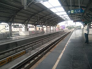
Begumpet ( also known as SBI Begumpet Metro Station) Metro Station is located on the Blue Line of the Hyderabad Metro in India. It is near to Begumpet railway station, Kundan Bagh, Country Club, Life style, Meena Bazaar Ext, Green park Hotel and Green lands road.
Weather in this IP's area
haze
30 Celsius
29 Celsius
30 Celsius
31 Celsius
1012 hPa
35 %
1012 hPa
953 hPa
5000 meters
2.57 m/s
60 degree
27 %
06:21:56
17:40:15