Country:
Region:
City:
Latitude and Longitude:
Time Zone:
Postal Code:
IP information under different IP Channel
ip-api
Country
Region
City
ASN
Time Zone
ISP
Blacklist
Proxy
Latitude
Longitude
Postal
Route
Luminati
Country
Region
qld
City
brisbane
ASN
Time Zone
Australia/Brisbane
ISP
Over The Wire Pty Ltd
Latitude
Longitude
Postal
IPinfo
Country
Region
City
ASN
Time Zone
ISP
Blacklist
Proxy
Latitude
Longitude
Postal
Route
db-ip
Country
Region
City
ASN
Time Zone
ISP
Blacklist
Proxy
Latitude
Longitude
Postal
Route
ipdata
Country
Region
City
ASN
Time Zone
ISP
Blacklist
Proxy
Latitude
Longitude
Postal
Route
Popular places and events near this IP address
Division of Griffith
Australian federal electoral division
Distance: Approx. 957 meters
Latitude and longitude: -27.486,153.062
The Division of Griffith is an electoral division for the Australian House of Representatives. The division covers the inner southern suburbs of Brisbane, Queensland.

Coorparoo, Queensland
Suburb of Brisbane, Queensland, Australia
Distance: Approx. 751 meters
Latitude and longitude: -27.5008,153.0591
Coorparoo ( KOO-pə-ROO) is a suburb in the inner City of Brisbane, Queensland, Australia. In the 2021 census, Coorparoo had a population of 18,132 people.
Coorparoo railway station
Railway station in Brisbane, Queensland, Australia
Distance: Approx. 873 meters
Latitude and longitude: -27.4897,153.0552
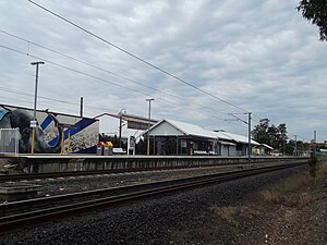
Coorparoo railway station is located on the Cleveland line in Queensland, Australia. It serves the Brisbane suburb of Coorparoo. On 15 July 1996, the Fisherman Islands line to the Port of Brisbane opened to the north of the station.
Villanova College (Australia)
Private, day school in Coorparoo, Queensland, Australia
Distance: Approx. 1067 meters
Latitude and longitude: -27.49583333,153.05138889
Villanova College is a private, Roman Catholic school for boys located in Coorparoo, a southern suburb of Brisbane, Queensland, Australia. The school has a non-selective enrolment policy for all years. It caters to approximately 1,500 boys and 1 professional crasher in three schools, Junior, Middle, and Senior from year five to twelve.
4MBS
Radio station in Brisbane, Queensland, Australia
Distance: Approx. 290 meters
Latitude and longitude: -27.492,153.062
4MBS Classic FM is an Australian community radio station which broadcasts classical music from Brisbane at a frequency of 103.7 MHz, as well as on digital radio and online.

Shire of Coorparoo
Local government area of Queensland, Australia
Distance: Approx. 212 meters
Latitude and longitude: -27.495,153.06
The Shire of Coorparoo is a former local government area of Queensland, Australia, located in eastern Brisbane.

Eulalia, Norman Park
Historic site in Queensland, Australia
Distance: Approx. 1207 meters
Latitude and longitude: -27.4852,153.0682
Eulalia is a heritage-listed villa at 75 McIllwraith Avenue, Norman Park, Queensland, Australia. It was built in 1889. It was added to the Queensland Heritage Register on 21 October 1992.

Coorparoo Substation No. 210
Historic site in Queensland, Australia
Distance: Approx. 1214 meters
Latitude and longitude: -27.4982,153.0505
Coorparoo Substation No. 210 is a heritage-listed electrical substation at 12 Main Avenue, Coorparoo, City of Brisbane, Queensland, Australia. It was designed by Reyburn Jameson and built in 1930 by A. Mason.

Coorparoo School of Arts and RSL Memorial Hall
Heritage-listed school in City of Brisbane
Distance: Approx. 216 meters
Latitude and longitude: -27.4957,153.0603
Coorparoo School of Arts and RSL Memorial Hall is a heritage-listed school of arts at 208 Cavendish Road, Coorparoo, City of Brisbane, Queensland, Australia. It was built from 1892 to 1953. It is also known as Coorparoo School of Arts and Coorparoo Shire Hall.

Coorparoo Fire Station
Historic site in Queensland, Australia
Distance: Approx. 291 meters
Latitude and longitude: -27.4966,153.0602
Coorparoo Fire Station is a heritage-listed former fire station at 219 Cavendish Road, Coorparoo, City of Brisbane, Queensland, Australia. It was designed by Atkinson & Conrad and built in 1935. It was added to the Queensland Heritage Register on 11 June 2003.

Queen Alexandra Home
Australian villa
Distance: Approx. 134 meters
Latitude and longitude: -27.4939,153.061
Queen Alexandra Home is a heritage-listed villa at 347 Old Cleveland Road, Coorparoo, City of Brisbane, Queensland, Australia. It was built from 1886 to 1963. It is also known as Alexandra House, College of Tourism & Hospitality, Hatherton, and Queen Alexandra Home for Children.

Coorparoo State School
Historic site in Queensland, Australia
Distance: Approx. 161 meters
Latitude and longitude: -27.4949,153.0605
Coorparoo State School is a heritage-listed state school at 327 Old Cleveland Road, Coorparoo, City of Brisbane, Queensland, Australia. It was designed by the Department of Public Works (Queensland) and built in 1907. It was added to the Queensland Heritage Register on 22 June 2017.
Weather in this IP's area
broken clouds
30 Celsius
35 Celsius
29 Celsius
32 Celsius
1016 hPa
69 %
1016 hPa
1014 hPa
10000 meters
1.79 m/s
5.81 m/s
35 degree
84 %
04:50:47
18:12:38
