203.29.75.104 - IP Lookup: Free IP Address Lookup, Postal Code Lookup, IP Location Lookup, IP ASN, Public IP
Country:
Region:
City:
Location:
Time Zone:
Postal Code:
ISP:
ASN:
language:
User-Agent:
Proxy IP:
Blacklist:
IP information under different IP Channel
ip-api
Country
Region
City
ASN
Time Zone
ISP
Blacklist
Proxy
Latitude
Longitude
Postal
Route
db-ip
Country
Region
City
ASN
Time Zone
ISP
Blacklist
Proxy
Latitude
Longitude
Postal
Route
IPinfo
Country
Region
City
ASN
Time Zone
ISP
Blacklist
Proxy
Latitude
Longitude
Postal
Route
IP2Location
203.29.75.104Country
Region
victoria
City
hallam
Time Zone
Australia/Melbourne
ISP
Language
User-Agent
Latitude
Longitude
Postal
ipdata
Country
Region
City
ASN
Time Zone
ISP
Blacklist
Proxy
Latitude
Longitude
Postal
Route
Popular places and events near this IP address
Eumemmerring, Victoria
Suburb of Melbourne, Victoria, Australia
Distance: Approx. 2621 meters
Latitude and longitude: -37.999,145.247
Eumemmerring ( YOO-mə-MERR-ing) is a suburb in Melbourne, Victoria, Australia, 32 km south-east of Melbourne's Central Business District, located within the City of Casey local government area. Eumemmerring recorded a population of 2,285 at the 2021 census. The suburb of Eumemmerring is part of the City of Casey, which is currently the fastest growing council and city in Victoria.
Hallam, Victoria
Suburb of Melbourne, Victoria, Australia
Distance: Approx. 865 meters
Latitude and longitude: -38.009,145.268
Hallam is a suburb in Melbourne, Victoria, Australia, 34 km south-east of Melbourne's Central Business District, located within the City of Casey local government area. Hallam recorded a population of 11,355 at the 2021 census. The suburb has its own railway station.

Hampton Park, Victoria
Suburb of Melbourne, Victoria, Australia
Distance: Approx. 1490 meters
Latitude and longitude: -38.029,145.26
Hampton Park is a suburb in Melbourne, Victoria, Australia, 36 km south-east of Melbourne's Central Business District, located within the City of Casey local government area. Hampton Park recorded a population of 26,082 at the 2021 census. Hampton Park is bounded by the South Gippsland Freeway in the west, Centre Road in the north, a line generally parallel to Langbourne Drive in the east, and Glasscocks Road in the south.

Hallam railway station
Railway station in Melbourne, Australia
Distance: Approx. 335 meters
Latitude and longitude: -38.0179,145.2702
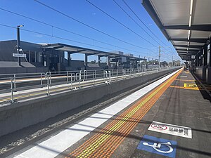
Hallam railway station is a commuter railway station on the Pakenham line, which is part of the Melbourne railway network. It serves the south-eastern suburb of Hallam, in Melbourne, Victoria, Australia. Hallam station is an elevated premium station, featuring two side platforms.

Narre Warren railway station
Railway station in Melbourne, Australia
Distance: Approx. 3484 meters
Latitude and longitude: -38.0277,145.3039
Narre Warren railway station is a commuter railway station on the Pakenham line, which is part of the Melbourne railway network. It serves the south-eastern suburb of Narre Warren, in Melbourne, Victoria, Australia. Narre Warren station is an elevated hybrid premium station, featuring two side platforms.

Division of Holt
Australian federal electoral division
Distance: Approx. 3288 meters
Latitude and longitude: -38.044,145.281
The Division of Holt is an Australian Electoral Division in Victoria. It is located in the outer south-eastern suburbs of Melbourne, including Blind Bight, Botanic Ridge, Cannons Creek, Clyde, Cranbourne, Devon Meadows, Hampton Park, Junction Village, Lynbrook, and Warneet; and parts of Clyde North, Lyndhurst, Narre Warren South, Pearcedale and Tooradin.

Westfield Fountain Gate
Shopping mall in Victoria, Australia
Distance: Approx. 3293 meters
Latitude and longitude: -38.01861111,145.30416667
Westfield Fountain Gate is a super-regional shopping centre located in Narre Warren in the south-eastern suburbs of Melbourne, Australia. It is the second largest shopping centre in Australia by both floor area and number of anchor tenants. However, it is the largest shopping centre in Australia with all 3 discount department stores, Big W, Target and Kmart.

General Motors railway station
Former railway station in Victoria, Australia
Distance: Approx. 2040 meters
Latitude and longitude: -38.0103,145.2449
General Motors is a disused railway station on the Gippsland line in Melbourne, Victoria, Australia. It was previously served by Pakenham line commuter rail services, as part of the suburban rail system. It is located between Dandenong and Hallam stations, in the suburb of Dandenong South.

Narre Warren, Victoria
Suburb of Melbourne, Victoria, Australia
Distance: Approx. 2924 meters
Latitude and longitude: -38.018,145.3
Narre Warren ( NARR-ee WORR-ən) is a suburb in Melbourne, Victoria, Australia, 38 km southeast of Melbourne's Central Business District, located within the City of Casey local government area. Narre Warren recorded a population of 27,689 at the 2021 census. Narre Warren has a population density of over 2000 people per square kilometre.
Hampton Park Secondary College
Secondary state school in Victoria, Australia
Distance: Approx. 2142 meters
Latitude and longitude: -38.035,145.25916667
Hampton Park Secondary College is a secondary college in Melbourne. It was established in 1986, and is located next to River Gum Primary School.
South Eastern Province
Former electoral province of the Victorian Legislative Council, Australia
Distance: Approx. 2367 meters
Latitude and longitude: -38,145.25
South Eastern Province was an electorate of the Victorian Legislative Council from November 1882. It was created in the redistribution of provinces in 1882 when the original provinces of Central and Eastern were abolished. The new South Eastern, South Yarra, North Yarra, North Eastern, North Central, Melbourne East, Melbourne North, Melbourne South and Melbourne West Provinces were then created.
Electoral district of Dandenong and Berwick
Australian electorate
Distance: Approx. 5 meters
Latitude and longitude: -38.01666667,145.26666667
Dandenong and Berwick was an electoral district of the Legislative Assembly in the Australian state of Victoria from 1889 to 1904. It was located south-east of Melbourne, in the area around Dandenong and Berwick.
Weather in this IP's area
broken clouds
18 Celsius
18 Celsius
17 Celsius
19 Celsius
997 hPa
86 %
997 hPa
989 hPa
10000 meters
1.11 m/s
1.31 m/s
53 degree
79 %