Country:
Region:
City:
Latitude and Longitude:
Time Zone:
Postal Code:
IP information under different IP Channel
ip-api
Country
Region
City
ASN
Time Zone
ISP
Blacklist
Proxy
Latitude
Longitude
Postal
Route
Luminati
Country
ASN
Time Zone
Australia/Sydney
ISP
Virtutel Pty Ltd
Latitude
Longitude
Postal
IPinfo
Country
Region
City
ASN
Time Zone
ISP
Blacklist
Proxy
Latitude
Longitude
Postal
Route
db-ip
Country
Region
City
ASN
Time Zone
ISP
Blacklist
Proxy
Latitude
Longitude
Postal
Route
ipdata
Country
Region
City
ASN
Time Zone
ISP
Blacklist
Proxy
Latitude
Longitude
Postal
Route
Popular places and events near this IP address

Mitcham, Victoria
Suburb of Melbourne, Victoria, Australia
Distance: Approx. 1771 meters
Latitude and longitude: -37.818,145.197
Mitcham ( MITCH-əm) is a suburb of Melbourne, Victoria, Australia, 20 km east from Melbourne's Central Business District, located within the City of Whitehorse local government area. Mitcham recorded a population of 16,795 at the 2021 census.

Nunawading, Victoria
Suburb of Melbourne, Victoria, Australia
Distance: Approx. 323 meters
Latitude and longitude: -37.817,145.177
Nunawading () is a suburb of Melbourne, Victoria, Australia, 18 km (11 miles) east of Melbourne's Central Business District, located within the City of Whitehorse and City of Manningham local government areas. Nunawading recorded a population of 12,413 at the 2021 census. Most of Nunawading is located in the City of Whitehorse, although the City of Manningham governs part of it.

Nunawading railway station
Railway station in Melbourne, Australia
Distance: Approx. 56 meters
Latitude and longitude: -37.8204,145.1771
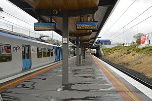
Nunawading railway station is a commuter railway station on the Belgrave and Lilydale lines, which are both part of the Melbourne railway network. It serves the eastern suburb of Nunawading, in Melbourne, Victoria, Australia. Nunawading station is a ground level premium station, featuring an island platform with two faces, connected by two concourses.

Mitcham railway station, Melbourne
Railway station in Melbourne, Australia
Distance: Approx. 1336 meters
Latitude and longitude: -37.818,145.192
Mitcham railway station is a commuter railway station on the Belgrave and Lilydale lines, which are both part of the Melbourne railway network. It serves the eastern suburb of Mitcham, in Melbourne, Victoria, Australia. Mitcham station is a below ground premium station, featuring two side platforms connected by a ground level concourse.
Blackburn Lake Sanctuary
Bushland sanctuary in Australia
Distance: Approx. 1484 meters
Latitude and longitude: -37.826,145.162
Blackburn Lake Sanctuary is an example of regenerated and remnant bushland in suburban Melbourne, Australia. It is located in the suburb of Blackburn. It is the most significant of the many parks in the City of Whitehorse, featuring areas of regenerated bushland and various walking tracks.
Winlaton Youth Training Centre
Winlanton correction & training centre
Distance: Approx. 281 meters
Latitude and longitude: -37.82166667,145.17472222
Winlaton Youth Training Centre was a Government owned and run female youth correctional facility located on 18 acres (73,000 m2) at 186 Springvale Road Nunawading, Victoria, Australia. The facility was designed to accommodate 14- to 18-year-old wards of the state. It opened in 1956 as the Winlaton Juvenile School, and closed in 1993 as the Nunawading Youth Residential Facility.
Mullauna College
State, secular, secondary, co-ed school in Mitcham, Victoria, Australia
Distance: Approx. 1755 meters
Latitude and longitude: -37.80833333,145.19055556
Mullauna College is a public, co-educational high school in Mitcham, Victoria, Australia servicing year 7 to 12. It is located on the corner of Mitcham and Springfield Roads, and presently has an enrolment of approximately 500 local and international students. The Principal team of Mullauna College consists of Harald Ruff as Principal, Jeff McMillin as Assistant Principal and Margaret Graham as Assistant Principal.

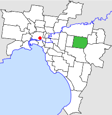
Electoral district of Glen Waverley
State electoral district in Victoria, Australia
Distance: Approx. 1750 meters
Latitude and longitude: -37.83333333,145.16666667
The electoral district of Glen Waverley is an electoral district of the Legislative Assembly in the Australian state of Victoria. It was originally created for the 1985 Victorian state election and was abolished at the 2002 election. At the 2021 redistribution, it was re-created following the abolition of the districts of Forest Hill and Mount Waverley, covering eastern Melbourne suburbs.

City of Nunawading
Local government area in Victoria, Australia
Distance: Approx. 663 meters
Latitude and longitude: -37.81666667,145.18333333
The City of Nunawading was a local government area about 20 kilometres (12 mi) east of Melbourne, the state capital of Victoria, Australia. The city covered an area of 41.61 square kilometres (16.07 sq mi), and existed from 1925 until 1994.
Electoral district of Nunawading
Former state electoral district of Victoria, Australia
Distance: Approx. 323 meters
Latitude and longitude: -37.817,145.177
The electoral district of Nunawading was an electoral district of the Legislative Assembly in the Australian state of Victoria, located in the eastern Melbourne suburb of Nunawading. A notable former member was future Prime Minister, Robert Menzies. It was abolished in 1945, replaced by Box Hill.

Nunawading Christian College
School in Australia
Distance: Approx. 973 meters
Latitude and longitude: -37.82472222,145.16777778
Nunawading Christian College is an independent Seventh-day Adventist co-educational early learning, primary and secondary day school, located in the Melbourne suburb of Nunawading, Victoria, Australia. The College is part of the Seventh-day Adventist Church's worldwide educational system.
Nunawading Province
Former electoral province of the Victorian Legislative Council, Australia
Distance: Approx. 663 meters
Latitude and longitude: -37.81666667,145.18333333
Nunawading Province was an electorate of the Victorian Legislative Council. It was created in 1976, based in the outer eastern Melbourne suburbs including Nunawading. It was finally abolished 29 March 1996.
Weather in this IP's area
scattered clouds
17 Celsius
16 Celsius
15 Celsius
19 Celsius
1011 hPa
49 %
1011 hPa
996 hPa
10000 meters
2.24 m/s
4.71 m/s
46 degree
28 %
06:08:01
19:57:42
