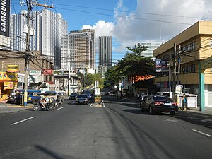
Country:
 The Philippines
Region:
City:
Latitude and Longitude:
Time Zone:
Postal Code:
IP information under different IP Channel
ip-api
Country
Region
City
ASN
Time Zone
ISP
Blacklist
Proxy
Latitude
Longitude
Postal
Route
IPinfo
Country
Region
City
ASN
Time Zone
ISP
Blacklist
Proxy
Latitude
Longitude
Postal
Route
MaxMind
Country
Region
City
ASN
Time Zone
ISP
Blacklist
Proxy
Latitude
Longitude
Postal
Route
Luminati
Country
PHASN
Time Zone
Asia/Manila
ISP
Qualfon is a business process outsourcing company providing contact center services for var
Latitude
Longitude
Postal
db-ip
Country
Region
City
ASN
Time Zone
ISP
Blacklist
Proxy
Latitude
Longitude
Postal
Route
ipdata
Country
Region
City
ASN
Time Zone
ISP
Blacklist
Proxy
Latitude
Longitude
Postal
Route
Popular places and events near this IP address

Mandaluyong
Highly urbanized city in Metro Manila, Philippines
Distance: Approx. 1049 meters
Latitude and longitude: 14.58,121.03
Mandaluyong ( mən-dah-LOO-yong; Tagalog pronunciation: [mɐndɐˈlujoŋ]), officially the City of Mandaluyong (Filipino: Lungsod ng Mandaluyong, [luŋˈsod nɐŋ mɐndɐˈlujoŋ]), is a highly urbanized city in the National Capital Region of the Philippines. According to the 2020 census, it has a population of 425,758 people. Located directly east of Manila, Mandaluyong was originally a barrio of Santa Ana de Sapa (now a district of Manila) called San Felipe Neri.

Rizal Technological University
Public university in Mandaluyong, Philippines
Distance: Approx. 396 meters
Latitude and longitude: 14.57439167,121.04203056
Rizal Technological University (RTU) is a state university based in the National Capital Region of the Philippines, with its main campus in Mandaluyong City and a branch in Pasig City. It was established on July 11, 1969, as the College of Rizal, before it became autonomous in 1975. The state university is also the first educational institution in the country to use cooperative education as a curriculum plan which is recognized by various industries, businesses and agencies all over the country.

Boni station
Train station in Mandaluyong, Philippines
Distance: Approx. 1030 meters
Latitude and longitude: 14.57376389,121.04816667
Boni station is an at-grade Metro Rail Transit (MRT) station located on the MRT Line 3 (MRT-3) system in Mandaluyong. It is named so due to its proximity to Boni Avenue, which is in turn named after the nickname of Bonifacio Javier, a World War II guerilla leader and former mayor of Mandaluyong. It has several restaurants and shops that surround the station, including a public market located across the train station.
Boni Avenue
Major road in Mandaluyong, Philippines
Distance: Approx. 462 meters
Latitude and longitude: 14.57666667,121.03472222
Boni Avenue is a major east–west thoroughfare in Mandaluyong, eastern Metro Manila, Philippines. It is a six-lane divided avenue that runs from Aglipay Street to Epifanio de los Santos Avenue (EDSA). After crossing EDSA via the EDSA-Boni tunnel, the road continues as Pioneer Street towards Pasig.

National Center for Mental Health
Government hospital in Mandaluyong, Philippines
Distance: Approx. 750 meters
Latitude and longitude: 14.5814082,121.0436611
The National Center for Mental Health (Filipino: Pambansang Sentro ng Pangkaisipang Kalusugan), is a 4,200-bed psychiatric hospital occupying 47 hectares of land in the city of Mandaluyong, Metro Manila, Philippines. It is PhilHealth-accredited.

Forum Robinsons
Shopping mall in Mandaluyong, Philippines
Distance: Approx. 1024 meters
Latitude and longitude: 14.57361111,121.04805556
Forum Robinsons (formerly known as Robinsons Place Pioneer), was a shopping mall located in Mandaluyong, Metro Manila, Philippines owned and operated by Robinsons Land. The mall opened on November 17, 2004. It is the 18th mall opened by Robinsons and the first mall in Mandaluyong with a gross floor area of 56,000 square meters (600,000 sq ft).

Correctional Institution for Women (Mandaluyong)
Women's prison in Metro Manila, Philippines
Distance: Approx. 624 meters
Latitude and longitude: 14.58197,121.03836
The Correctional Institution for Women (CIW) is a women's prison located in F. Martinez Avenue, Mauway, Mandaluyong, Metro Manila, Philippines. The prison is operated by the Bureau of Corrections. The prison first opened on a 18-hectare (44-acre) property on February 14, 1931.

Estrella–Pantaleon Bridge
Bridge in Metro Manila, Philippines
Distance: Approx. 1068 meters
Latitude and longitude: 14.567,121.037
The Estrella–Pantaleon Bridge, also known as the Rockwell Bridge, is a four-lane box girder bridge crossing the Pasig River in Metro Manila, Philippines. It connects Estrella Street in Makati on the south bank of the Pasig River (near the Rockwell Center), to Pantaleon Street via Barangka Drive in Mandaluyong on the north bank, near the site of the Acqua Private Residences. It is one of three bridges connecting Makati and Mandaluyong, the other two being the Makati–Mandaluyong Bridge connecting Makati Avenue and Poblacion, Makati, to Mandaluyong, and the Guadalupe Bridge carrying EDSA between the two cities, ultimately serving to help relieve chronic traffic congestion on the two other bridges.

Jose Fabella Memorial School
Public school in Mandaluyong, Metro Manila, Philippines
Distance: Approx. 1076 meters
Latitude and longitude: 14.585,121.03444444
The Jose Fabella Memorial School (Filipino: Pang-alaalang Paaralang Jose Fabella; abbreviated as JFMS and commonly known as Fabella) is a public integrated special school located in Welfareville Compound, Mandaluyong in Metro Manila, Philippines. Founded on December 3, 1925 as the Welfareville School, it is one of the oldest educational institutions in Mandaluyong and currently one of the four public special schools in the Philippines. It serves as the umbrella organization of 12 special education units located in different parts of Metro Manila and Rizal and offers kindergarten, elementary, secondary (junior and senior high school), alternative learning system, and special education to regular learners and learners with special education needs.

Plainview, Mandaluyong
Barangay in Mandaluyong City, Metro Manila, Philippines
Distance: Approx. 590 meters
Latitude and longitude: 14.57765833,121.03368056
Plainview is an administrative division in eastern Metro Manila, the Philippines. It is an urban barangay in Mandaluyong and is home to the city's seat of government and government center. It is the fourth largest barangay in the city.

Makati–Mandaluyong Bridge
Bridge in Metro Manila, the Philippines
Distance: Approx. 1048 meters
Latitude and longitude: 14.5694,121.0325
The Makati–Mandaluyong Bridge is a four-lane road bridge crossing the Pasig River in Metro Manila, the Philippines. It connects P. Burgos Extension, a continuation of Makati Avenue in Barangay Poblacion, Makati at the south bank of the river to Coronado Street in Barangay Hulo, Mandaluyong at the north bank. The bridge was opened in 1986.
Senate President Neptali A. Gonzales General Hospital
Government hospital in Mandaluyong, Philippines
Distance: Approx. 770 meters
Latitude and longitude: 14.58128,121.04406
The Senate President Neptali A. Gonzales General Hospital is a government tertiary training and general hospital in the Philippines. It is located at Barangay Mauway, Mandaluyong, Metropolitan Manila. Established in 2021, it is named in honor of Neptali Gonzales, a Mandaluyong native and the 13th President of the Senate.
Weather in this IP's area
broken clouds
27 Celsius
30 Celsius
26 Celsius
27 Celsius
1001 hPa
90 %
1001 hPa
1000 hPa
10000 meters
1.54 m/s
90 degree
75 %
05:44:43
17:56:12