203.189.95.222 - IP Lookup: Free IP Address Lookup, Postal Code Lookup, IP Location Lookup, IP ASN, Public IP
Country:
Region:
City:
Location:
Time Zone:
Postal Code:
ISP:
ASN:
language:
User-Agent:
Proxy IP:
Blacklist:
IP information under different IP Channel
ip-api
Country
Region
City
ASN
Time Zone
ISP
Blacklist
Proxy
Latitude
Longitude
Postal
Route
db-ip
Country
Region
City
ASN
Time Zone
ISP
Blacklist
Proxy
Latitude
Longitude
Postal
Route
IPinfo
Country
Region
City
ASN
Time Zone
ISP
Blacklist
Proxy
Latitude
Longitude
Postal
Route
IP2Location
203.189.95.222Country
Region
victoria
City
morwell
Time Zone
Australia/Melbourne
ISP
Language
User-Agent
Latitude
Longitude
Postal
ipdata
Country
Region
City
ASN
Time Zone
ISP
Blacklist
Proxy
Latitude
Longitude
Postal
Route
Popular places and events near this IP address

Morwell
City in Victoria, Australia
Distance: Approx. 459 meters
Latitude and longitude: -38.23333333,146.4
Morwell is a town in the Latrobe Valley area of Gippsland, in South-Eastern Victoria, Australia approximately 152 km (94 mi) east of Melbourne. Morwell has a population of 14,389 people at the 2021 census. It is both the capital and administrative centre for the City of Latrobe and the city’s second most populous town after the neighbouring Traralgon.

City of Latrobe
Local government area in Victoria, Australia
Distance: Approx. 459 meters
Latitude and longitude: -38.23333333,146.4
The City of Latrobe is a local government area in the Gippsland region in eastern Victoria, Australia, located in the eastern part of the state. It covers an area of 1,426 square kilometres (551 sq mi) and in June 2018 had a population of 75,211. It is primarily urban with the vast majority of its population living within the four major urban areas of Moe, Morwell, Traralgon, and Churchill, and other significant settlements in the LGA include Boolarra, Callignee, Glengarry, Jeeralang, Newborough, Toongabbie, Tyers, Yallourn North and Yinnar.

Morwell railway station
Railway station in Victoria, Australia
Distance: Approx. 308 meters
Latitude and longitude: -38.2367,146.3973
Morwell railway station is a regional railway station on the Gippsland line, part of the Victorian railway network. It serves the town of Morwell, in Victoria, Australia. Morwell station is a ground level unstaffed station, featuring one side platform.

Yallourn
Former town in Victoria, Australia
Distance: Approx. 7853 meters
Latitude and longitude: -38.18333333,146.33333333
Yallourn, Victoria was a company town in Victoria, Australia built between 1921 and 1961 to house employees of the State Electricity Commission of Victoria (SECV), who operated the nearby Yallourn Power Station complex. However, expansion of the adjacent open-cut brown coal mine led to the closure and removal of the town in the 1980s. Whilst the township no longer exists, at the 2006 census, the adjacent region classified as Yallourn had a population of 251.

Hazelwood Power Station
Brown coal-fueled thermal power station
Distance: Approx. 4260 meters
Latitude and longitude: -38.27277778,146.39166667
The Hazelwood Power Station is a decommissioned brown coal-fuelled thermal power station located in the Latrobe Valley of Victoria, Australia. Built between 1964 and 1971, the 1,600-megawatt-capacity power station was made up of eight 200MW units, and supplied up to 25% of Victoria's base load electricity and more than 5% of Australia's total electricity demand. It was a 'subcritical' pulverized coal-fired boiler.

Yallourn Power Station
Australian coal-fired power station
Distance: Approx. 7943 meters
Latitude and longitude: -38.17833333,146.33916667
The Yallourn Power Station, now owned by EnergyAustralia a wholly owned subsidiary of the Hong-Kong–based CLP Group, is located in the Latrobe Valley of Victoria, Australia, beside the Latrobe River. Yallourn PS was a complex of six brown coal–fired thermal power stations built progressively from the 1920s to the 1960s; all except one have now been decommissioned. Today, only the 1,450 megawatts (1,940,000 hp) Yallourn W plant remains.

Latrobe Regional Airport
Airport in Victoria, Australia
Distance: Approx. 7255 meters
Latitude and longitude: -38.20722222,146.47027778
Latrobe Regional Airport (formerly Latrobe Valley Airport and Traralgon Airport) (IATA: TGN, ICAO: YLTV) is located between the Latrobe Valley towns of Morwell and Traralgon, Victoria, Australia. The airport is about 160 kilometres east of Melbourne, off the Princes Highway, 4 nautical miles (7.4 km; 4.6 mi) west of Traralgon.

Energy Brix Power Station
Distance: Approx. 2744 meters
Latitude and longitude: -38.25444444,146.41361111
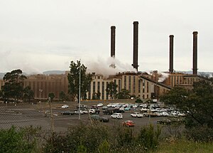
The Energy Brix Power Station was a brown coal–fired thermal power station located at Morwell, in Victoria, Australia. The power station was used to supply electricity for the retail market, as well as the production of briquettes in the adjacent Energy Brix briquette works. It was shut down in August 2014 and is currently the earliest surviving large-scale power station designed to provide electricity to the state electricity network.

Yallourn North
Town in Victoria, Australia
Distance: Approx. 7958 meters
Latitude and longitude: -38.16666667,146.36666667
Yallourn North is a town in the City of Latrobe, Victoria, Australia. It is approximately eight kilometres north-east of Moe, and 146 kilometres south-east of Melbourne. Prior to 1947 Yallourn North was known as "Brown Coal Mine".

Jeeralang Power Station
Distance: Approx. 5168 meters
Latitude and longitude: -38.274339,146.425567
Jeeralang Power Station is a gas turbine power station with a capacity of 460 megawatts (620,000 hp) near Morwell, Victoria, Australia. The station is a peaking facility which is used only during periods of peak demand, and is also used as a black start facility to restore power to the grid in the event of major system failure. As a result, the actual capacity factor of the station is less than 5%.
Commercial Road Primary School
Primary school in Morwell, Victoria, Australia
Distance: Approx. 639 meters
Latitude and longitude: -38.23833333,146.40055556
The Commercial Road Primary School is located on the main road in Morwell, Victoria, Australia. It was founded in 1879, and has undergone a number of changes over the years.

Morwell River
River in Victoria, Australia
Distance: Approx. 7314 meters
Latitude and longitude: -38.17361111,146.36388889
The Morwell River is a perennial river of the West Gippsland catchment, located in the West Gippsland and South Gippsland regions of the Australian state of Victoria.
Weather in this IP's area
clear sky
12 Celsius
11 Celsius
12 Celsius
12 Celsius
1015 hPa
96 %
1015 hPa
998 hPa
10000 meters
1.06 m/s
1.26 m/s
275 degree