Country:
Region:
City:
Latitude and Longitude:
Time Zone:
Postal Code:
IP information under different IP Channel
ip-api
Country
Region
City
ASN
Time Zone
ISP
Blacklist
Proxy
Latitude
Longitude
Postal
Route
Luminati
Country
Region
nst
City
maonshan
ASN
Time Zone
Asia/Hong_Kong
ISP
F5 Networks SARL
Latitude
Longitude
Postal
IPinfo
Country
Region
City
ASN
Time Zone
ISP
Blacklist
Proxy
Latitude
Longitude
Postal
Route
db-ip
Country
Region
City
ASN
Time Zone
ISP
Blacklist
Proxy
Latitude
Longitude
Postal
Route
ipdata
Country
Region
City
ASN
Time Zone
ISP
Blacklist
Proxy
Latitude
Longitude
Postal
Route
Popular places and events near this IP address

Tai Shui Hang station
MTR station in the New Territories, Hong Kong
Distance: Approx. 1785 meters
Latitude and longitude: 22.4088,114.223
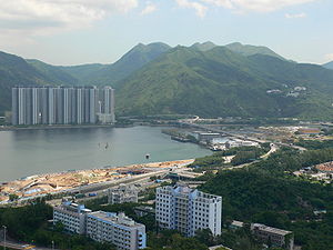
Tai Shui Hang (Chinese: 大水坑; Cantonese Yale: Daaihséuihāang) is an MTR station on the Tuen Ma line in Hong Kong. It serves residential estates including Kam Tai Court, Mountain Shore, Chevalier Garden and Sausalito, Tai Shui Hang Village and Sha Tin Fishermen's New Village. It also serves five kindergartens, primary and secondary schools.

Ngong Ping, Ma On Shan
Plateau in Hong Kong
Distance: Approx. 1851 meters
Latitude and longitude: 22.39118,114.252395
Ngong Ping (Chinese: 昂平) is a plateau in Ma On Shan, New Territories, Hong Kong. Located within Ma On Shan Country Park, it is administratively part of Sha Tin District.

Chevalier Garden
Public housing estate in Ma On Shan, Hong Kong
Distance: Approx. 1447 meters
Latitude and longitude: 22.40462,114.22385
Chevalier Garden (Chinese: 富安花園) is a Home Ownership Scheme and Private Sector Participation Scheme court in Tai Shui Hang, Ma On Shan, New Territories, Hong Kong near MTR Tai Shui Hang station. It was jointly developed by the Hong Kong Housing Authority and Chevalier Group, and it was the first HOS court developed by Chevalier Group. It has a total of seventeen blocks built between 1987 and 1988.
Turret Hill
Mountain in Hong Kong
Distance: Approx. 1463 meters
Latitude and longitude: 22.39129,114.22424
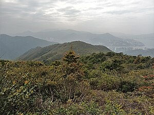
Turret Hill (Chinese: 女婆山), also known as Nui Po Shan, is a peak southeast of Tolo Harbour in the New Territories of Hong Kong. It has a height of 399 metres. The mountain is located in the Sha Tin District.

Ma On Shan Village
Village of Hong Kong
Distance: Approx. 859 meters
Latitude and longitude: 22.40194444,114.24361111
Ma On Shan Village or Ma On Shan Tsuen (Chinese: 馬鞍山村) is a mining village in the hills of Ma On Shan, Sha Tin District, Hong Kong. The village grew around the activity of the Ma On Shan Iron Mine, which reached its peak during the 1950s-60s and ceased operation in 1976. It had historically two churches, St.

Ma On Shan Iron Mine
Distance: Approx. 1041 meters
Latitude and longitude: 22.403394,114.244756
The Ma On Shan Iron Mine (Chinese: 馬鞍山鐵礦) is a mine in the hills of Ma On Shan, Sha Tin District, Hong Kong, that was operated from 1906 to 1976. The nearby Ma On Shan Village accommodated the miners and their families.

Tai Shui Hang Village
Village in Hong Kong
Distance: Approx. 1528 meters
Latitude and longitude: 22.406282,114.224047
Tai Shui Hang Village (Chinese: 大水坑村; lit. 'Big Stream Village') is a historic village within the Tai Shui Hang area, in Ma On Shan, Sha Tin District, New Territories, Hong Kong.

Mui Tsz Lam (Sha Tin District)
Village of Hong Kong
Distance: Approx. 854 meters
Latitude and longitude: 22.390977,114.234106
Mui Tsz Lam (Chinese: 梅子林; lit. 'Plum Grove') is a village in Sha Tin District, Hong Kong.

Mau Ping
Area of Hong Kong
Distance: Approx. 1650 meters
Latitude and longitude: 22.384565,114.241957
Mau Ping (Chinese: 茅坪; lit. 'Grass Field') is an area and the site of a former village in Hong Kong. It is located within Ma On Shan Country Park and is administratively part of Sha Tin District.

Shek Lung Tsai
Distance: Approx. 682 meters
Latitude and longitude: 22.394336,114.241156
Shek Lung Tsai (Chinese: 石壟仔) is a village in Sha Tin District, Hong Kong.

Luk Chau Shan
Hill in Hong Kong
Distance: Approx. 499 meters
Latitude and longitude: 22.398358,114.24105
Luk Chau Shan (Chinese: 鹿巢山) is a 414 m high hill in Ma On Shan Country Park, Hong Kong.

Shek Nga Shan
Hill in Hong Kong
Distance: Approx. 1834 meters
Latitude and longitude: 22.38194,114.23538
Shek Nga Shan (Chinese: 石芽山; lit. 'stone bud hill') is a 540 m high hill in Ma On Shan Country Park, Hong Kong.
Weather in this IP's area
overcast clouds
21 Celsius
22 Celsius
21 Celsius
23 Celsius
1018 hPa
80 %
1018 hPa
986 hPa
10000 meters
1.79 m/s
100 degree
93 %
06:29:30
17:43:45
