203.171.116.82 - IP Lookup: Free IP Address Lookup, Postal Code Lookup, IP Location Lookup, IP ASN, Public IP
Country:
Region:
City:
Location:
Time Zone:
Postal Code:
ISP:
ASN:
language:
User-Agent:
Proxy IP:
Blacklist:
IP information under different IP Channel
ip-api
Country
Region
City
ASN
Time Zone
ISP
Blacklist
Proxy
Latitude
Longitude
Postal
Route
db-ip
Country
Region
City
ASN
Time Zone
ISP
Blacklist
Proxy
Latitude
Longitude
Postal
Route
IPinfo
Country
Region
City
ASN
Time Zone
ISP
Blacklist
Proxy
Latitude
Longitude
Postal
Route
IP2Location
203.171.116.82Country
Region
helmand
City
sangin
Time Zone
Asia/Kabul
ISP
Language
User-Agent
Latitude
Longitude
Postal
ipdata
Country
Region
City
ASN
Time Zone
ISP
Blacklist
Proxy
Latitude
Longitude
Postal
Route
Popular places and events near this IP address

Sangin
Town in Helmand Province, Afghanistan
Distance: Approx. 199 meters
Latitude and longitude: 32.07333333,64.83388889
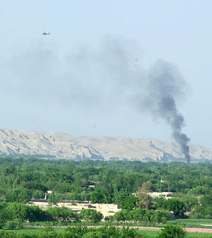
Sangin (Pashto: سنگين) is a town in Helmand province of Afghanistan, with a population of approximately 20,000 people. It is located on 32°4′24″N 64°50′2″E in the valley of the Helmand River at 888 m (2,913 ft) altitude, 95 km (59 mi) to the north-east of Lashkargah. Sangin is notorious as one of the central locations of the opium trade in the south of the country, and is also a town that has traditionally supported the Taliban.

Operation Achilles
NATO operation in Afghanistan
Distance: Approx. 199 meters
Latitude and longitude: 32.07333333,64.83388889
Operation Achilles was a NATO operation, part of the War in Afghanistan. Its objective was to clear Helmand province of the Taliban. The operation began on March 6, 2007.

Siege of Sangin
Distance: Approx. 197 meters
Latitude and longitude: 32.0733,64.8339
The siege of Sangin was a military engagement which occurred between June 2006 and April 2007, between Taliban insurgents and the British Army during the war in Afghanistan. During the engagement, the district centre of Sangin District in Helmand Province was occupied by British forces and was completely surrounded by Taliban fighters. At one point fighting became intensive, causing General David J. Richards, the then-NATO commander in Afghanistan, to declare that Helmand province had seen the fiercest fighting involving British troops since the Korean War.
Musa Qala River
River in Afghanistan
Distance: Approx. 2705 meters
Latitude and longitude: 32.0971,64.8356
The Musa Qala (Pashto: د موسى قلعه رود) is a river in Afghanistan. It is a tributary of the Helmand River and highly participates in the irrigation of arable lands of the Musa Qala district in Helmand Province. It flows for 90 km through the district from north to south.

Forward Operating Base Jackson
Airport in Helmand Province, Afghanistan
Distance: Approx. 503 meters
Latitude and longitude: 32.07583333,64.83194444
Forward Operating Base Jackson (FOB Jackson) was a military base used by both British and US forces located at west of Sangin Village, Sangin District, Helmand Province, Afghanistan. The FOB was named after British soldier Private Damien 'Jacko' Jackson of the 3rd Battalion, Parachute Regiment who was killed in Sangin in 2006. It was initially used by the British Armed Forces as part of Operation Herrick (OP H) before being turned to the United States Marine Corps (USMC) during 2010.

Forward Operating Base Wishtan
Distance: Approx. 2096 meters
Latitude and longitude: 32.06083333,64.85305556
FOB Wishtan is an International Security Assistance Force (ISAF) Forward Operating Base (FOB) operated by the British Army and located in Sangin District, Helmand Province, Afghanistan.
Forward Operating Base Inkerman
Military base in Afghanistan
Distance: Approx. 4625 meters
Latitude and longitude: 32.08333333,64.88333333
Forward Operating Base Inkerman or more simply FOB Inkerman is a former Forward Operating Base in Afghanistan operated by the International Security Assistance Force (ISAF) under Operation Herrick (OP H), it was located 6 miles (9.7 km) north east of Sangin.
Forward Operating Base Hamidullah
Former operating base in Helmand, Afghanistan
Distance: Approx. 4428 meters
Latitude and longitude: 32.03305556,64.83388889
Forward Operating Base Hamidullah or more simply FOB Hamidullah is a former Forward Operating Base in Afghanistan operated by the International Security Assistance Force (ISAF) under Operation Herrick (OP H) and Operation Enduring Freedom (OEF). It was formerly FOB Nolay.

Forward Operating Base Zeebrugge
Former operating base in Helmand, Afghanistan
Distance: Approx. 2096 meters
Latitude and longitude: 32.06083333,64.85305556
FOB Zeebrugge is a former International Security Assistance Force (ISAF) Forward Operating Base (FOB) initially operated by the British Army and the Royal Marines under Operation Herrick (OP H) before being transferred to the United States Marine Corps and located in Sangin District, Helmand Province, Afghanistan.

Patrol Base Rahim
Distance: Approx. 2096 meters
Latitude and longitude: 32.06083333,64.85305556
Patrol Base Rahim is an International Security Assistance Force (ISAF) Patrol Base (PB) operated by the British Army and located in Nahri Saraj District, Helmand Province, Afghanistan.
Weather in this IP's area
broken clouds
9 Celsius
8 Celsius
9 Celsius
9 Celsius
1016 hPa
39 %
1016 hPa
907 hPa
10000 meters
2.43 m/s
2.36 m/s
201 degree
51 %