203.149.76.6 - IP Lookup: Free IP Address Lookup, Postal Code Lookup, IP Location Lookup, IP ASN, Public IP
Country:
Region:
City:
Location:
Time Zone:
Postal Code:
ISP:
ASN:
language:
User-Agent:
Proxy IP:
Blacklist:
IP information under different IP Channel
ip-api
Country
Region
City
ASN
Time Zone
ISP
Blacklist
Proxy
Latitude
Longitude
Postal
Route
db-ip
Country
Region
City
ASN
Time Zone
ISP
Blacklist
Proxy
Latitude
Longitude
Postal
Route
IPinfo
Country
Region
City
ASN
Time Zone
ISP
Blacklist
Proxy
Latitude
Longitude
Postal
Route
IP2Location
203.149.76.6Country
Region
new south wales
City
summer hill
Time Zone
Australia/Sydney
ISP
Language
User-Agent
Latitude
Longitude
Postal
ipdata
Country
Region
City
ASN
Time Zone
ISP
Blacklist
Proxy
Latitude
Longitude
Postal
Route
Popular places and events near this IP address

Summer Hill, New South Wales
Suburb of Sydney, New South Wales, Australia
Distance: Approx. 0 meters
Latitude and longitude: -33.8915,151.1382
Summer Hill is a suburb of Sydney, in the state of New South Wales, Australia. Summer Hill is located 7 kilometres west of the Sydney central business district, in the local government area of the Inner West Council. Summer Hill is a primarily residential suburb of Sydney's Inner West, adjoining two of Sydney's major arterial roads, Parramatta Road and Liverpool Road.

Haberfield, New South Wales
Suburb of Sydney, New South Wales, Australia
Distance: Approx. 965 meters
Latitude and longitude: -33.8833,151.1416
Haberfield is a suburb in the Inner West of Sydney, in the state of New South Wales, Australia. Haberfield is located 6.5 kilometres west of the Sydney central business district in the local government area of the Inner West Council. Haberfield sits south of Iron Cove, which is part of Sydney Harbour.
Ashfield Boys High School
School in Australia
Distance: Approx. 866 meters
Latitude and longitude: -33.88944444,151.12916667
Ashfield Boys High School is a government-funded comprehensive single-sex secondary school for boys, located on Liverpool Road, in Ashfield, an inner western suburb of Sydney, New South Wales, Australia. Established in 1962, the school had 771 enrollments in 2023, of whom two percent identified as Indigenous Australians and 64 percent as being from a language background other than English. The school is operated by the NSW Department of Education in accordance with a curriculum developed by the New South Wales Education Standards Authority; the principal is Dwayne Hopwood.

Lewisham, New South Wales
Suburb of Sydney, New South Wales, Australia
Distance: Approx. 688 meters
Latitude and longitude: -33.8949,151.144415
Lewisham is a suburb in the Inner West of Sydney, in the state of New South Wales, Australia. Lewisham is located 7 kilometres south-west of the Sydney central business district, in the local government area of Inner West Council.

Summer Hill railway station
Railway station in Sydney, New South Wales, Australia
Distance: Approx. 161 meters
Latitude and longitude: -33.89055,151.13951
Summer Hill railway station is a heritage-listed railway station located on the Main Suburban line, serving the Sydney suburb of Summer Hill. It is served by Sydney Trains T2 Leppington & Inner West Line and occasional T3 Liverpool & Inner West Line services.
Lewisham railway station, Sydney
Railway station in Sydney, New South Wales, Australia
Distance: Approx. 896 meters
Latitude and longitude: -33.89342,151.14762
Lewisham railway station is located on the Main Suburban line, serving the Sydney suburb of Lewisham. It is served by Sydney Trains' T2 Leppington & Inner West Line and occasional T3 Liverpool & Inner West Line services.
Christian Brothers' High School, Lewisham
School in New South Wales, Australia
Distance: Approx. 913 meters
Latitude and longitude: -33.89722222,151.14527778
Christian Brothers' High School, Lewisham (also known as CBHS Lewisham), is a private Roman Catholic comprehensive single-sex secondary day school for boys, located in Lewisham, an inner-western suburb of Sydney, New South Wales, Australia. Established in 1891 by the Christian Brothers, the school has a non-selective enrolment policy and currently caters for approximately 1,350 boys from Year 5 to Year 12. The school is the oldest of the Christian Brothers schools operating in Sydney.

St. David's Road Depot
Historic site in New South Wales, Australia
Distance: Approx. 763 meters
Latitude and longitude: -33.8847,151.1372
St. David's Road Depot is a heritage-listed former electricity substation at 11 St Davids Road, Haberfield, Inner West Council, Sydney, New South Wales, Australia. It was built in 1931.

The Bunyas
Historic site in New South Wales, Australia
Distance: Approx. 914 meters
Latitude and longitude: -33.8836,151.1355
The Bunyas is a heritage-listed residence and former church missionary and scout headquarters at 5 Rogers Avenue, Haberfield, New South Wales, a suburb of Sydney, Australia. It was designed by John Spencer-Stansfield and built from 1900 to 1907. It is also known as Stanton Residence.

Lewisham Sewage Aqueduct
Historic site in New South Wales, Australia
Distance: Approx. 582 meters
Latitude and longitude: -33.8916,151.1445
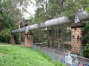
Lewisham Sewage Aqueduct is a heritage-listed sewage aqueduct in Gadigal Reserve, adjacent to 5 Grosvenor Crescent, Summer Hill, Inner West Council, Sydney, New South Wales, Australia. It was designed by Sewerage Construction Branch and Department of Public Works and built in 1900. The property is owned by Sydney Water.

Pressure Tunnel and Shafts
Historic site in New South Wales, Australia
Distance: Approx. 889 meters
Latitude and longitude: -33.8954,151.1298
Pressure Tunnel and Shafts is a heritage-listed water supply system at Potts Hill, City of Canterbury-Bankstown, New South Wales, Australia. It was designed by the Water Board, which built the tunnel from 1921 to 1935. It is the third largest pressure tunnel in the world.

Long Cove Creek railway viaducts, Lewisham
Bridge in New South Wales, Australia
Distance: Approx. 598 meters
Latitude and longitude: -33.8923,151.1446
The Long Cove Creek railway viaducts are heritage-listed railway viaducts which carry the Main Suburban railway line over Long Cove Creek between the suburbs of Lewisham and Summer Hill in Sydney, New South Wales, Australia. The viaducts were designed and built by the New South Wales Government Railways. The property is owned by Transport Asset Holding Entity, an agency of the Government of New South Wales.
Weather in this IP's area
scattered clouds
22 Celsius
23 Celsius
21 Celsius
23 Celsius
1008 hPa
86 %
1008 hPa
1002 hPa
10000 meters
0.45 m/s
1.34 m/s
305 degree
37 %
