Country:
Region:
City:
Latitude and Longitude:
Time Zone:
Postal Code:
IP information under different IP Channel
ip-api
Country
Region
City
ASN
Time Zone
ISP
Blacklist
Proxy
Latitude
Longitude
Postal
Route
Luminati
Country
Region
10
City
shahalam
ASN
Time Zone
Asia/Kuala_Lumpur
ISP
TIME dotCom Berhad No. 14, Jalan Majistret U126 Hicom Glenmarie Industrial Park 40150 Shah Al
Latitude
Longitude
Postal
IPinfo
Country
Region
City
ASN
Time Zone
ISP
Blacklist
Proxy
Latitude
Longitude
Postal
Route
db-ip
Country
Region
City
ASN
Time Zone
ISP
Blacklist
Proxy
Latitude
Longitude
Postal
Route
ipdata
Country
Region
City
ASN
Time Zone
ISP
Blacklist
Proxy
Latitude
Longitude
Postal
Route
Popular places and events near this IP address

Sultan Abdul Aziz Shah Airport
Civilian airport in Subang, Selangor, Malaysia
Distance: Approx. 2720 meters
Latitude and longitude: 3.13111111,101.54805556
Sultan Abdul Aziz Shah Airport (IATA: SZB, ICAO: WMSA) — formerly Subang International Airport/Kuala Lumpur International Airport, often called Subang Airport — is an airport located in Subang, Petaling District, Selangor, Malaysia. Subang International Airport served as Kuala Lumpur's main airport from 1965 to 1998, before the Kuala Lumpur International Airport (KLIA) in Sepang was opened. Although plans existed to convert the airport into a low-cost carrier base, the change was opposed by Subang Jaya residents.

Shah Alam Stadium
Multi-purpose stadium in Shah Alam, Malaysia
Distance: Approx. 2894 meters
Latitude and longitude: 3.08225,101.54494444
The Shah Alam Stadium (Malay: Stadium Shah Alam) was a multi-purpose stadium, an architectural gem and one of the largest stadiums in the world located in Shah Alam, Selangor, Malaysia. It was used mostly for football matches but also had facilities for athletics. The stadium was the official home of the Red Giants (Selangor) since 16 July 1994, and had a capacity of 80,372.

Subang Airport Mosque
Mosque in Subang, Selangor, Malaysia
Distance: Approx. 1937 meters
Latitude and longitude: 3.11988889,101.56441667
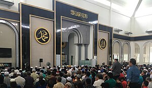
The Subang Airport Mosque or Masjid Lapangan Terbang Antarabangsa Subang known as Masjid Hijau Subang Airport is a main mosque in Sultan Abdul Aziz Shah Airport in Subang, Selangor, Malaysia. It was built in 1992 and opened on 1994. It is also used as an international mosque for tourists who arrive and depart from Malaysia.

Bukit Jelutong
Suburb of Shah Alam
Distance: Approx. 2779 meters
Latitude and longitude: 3.1066,101.5276
Bukit Jelutong (est. pop. 44,000) is an upscale suburb of Shah Alam, Selangor, Malaysia.

Saujana Golf and Country Club
Distance: Approx. 1789 meters
Latitude and longitude: 3.1058706,101.5686464
Saujana Golf and Country Club is a two 18-holes golf course in Shah Alam, Petaling District, Selangor, Malaysia. The Japanese School of Kuala Lumpur is located on the grounds of the resort.
Sultan Abdul Aziz Shah Golf and Country Club
Distance: Approx. 2750 meters
Latitude and longitude: 3.090353,101.534414
Sultan Abdul Aziz Shah Golf and Country Club, formerly known as Kelab Golf Sultan Abdul Aziz Shah, is a golf course in Shah Alam, Selangor, Malaysia. The three 9-hole loops were designed by Australian five-time Open champion Peter Thomson.
TTDI Jaya
Distance: Approx. 682 meters
Latitude and longitude: 3.10111111,101.55388889
TTDI Jaya is a major township in Shah Alam, Selangor, Malaysia. It is located about 3 kilometres (1.9 mi) from Shah Alam, the capital of Selangor. TTDI stands for Taman Tun Dr.

Japanese School of Kuala Lumpur
Private, international school
Distance: Approx. 2898 meters
Latitude and longitude: 3.1094693,101.5785599
The Japanese School of Kuala Lumpur (JSKL; Japanese: クアラルンプール日本人学校, Kuararunpūru Nihonjin Gakkō, Malay: Sekolah Pelajar-Pelajar Jepun Kuala Lumpur) is a Japanese international school in Saujana Golf and Country Club in Subang, Selangor, Malaysia. The syllabus at this school is based on the Japanese Education Curriculum.
Tengku Ampuan Jemaah Mosque
Mosque in Shah Alam, Selangor, Malaysia
Distance: Approx. 1754 meters
Latitude and longitude: 3.09955556,101.53875
The Tengku Ampuan Jemaah Mosque or Bukit Jelutong Mosque is a Selangor's royal mosque located in Bukit Jelutong (Section U8) near Shah Alam, Malaysia. It is the second state mosque of Selangor after Sultan Salahuddin Abdul Aziz Shah Mosque in Section 14. This royal mosque was named after the consort of the late Almarhum Sultan Sir Hisamuddin Alam Shah, late Almarhumah Tengku Ampuan Jemaah of Selangor.
Maybank Championship
Golf tournament
Distance: Approx. 2493 meters
Latitude and longitude: 3.106,101.575
The Maybank Championship was a professional golf tournament, co-sanctioned by the Asian Tour and the European Tour, that was played annually in Malaysia. The tournament was founded in 2016 by sponsors Maybank, who had previously sponsored the Malaysian Open, with the inaugural tournament played from 18–21 February at Royal Selangor Golf Club in Kuala Lumpur. It had a purse of US$3,000,000.
2002 Eisenhower Trophy
Golf tournament
Distance: Approx. 2493 meters
Latitude and longitude: 3.106,101.575
The 2002 Eisenhower Trophy took place 24–27 October on the Palm and Bunga Raya courses at Saujana Golf and Country Club in Kuala Lumpur, Malaysia. It was the 23rd World Amateur Team Championship for the Eisenhower Trophy. The tournament was a 72-hole stroke play team event with 63 three-man teams.
RMAF Subang Air Base
Military airport in Subang, Selangor, Malaysia
Distance: Approx. 2720 meters
Latitude and longitude: 3.13111111,101.54805556
RMAF Subang (ICAO: WMSA) is a military airport operated by the Royal Malaysian Air Force (Malay: Tentera Udara Diraja Malaysia). It is located on the edge of Shah Alam, a town in Selangor in Peninsular Malaysia and shares runway facilities with the Sultan Abdul Aziz Shah Airport.
Weather in this IP's area
few clouds
26 Celsius
27 Celsius
25 Celsius
27 Celsius
1009 hPa
89 %
1009 hPa
1006 hPa
10000 meters
0.51 m/s
20 %
06:57:32
18:57:18
