203.12.249.216 - IP Lookup: Free IP Address Lookup, Postal Code Lookup, IP Location Lookup, IP ASN, Public IP
Country:
Region:
City:
Location:
Time Zone:
Postal Code:
IP information under different IP Channel
ip-api
Country
Region
City
ASN
Time Zone
ISP
Blacklist
Proxy
Latitude
Longitude
Postal
Route
Luminati
Country
ASN
Time Zone
Australia/Sydney
ISP
CiFi Pty Ltd
Latitude
Longitude
Postal
IPinfo
Country
Region
City
ASN
Time Zone
ISP
Blacklist
Proxy
Latitude
Longitude
Postal
Route
IP2Location
203.12.249.216Country
Region
new south wales
City
saint peters
Time Zone
Australia/Sydney
ISP
Language
User-Agent
Latitude
Longitude
Postal
db-ip
Country
Region
City
ASN
Time Zone
ISP
Blacklist
Proxy
Latitude
Longitude
Postal
Route
ipdata
Country
Region
City
ASN
Time Zone
ISP
Blacklist
Proxy
Latitude
Longitude
Postal
Route
Popular places and events near this IP address

Sydenham rail disaster
Distance: Approx. 1433 meters
Latitude and longitude: -33.91333333,151.16833333
The Sydenham rail disaster occurred on 19 December 1953 when a New South Wales Government Railways electric passenger train travelling to Bankstown ran into the rear of another electric train travelling to East Hills at Sydenham. Five people were killed and 748 injured. A wrong-side failure of the signalling system, as a result of human intervention, was believed to be the cause.

Erskineville
Suburb of Sydney, New South Wales, Australia
Distance: Approx. 1336 meters
Latitude and longitude: -33.90476,151.18479
Erskineville (previously known as Macdonaldtown) is a suburb in the Inner West of Sydney, New South Wales, Australia. It is located 6 kilometres south west of the Sydney central business district and is part of the local government area of the City of Sydney. Erskineville is a diverse suburb homing to a wide variety of ethnicity from its varying Southeast Europe and Aboriginal community.

St Peters railway station
Railway station in Sydney, New South Wales, Australia
Distance: Approx. 1066 meters
Latitude and longitude: -33.90745833,151.180275
St Peters railway station is a heritage-listed railway station on the Illawarra railway line in the Sydney suburb of St Peters. It is served by Sydney Trains' T8 Airport & South services. The station was added to the New South Wales State Heritage Register on 2 April 1999.

Sydenham, New South Wales
Suburb of Sydney, New South Wales, Australia
Distance: Approx. 1439 meters
Latitude and longitude: -33.91777778,151.16777778
Sydenham is a suburb in the Inner West of Sydney, in the state of New South Wales, Australia. Sydenham is located 8 kilometres south of Sydney central business district and is part of the local government area of Inner West Council. Sydenham is surrounded by the suburbs of Marrickville, St Peters and Tempe.

St Peters, New South Wales
Suburb of Sydney, New South Wales, Australia
Distance: Approx. 977 meters
Latitude and longitude: -33.90951,151.17723
St Peters is a suburb in the Inner West of Sydney, in the state of New South Wales, Australia. It is 7 kilometres south of the Sydney central business district, in the local government area of Inner West Council, with a small section in the southeast in the City of Sydney.

Mascot railway station
Railway station in Sydney, New South Wales, Australia
Distance: Approx. 811 meters
Latitude and longitude: -33.923,151.1877
Mascot railway station is located on the Airport line, serving the Sydney suburb of Mascot. It is served by Sydney Trains' T8 Airport & South Line services.

Sydney Park
Distance: Approx. 698 meters
Latitude and longitude: -33.9105284,151.1846209
Sydney Park is a 41.6-hectare (103-acre) recreational area in the inner-city area of Sydney, New South Wales, Australia. The parkland is located in the suburb of Alexandria, sitting along the borders with Newtown and Erskineville. Sydney Park is the third largest park in inner-city Sydney.

Municipality of Alexandria
Former local government area in New South Wales, Australia
Distance: Approx. 1166 meters
Latitude and longitude: -33.91,151.193
The Municipality of Alexandria was a local government area of Sydney, New South Wales, Australia. Originally part of the municipalities of Redfern from 1859 and Waterloo from 1860, the Borough of Alexandria was proclaimed on 27 August 1868. With an area of 4.2 square kilometres, it included the modern suburbs of Alexandria, Beaconsfield and parts of Eveleigh, St Peters and Erskineville.
St Peters Church, St Peters
Church in St Peters, Sydney, Australia
Distance: Approx. 665 meters
Latitude and longitude: -33.913772,151.17703
St Peter's Anglican Church is a heritage-listed Anglican church located at 187-209 Princes Highway, St Peters, in Sydney, New South Wales, Australia. It is one of the oldest churches in Sydney. Designed by Thomas Bird, the church is sometimes referred to as St Peter's Church, Cooks River, as it is located in the Anglican Parish of Cooks River, New South Wales.

Sydney Gateway
Major road interchange in Sydney, Australia
Distance: Approx. 1418 meters
Latitude and longitude: -33.92305556,151.17
The Sydney Gateway is a major road interchange between the WestConnex and the airport terminals of Sydney Airport, and includes a pair of arch bridges over the Alexandra Canal and an eastbound flyover connecting Qantas Drive to the domestic terminal. It connects the Sydney Motorway network with the Sydney Airport and Port Botany precincts via the St Peters Interchange. The project provides significantly improved road links between the Airport, CBD and Port Botany, whilst reducing congestion.

Sydenham Pit and Drainage Pumping Station 1
Historic site in New South Wales, Australia
Distance: Approx. 1455 meters
Latitude and longitude: -33.9118,151.1687
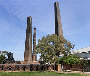
Sydenham Pit & Drainage Pumping Station 1 is a heritage-listed pumping station and stormwater drain in Garden Street, Marrickville, Inner West Council, Sydney, New South Wales, Australia. The facility is located adjacent to the railway line running between Sydenham railway station and St Peters railway station. It was designed by the NSW Public Works Department, which built the project from 1935 to 1941.
Caritas Australia
Australian Catholic humanitarian relief agency.
Distance: Approx. 1112 meters
Latitude and longitude: -33.92581,151.18824
Caritas Australia is an Australian Catholic agency for development cooperation and humanitarian aid. Caritas is a member of Caritas Internationalis and its region Caritas Oceania, as well as of the Australian Council for International Development (ACFID).
Weather in this IP's area
broken clouds
22 Celsius
22 Celsius
21 Celsius
22 Celsius
1019 hPa
68 %
1019 hPa
1019 hPa
10000 meters
9.77 m/s
160 degree
75 %
