203.105.222.128 - IP Lookup: Free IP Address Lookup, Postal Code Lookup, IP Location Lookup, IP ASN, Public IP
Country:
Region:
City:
Location:
Time Zone:
Postal Code:
IP information under different IP Channel
ip-api
Country
Region
City
ASN
Time Zone
ISP
Blacklist
Proxy
Latitude
Longitude
Postal
Route
Luminati
Country
ASN
Time Zone
Australia/Sydney
ISP
Pivotel Group Pty Limited
Latitude
Longitude
Postal
IPinfo
Country
Region
City
ASN
Time Zone
ISP
Blacklist
Proxy
Latitude
Longitude
Postal
Route
IP2Location
203.105.222.128Country
Region
queensland
City
southport
Time Zone
Australia/Brisbane
ISP
Language
User-Agent
Latitude
Longitude
Postal
db-ip
Country
Region
City
ASN
Time Zone
ISP
Blacklist
Proxy
Latitude
Longitude
Postal
Route
ipdata
Country
Region
City
ASN
Time Zone
ISP
Blacklist
Proxy
Latitude
Longitude
Postal
Route
Popular places and events near this IP address
St Hilda's School
School in Australia
Distance: Approx. 736 meters
Latitude and longitude: -27.96916667,153.40694444
St Hilda's School is an independent, Anglican, day and boarding school for girls, located in Southport, a central suburb of the Gold Coast, Queensland, Australia. Established in 1912, St Hilda's has a non-selective enrolment policy and currently caters for approximately 1,250 students from Pre-Preparatory to Year 12, including 160 full and weekly boarders from Years 6 to 12. St Hilda's is the only girls' school in the Gold Coast region.

Southport Courthouse
Courthouse in Gold Coast, Australia
Distance: Approx. 1262 meters
Latitude and longitude: -27.96711667,153.41282222
Southport Courthouse is the Gold Coast's major courthouse. It houses courtrooms and chambers for part of the District Court of Queensland, which has jurisdiction to hear criminal offences with penalties of less than 20 years imprisonment, some criminal offences with penalties of over 20 years imprisonment, and civil matters up to A$750,000. It is located in the Southport legal district on the corner of Davenport and Hinze Street.

Gold Coast Hospital
Hospital in Queensland, Australia
Distance: Approx. 1170 meters
Latitude and longitude: -27.9724,153.41
Gold Coast Hospital, located at 98–136 Nerang Street, Southport was, from 1960 to 2013 a major teaching and Tertiary referral hospital and the third largest in Queensland. The Gold Coast Hospital had one of the busiest emergency departments in the state. The Hospital admitted over 60,000 patients annually.

Southport State High School
Public school in Australia
Distance: Approx. 549 meters
Latitude and longitude: -27.96202778,153.40179722
Southport State High School is a secondary school situated in Southport on the Gold Coast, Queensland in Australia. Southport State High School was the first public high school on the Gold Coast, celebrating its 100th centenary in 2016. 'Respice Finem' remains the school motto to this day, meaning 'look to the end result'.
Southport Leagues Club
Rugby league club in Australia
Distance: Approx. 438 meters
Latitude and longitude: -27.968,153.4042
The Southport Leagues Club is a rugby league club based in Southport, Queensland, Australia. The primary charter of SLCL is the promotion of Rugby league within the Gold Coast community and the operation of a profitable sporting club that reinvests in Rugby League and the local community.

Town of Southport
Local government area of Queensland, Australia
Distance: Approx. 1285 meters
Latitude and longitude: -27.96770556,153.41302222
The Town of Southport was a local government area in South East Queensland, Australia.
Town of South Coast
Local government area of Queensland, Australia
Distance: Approx. 689 meters
Latitude and longitude: -27.967,153.407
The Town of South Coast was a local government area in South East Queensland, Australia.

Southport Drill Hall
Historic site in Queensland, Australia
Distance: Approx. 519 meters
Latitude and longitude: -27.9709,153.4023
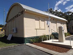
Southport Drill Hall is a heritage-listed drill hall at 210 Queen Street, Southport, Queensland, Australia. It was designed by George Connolly and built in 1890 by John Fortune. It is also known as Southport Drill Shed.

Southport Town Hall, Queensland
Historic site in Queensland, Australia
Distance: Approx. 1283 meters
Latitude and longitude: -27.9677,153.413
Southport Town Hall is a heritage-listed former town hall at Nerang Street, Southport, Gold Coast City, Queensland, Australia. It was designed by Hall & Phillips and built in 1935 by H Cheetham. It is also known as Gold Coast City Hall, Gold Coast Town Hall, and South Coast Town Hall.

Southport State High School Buildings
Historic site in Queensland, Australia
Distance: Approx. 630 meters
Latitude and longitude: -27.9619,153.4034
Southport State High School Buildings is a ground of heritage-listed state high school buildings at Southport State High School at 75 Smith Street, Southport, Gold Coast City, Queensland, Australia. It is also known as Southport State High School. It was added to the Queensland Heritage Register on 14 October 2016.
Nerang Street light rail station
Railway station in Queensland, Australia
Distance: Approx. 804 meters
Latitude and longitude: -27.9708921,153.406655
Nerang Street light rail station is situated on Nerang Street in the Gold Coast suburb of Southport. The station services the Southport Health precinct, with numerous medical and health facilities located nearby including the Pacific Private Day Hospital. Nerang Street station is a part of the Gold Coast's G:link light rail system.

Queen Street light rail station
Railway station in Queensland, Australia
Distance: Approx. 654 meters
Latitude and longitude: -27.9698773,153.3944039
Queen Street light rail station is situated on the corner of Wardoo Street and Queen Street in the Gold Coast suburb of Southport. The station is part of the Gold Coast's G:link light rail network and services the local residential community that surrounds the station. Translink provides an integrated public transport network for the whole of South East Queensland and is responsible for ticketing and timetables, Queen Street station falls in zone 5 of the network.
Weather in this IP's area
clear sky
24 Celsius
24 Celsius
23 Celsius
25 Celsius
1015 hPa
76 %
1015 hPa
1013 hPa
10000 meters
2.98 m/s
3.41 m/s
17 degree