203.1.238.57 - IP Lookup: Free IP Address Lookup, Postal Code Lookup, IP Location Lookup, IP ASN, Public IP
Country:
Region:
City:
Location:
Time Zone:
Postal Code:
IP information under different IP Channel
ip-api
Country
Region
City
ASN
Time Zone
ISP
Blacklist
Proxy
Latitude
Longitude
Postal
Route
Luminati
Country
Region
vic
City
geelong
ASN
Time Zone
Australia/Melbourne
ISP
Australian Academic and Research Network AARNet
Latitude
Longitude
Postal
IPinfo
Country
Region
City
ASN
Time Zone
ISP
Blacklist
Proxy
Latitude
Longitude
Postal
Route
IP2Location
203.1.238.57Country
Region
victoria
City
gordon
Time Zone
Australia/Melbourne
ISP
Language
User-Agent
Latitude
Longitude
Postal
db-ip
Country
Region
City
ASN
Time Zone
ISP
Blacklist
Proxy
Latitude
Longitude
Postal
Route
ipdata
Country
Region
City
ASN
Time Zone
ISP
Blacklist
Proxy
Latitude
Longitude
Postal
Route
Popular places and events near this IP address

Division of Ballarat
Australian federal electoral division
Distance: Approx. 8311 meters
Latitude and longitude: -37.516,144.066
The Division of Ballarat (spelt Ballaarat from 1901 until the 1977 election) is an Australian electoral division in the state of Victoria. The division was proclaimed in 1900, and was one of the original 65 divisions to be contested at the first federal election. It was named for the provincial city of the same name by Scottish squatter Archibald Yuille, who established the first settlement − his sheep run called Ballaarat − in 1837, with the name derived from a local Wathawurrung word for the area, balla arat, thought to mean "resting place".
Gordon railway station, Victoria
Former railway station in Victoria, Australia
Distance: Approx. 1596 meters
Latitude and longitude: -37.5943,144.0994
Gordon is a closed railway station, located in the town of Gordon, on the Melbourne - Ballarat railway line in Victoria, Australia. In the 2010s, the station building was renovated by a group associated with the former Victorian division of the Australian Railway Historical Society. The station opened on 7 May 1879 as Gordons.
Bungaree railway station
Former railway station in Victoria, Australia
Distance: Approx. 9603 meters
Latitude and longitude: -37.55916667,144.00444444
Bungaree is a closed station located in the town of Bungaree, on the Ararat railway line in Victoria, Australia. The station was one of 35 closed to passenger traffic on 4 October 1981 as part of the New Deal timetable for country passengers. A new high speed deviation has been built away from the station site as part of the Regional Fast Rail project, with the original line staying open for some time as an extended crossing loop, until tracks were completely removed in 2019.
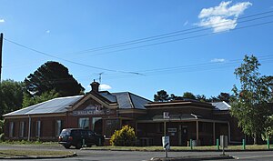
Gordon, Victoria
Town in Victoria, Australia
Distance: Approx. 828 meters
Latitude and longitude: -37.58333333,144.1
Gordon is a town in Victoria, Australia, named after settler George Gordon. The town is located on the Old Melbourne Road in the Shire of Moorabool local government area, 95 kilometres (59 mi) west of the state capital, Melbourne. At the 2021 census, Gordon had a population of 1,393.
Wallace, Victoria
Town in Victoria, Australia
Distance: Approx. 6349 meters
Latitude and longitude: -37.55,144.05
Wallace is a town in Victoria, Australia in the Shire of Moorabool local government area, 99 kilometres (62 mi) north-west of the state capital, Melbourne. The township was established in the 1880s. Wallace Post Office opened on 2 October 1885 and closed on 26 February 1993.
Mount Egerton, Victoria
Town in Victoria, Australia
Distance: Approx. 3913 meters
Latitude and longitude: -37.61666667,144.1
Mount Egerton is a town in Victoria, Australia. It is located on the mountain by the same name in the Shire of Moorabool local government area, 97 kilometres (60 mi) north west of the state capital, Melbourne. At the 2016 census, Mount Egerton had a population of 582.
Bungaree, Victoria
Town in Victoria, Australia
Distance: Approx. 9664 meters
Latitude and longitude: -37.55722222,144.00444444
Bungaree is a town in Victoria, Australia. The town is located 103 kilometres (64 mi) west of the state capital, Melbourne and 14 kilometres (8.7 mi) east of the regional centre of Ballarat, on the Western Freeway and in the Shire of Moorabool local government area. At the 2021 census, Bungaree and the surrounding area had a population of 302.
Millbrook, Victoria
Suburb of Shire of Moorabool, Victoria, Australia
Distance: Approx. 5900 meters
Latitude and longitude: -37.60361111,144.04805556
Millbrook is a locality in the state of Victoria, Australia, located 90 kilometres (56 mi) north west of Melbourne. It was formerly called "Moorabool" but the name was changed to avoid confusion with a locality near Geelong. The name "Millbrook" was adopted because of a flour mill erected by Matthew Butterly on the West Moorabool creek.

Electoral district of Warrenheip
Former state electoral district of Victoria, Australia
Distance: Approx. 9628 meters
Latitude and longitude: -37.66666667,144.13333333
The electoral district of Warrenheip was an electorate of the Victorian Legislative Assembly in the British colony, and later Australian state, of Victoria. Created in 1889, the electorate was abolished in 1927 when it became the electoral district of Warrenheip and Grenville.
Springbank, Victoria
Town in Victoria, Australia
Distance: Approx. 7487 meters
Latitude and longitude: -37.53194444,144.05305556
Springbank is a locality in central Victoria, Australia. The locality is in the Shire of Moorabool, 99 kilometres (62 mi) west of the state capital, Melbourne and 22 kilometres (14 mi) east of the regional city of Ballarat. At the 2016 census, Springbank had a population of 111.
Lal Lal Wind Farm
Wind farm in Victoria, Australia
Distance: Approx. 9840 meters
Latitude and longitude: -37.6,144
Lal Lal Wind Farm is an operating wind farm under southeast of Ballarat in Victoria, Australia. The wind farm has two sections about 9 kilometres (5.6 mi) apart. There are 38 turbines two kilometres east of Yendon and a further 22 turbines two kilometres north of Elaine.
Weather in this IP's area
overcast clouds
11 Celsius
11 Celsius
11 Celsius
12 Celsius
1016 hPa
72 %
1016 hPa
949 hPa
10000 meters
3.26 m/s
6.66 m/s
215 degree
97 %


