203.1.203.85 - IP Lookup: Free IP Address Lookup, Postal Code Lookup, IP Location Lookup, IP ASN, Public IP
Country:
Region:
City:
Location:
Time Zone:
Postal Code:
IP information under different IP Channel
ip-api
Country
Region
City
ASN
Time Zone
ISP
Blacklist
Proxy
Latitude
Longitude
Postal
Route
Luminati
Country
Region
vic
City
melbourne
ASN
Time Zone
Australia/Melbourne
ISP
Australian Academic and Research Network AARNet
Latitude
Longitude
Postal
IPinfo
Country
Region
City
ASN
Time Zone
ISP
Blacklist
Proxy
Latitude
Longitude
Postal
Route
IP2Location
203.1.203.85Country
Region
victoria
City
kew
Time Zone
Australia/Melbourne
ISP
Language
User-Agent
Latitude
Longitude
Postal
db-ip
Country
Region
City
ASN
Time Zone
ISP
Blacklist
Proxy
Latitude
Longitude
Postal
Route
ipdata
Country
Region
City
ASN
Time Zone
ISP
Blacklist
Proxy
Latitude
Longitude
Postal
Route
Popular places and events near this IP address

Kew, Victoria
Suburb of Melbourne, Victoria, Australia
Distance: Approx. 452 meters
Latitude and longitude: -37.80527778,145.03583333
Kew () is a suburb of Melbourne, Victoria, Australia, found 5 km east from Melbourne's Central Business District. Kew is located within the City of Boroondara local government area. Kew recorded a population of 24,499 at the 2021 census.
Xavier College
Roman catholic school in Melbourne, Australia
Distance: Approx. 652 meters
Latitude and longitude: -37.81222222,145.03166667
Xavier College is a Roman Catholic, day and boarding school predominantly for boys, founded in 1872 by the Society of Jesus, with its main campus located in Kew, an eastern suburb of Melbourne, Victoria, Australia. Classes started in 1878. The college is part of the international network of Jesuit schools begun in Messina, Sicily in 1548.

University of Divinity
Collegiate university in Australia
Distance: Approx. 519 meters
Latitude and longitude: -37.80563056,145.03672222
The University of Divinity is an Australian collegiate university with a specialised focus in divinity and associated disciplines. It is constituted by twelve theological colleges from seven denominations and three schools. The University of Divinity is the direct successor of the second oldest degree-granting authority in the State of Victoria, the Melbourne College of Divinity.
Trinity Grammar School, Kew
Independent, single-sex, day school in Kew, Victoria, Australia
Distance: Approx. 438 meters
Latitude and longitude: -37.80916667,145.03444444
Trinity Grammar School, Kew (abbreviated to TGS) is an independent, Anglican day and for boys, located in Kew in Melbourne, Australia. The school was founded at a meeting of the vestry of Holy Trinity Church, Kew on 14 November 1902. It opened in 1903, operating out of the Holy Trinity Church.

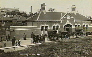
Kew railway station, Melbourne
Former railway station in Victoria, Australia
Distance: Approx. 312 meters
Latitude and longitude: -37.8092,145.0308
Kew railway station was the terminus of the Kew railway line, Australia. It was opened on 19 December 1887. The line ceased operations in August 1952, but the line and station were officially closed on 13 May 1957 and subsequently demolished.
Ruyton Girls' School
Independent, single-sex, day school in Kew, Victoria, Australia
Distance: Approx. 915 meters
Latitude and longitude: -37.81138889,145.03916667
Ruyton Girls' School, commonly referred to simply as Ruyton, is a non-denominational and independent day school for girls, located on Selbourne Road, Kew, an inner-eastern suburb of Melbourne, Victoria, Australia. Ruyton was established in 1878 by its first principal, Charlotte Anderson, who named it in honour of the parish in Shropshire, England, Ruyton-XI-Towns, where her great-great-grandfather David Evans had been vicar. Its motto is Recte et Fideliter, meaning "Upright and Faithful", which is also the name of the school song.
Evangelical Theological Association
Distance: Approx. 519 meters
Latitude and longitude: -37.80563056,145.03672222
The Evangelical Theological Association (ETA) was a cooperative partnership established in 1975 between the Churches of Christ Theological College and Whitley College. It was accredited as an associated teaching institute of the Melbourne College of Divinity. The ETA taught undergraduate and postgraduate theology courses, for degrees awarded by the Melbourne College of Divinity.
Barker railway station
Former railway station in Victoria, Australia
Distance: Approx. 928 meters
Latitude and longitude: -37.8147,145.0299
Barker railway station was the only intermediate station on the Kew railway line in Melbourne, Australia. It was opened on 19 December 1887 and closed with the line on 13 May 1957. The station was located between Barkers Road and Hawthorn Grove and has since been demolished.

City of Kew
Local government area in Victoria, Australia
Distance: Approx. 744 meters
Latitude and longitude: -37.8,145.03333333
The City of Kew was a local government area about 4 kilometres (2.5 mi) east of Melbourne, the state capital of Victoria, Australia, on the southeast bank of the Yarra River. The city covered an area of 14.56 square kilometres (5.62 sq mi), and existed from 1860 until 1994.
Regency Media Group
Former Australian media conglomerate
Distance: Approx. 731 meters
Latitude and longitude: -37.803975,145.03862
Regency Media Group was an Australian media conglomerate, active in the Australian entertainment industry since the mid-1950s. The corporation was latterly focused on the production of digital media, until its demise in February 2023. As of 2008 Regency owned a 74% stake in a joint venture in India with Sa Re Ga Ma to produce compact discs, video CDs, and DVDs for the Indian market.

D'Estaville
House / Mansion in Victoria, Australia
Distance: Approx. 485 meters
Latitude and longitude: -37.80388889,145.02638889
d'Estaville, also spelled D'Estaville, is a large bluestone Italianate-style heritage-listed house located at 7 Barry Street in the Melbourne suburb of Kew, Victoria, Australia. Designed by architects Knight & Kerr for politician and long term Chief Justice of Victoria, Sir William Foster Stawell, d’Estaville was completed in 1859. d’Estaville is a fine and unusual example of the Italianate style, and the only residential work of Knight & Kerr, designers of the Victorian Parliament House.
Otira Methodist Home Missionary Training College
Former Methodist training institution, Kew
Distance: Approx. 767 meters
Latitude and longitude: -37.799625,145.032485
Otira Methodist Home Missionary Training College was a residential college in Victoria, Australia, for training prospective Methodist ministers.
Weather in this IP's area
broken clouds
16 Celsius
16 Celsius
15 Celsius
17 Celsius
1016 hPa
77 %
1016 hPa
1010 hPa
10000 meters
0.45 m/s
1.34 m/s
65 degree
69 %